
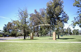
Binda is a village in the Southern Tablelands region of New South Wales, Australia in Upper Lachlan Shire. At the 2016 census, Binda had a population of 280 people.

Bigga is a village in the Southern Tablelands of New South Wales, Australia, in Upper Lachlan Shire. It is in the Parish of Bigga, County of Georgiana. At the 2016 census, Bigga and the surrounding area had a population of 245. The name Bigga is thought to originate as a shortened version of the Biggs Grant. Bigga is on the western side of the Abercrombie Mountains. It is 91 km northwest of Goulburn and 52 km southeast of Cowra. Nearby towns are: Abercrombie River, Binda, Greenmantle, Grabine, Reids Flat, and Tuena. Nearby places are: Blanket Flat and Crooked Corner. These places were once towns.

Oakhurst is a suburb of Sydney, in the state of New South Wales, Australia 46 kilometres west of the Sydney central business district, in the local government area of the City of Blacktown. It is part of the Greater Western Sydney region.

Oak Flats is a single-platform intercity train station located in Oak Flats, New South Wales, Australia, on the South Coast railway line. The station serves NSW TrainLink trains travelling south to Kiama and north to Wollongong and Sydney. Together with the Dunmore and later Shellharbour Junction stations, Oak Flats has long served as the rail connection for the coastal suburbs of the City of Shellharbour.
Parkview is a residential suburb of Leeton, New South Wales in Leeton Shire. Parkview is located to the south west of town, and can be accessed via the Oak Street Bridge. Parkview is home to Leeton's second state school, Parkview Public School, a small shop and butcher, two churches, and an array of sporting facilities such as tennis and basketball courts. Leeton's showground, racecourse and the MIA Sports Club are located to the east of the suburb across the railway track.

Oak Flats, fondly referred to by many locals as Oaf Klats, is a suburb of Shellharbour, New South Wales, Australia situated on the south western shores of Lake Illawarra and within the South Coast region of New South Wales. It is a residential area, which had a population of 6,415 at the 2016 census.

Kilaben Bay is a suburb of the city of Lake Macquarie in the Hunter Region of New South Wales, Australia. It is named for the bay of the same name that lies to the south of the suburb. The suburb's western boundary is heavily forested. Kilaben Bay is one of many suburbs that ring Lake Macquarie, Lake Munmorah, and Tuggerah Lake. Kilaben Bay is part of the West Ward of the City of Lake Macquarie local government area. For telephone call charges, Kilaben Bay is within the local call zone of the City of Newcastle.

Tomago is a combined industrial/semi-rural suburb of the Port Stephens local government area in the Hunter Region of New South Wales, Australia. It is located just north of the Hunter River and west of the body of water known as Fullerton Cove. Tomago means "sweet water" in the local Aboriginal language.

Fullerton Cove is a rural suburb of the Port Stephens local government area in the Hunter Region of New South Wales, Australia, located just north of Fern Bay and adjacent to Fullerton Cove, from which the suburb gets its name. At the 2011 census the population of Fullerton Cove was 300.

Tanilba Bay is a suburb of the Port Stephens local government area in the Hunter Region of New South Wales, Australia. It is located on the Tilligerry Peninsula adjacent to the bay from which it got its name. "Tanilba" is said to mean "place of white flowers" in a local Indigenous language, presumably a reference to the flannel flowers which formerly thrived in the area. At the 2016 census Tanilba Bay had a population of 3,156.

Mallabula is a primarily residential suburb of the Port Stephens local government area in the Hunter Region of New South Wales, Australia. It is located on the Tilligerry Peninsula between Lemon Tree Passage and Tanilba Bay. The origin of the name may mean "three swamps" in the local Aboriginal language.
Glen Oak is a small community in the Hunter Region of New South Wales, Australia, shared between the Port Stephens and Dungog local government areas (LGA). Approximately two thirds of the suburb's 45.1 square kilometres (17.4 sq mi) is located within the Port Stephens LGA while the remaining third, which is sparsely populated, is located in Dungog Shire.

Limbri is a small village on Swamp Oak Creek, about 30 km east northeast of Tamworth and about 8 km east southeast of Moonbi in northern New South Wales, Australia. The population of the Limbri region in 2006 was 259.
Suburbs and localities are the names of geographic subdivisions in Australia, used mainly for address purposes. The term locality is used in rural areas, while the term suburb is used in urban areas. Australian postcodes closely align with the boundaries of localities and suburbs.
East Seaham is a primarily rural suburb of the Port Stephens local government area in the Hunter Region of New South Wales, Australia. It is situated on the east bank of the Williams River, opposite Glen Oak and Seaham. At the 2011 census, the population of East Seaham and the adjacecent suburb of Balickera was 359, with the two suburbs having an average population density of 5.5/km2 (14/sq mi).
Wallalong is a rural suburb of the Port Stephens local government area in the Hunter Region of New South Wales, Australia. The suburb is bisected by High Street, along which a small residential zone of 938 people exists. To the east and west of this area the suburb is almost exclusively rural.

Campvale is a sparsely populated rural suburb of the Port Stephens local government area in the Hunter Region of New South Wales, Australia.

Hoskinstown is a locality in Queanbeyan-Palerang Regional Council, New South Wales, Australia. The town is 38km southeast of Canberra the Capital city of Australia, and 299km southwest of Sydney. At the 2016 census, it had a population of 189.

Ferodale is a sparsely populated rural suburb of the Port Stephens local government area in the Hunter Region of New South Wales, Australia. A large portion of the suburb is occupied by Grahamstown Dam, the lower Hunter Region's main water storage reservoir.
Wattle Flat is a locality in the Bathurst Region of New South Wales, Australia. It had a population of 290 people as of the 2016 census.


