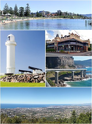
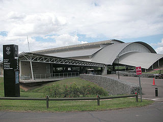
Wollongong, colloquially referred to as The Gong, is a city located in the Illawarra region of New South Wales, Australia. The name is believed to originate from the Dharawal language, meaning either 'five islands/clouds', 'ground near water' or 'sound of the sea'. Wollongong lies on the narrow coastal strip between the Illawarra Escarpment and the Pacific Ocean, 85 kilometres south of central Sydney. Wollongong had an estimated urban population of 302,739 at June 2018, making it the third-largest city in New South Wales after Sydney and Newcastle and the tenth-largest city in Australia by population. The city's current Lord Mayor is Gordon Bradbery AM who was elected in 2021.

Waterfall is a small suburb in southern Sydney, in the state of New South Wales, Australia. It is 40 kilometres south of the Sydney central business district in the Sutherland Shire. It is the southernmost suburb of Sydney in the eastern corridor, on the Princess Highway, bordering the Illawarra region.

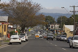
Fairy Meadow is a suburb in the City of Wollongong, New South Wales, Australia. Located in the Illawarra region and only 4 km from the city centre, it is a mainly low-density residential area, with a large strip of commercial and industrial properties along and off the Princes Highway.
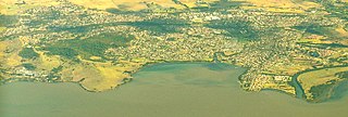
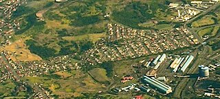
Dapto is a suburb of Wollongong in the Illawarra region of New South Wales, Australia, located on the western side of Lake Illawarra and covering 7.15 square kilometres (2.76 sq mi). As at the 2016 census, the suburb had a population of 10,730.
Albion Park is a suburb situated in the Macquarie Valley in the City of Shellharbour, which is in turn one of the three local government areas that comprise the Wollongong Metropolitan Area, New South Wales, Australia. Although it is surrounded by a 'green belt' of farms, Albion Park had a population of 13,316 at the 2016 census.

Bowral is the largest town in the Southern Highlands of New South Wales, Australia, about ninety minutes southwest of Sydney. It is the main business and entertainment precinct of the Wingecarribee Shire and Highlands.

Smithfield is a suburb of Sydney, in the state of New South Wales, Australia. Smithfield is located 31 kilometres (19 mi) west of the Sydney central business district, in the local government areas of the City of Fairfield and Cumberland Council. Located in the Greater Western Sydney region, the suburb is one of the largest in Fairfield City by area.

Moss Vale is a town in the Southern Highlands of New South Wales, Australia, in the Wingecarribee Shire. It is located on the Illawarra Highway, which connects to Wollongong and the Illawarra coast via Macquarie Pass.
Horsley Park is a suburb of Sydney in the state of New South Wales, Australia. Horsley Park is located 39 kilometres west of the Sydney central business district in the local government area of the City of Fairfield. Horsley Park is part of the Greater Western Sydney region. It is a semi-rural suburb, located 5 km west of Wetherill Park and 11 km north-west of Fairfield.

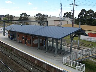
Dapto railway station is located on the South Coast railway line in the Wollongong suburb of Dapto, New South Wales, Australia.
Unanderra railway station is located on the South Coast railway line in the Wollongong suburb of Unanderra, New South Wales, Australia.

The Illawarra escarpment, or officially the Illawarra Range, is the fold-created cliffs and plateau-eroded outcrop mountain range west of the Illawarra coastal plain south of Sydney, in the state of New South Wales, Australia. The range encloses the Illawarra region which stretches from Stanwell Park in the north to Kiama, Gerringong and the Shoalhaven River in the south.
Cringila is a southern suburb of the city of Wollongong, New South Wales, Australia. The suburb is bounded by Berkeley, Unanderra, Lake Heights and Warrawong.

Gwynneville is an inner city suburb of Wollongong, New South Wales, Australia located approximately 2 km north west of the city centre.

Marshall Mount is a suburb of Wollongong in New South Wales, Australia. It is located between the larger centres of Dapto and Albion Park.
Berkeley is a suburb of Wollongong, New South Wales. The suburb is located in Wollongong's southern suburbs, on the northern shore of Lake Illawarra, and is one of the city's most populous suburbs. At the 2016 census, it had a population of 7,605.
Kanahooka is a southern suburb in Wollongong City Council. It has a few shops and a playground. Situated on Lake Illawarra is a Park with a playground. It has a public school and a high school.
Cleveland is a suburb of the City of Wollongong to the west of Dapto. At the 2016 census, it had a population of 21.
Huntley is a suburb of the City of Wollongong to the west of Dapto. At the 2016 census, it had a population of 50.
Horsley Homestead is a heritage-listed residence at Horsley Drive, Dapto, City of Wollongong, New South Wales, Australia. It was built from 1842 to 1909. The homestead has also previously served as a museum (1972-1985) and as a function venue (1985-1992). It was added to the New South Wales State Heritage Register on 4 August 2000.