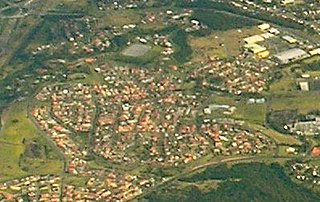
Balgowlah is a suburb of northern Sydney, in the state of New South Wales, Australia. Balgowlah is located 12 kilometres north-east of the Sydney central business district in the local government area of Northern Beaches Council, in the Northern Beaches region. Balgowlah shares the postcode 2093 with the adjacent suburbs of Manly Vale, Balgowlah Heights and North Balgowlah.

Craigieburn is a satellite suburb, outside of Melbourne, Victoria, Australia, 26 km north of Melbourne's central business district. Its local government area is the City of Hume. At the 2016 Census, Craigieburn had a population of 50,347.
Stockland Glendale is a major shopping centre located in Glendale, a suburb of the City of Lake Macquarie, New South Wales, Australia.

Albion Park is a suburb situated in the Macquarie Valley in the City of Shellharbour, which is in turn one of the three local government areas that comprise the Wollongong Metropolitan Area, New South Wales, Australia. Although it is surrounded by a 'green belt' of farms, Albion Park had a population of 13,316 at the 2016 census.

Macquarie Park is a suburb in northern Sydney, New South Wales, Australia. Macquarie Park is located 15 kilometres north-west of the Sydney central business district in the local government area of the City of Ryde. Macquarie Park is part of the Northern Suburbs region.

Prairiewood is a suburb of Sydney, in the state of New South Wales, Australia 34 kilometres west of the Sydney central business district, in the local government area of the City of Fairfield. It is part of the Greater Western Sydney region.

Warilla is a seaside suburb of the City of Shellharbour, Australia within the Wollongong urban area. It is one of the more established areas and is between the suburbs of Mount Warrigal in the west, Barrack Heights and Barrack Point in the south and Lake Illawarra in the north.

Wollongong Central is a major shopping centre in the Illawarra region, located in the CBD of Wollongong, New South Wales approximately 90 kilometres south of Sydney. It is operated and managed by Australian property investment company, General Property Trust (GPT). It is of local importance and is used by much of the Illawarra community as a social and shopping centre. It is situated in the western half of the Crown Street Mall.

Dapto Mall is a shopping centre in the suburb of Dapto, a suburb of Wollongong in the Illawarra region of New South Wales, Australia. The centre features 66 stores including Big W, Coles and Woolworths.

Wallsend is a western suburb of Newcastle, New South Wales, Australia 11 kilometres (6.8 mi) from Newcastle's central business district. It is part of the City of Newcastle local government area.

Jesmond is a suburb of the City of Newcastle LGA, located about 9.5 km (6 mi) west of the Newcastle CBD in the Hunter Region of New South Wales, Australia. It is both a commercial centre and dormitory suburb of Newcastle. Residents include Australian and international students attending the University of Newcastle in adjacent Callaghan. The suburb also has numerous aged housing facilities. The suburb is very multicultural due to many international university students. According to the 2006 Census there were 2,442 people in 1,144 dwellings.
Cameron Park is a suburb of the City of Lake Macquarie local government area in New South Wales, Australia, located 19 kilometres (12 mi) west of Newcastle's central business district near West Wallsend and the Sydney-Newcastle Freeway.

Barrack Heights is a suburb of the City of Shellharbour in New South Wales, Australia in the local government area of the same name. Many institutions are located in Barrack Heights, including Shellharbour Public Hospital, Shellharbour Private Hospital, Warilla Bowling Club, Warilla Sports Club and Warilla High School.

Mount Warrigal is a large suburb of Shellharbour, New South Wales, Australia. The population, according to the 2016 Australian Census, was 4,909. The suburb is in the Shellharbour City LGA.

Flinders is a seaside southern suburb of Shellharbour, located in one of the most picturesque regions in the Illawarra region of New South Wales, Australia. Flinders is located approximately 86 kilometres south-southwest of New South Wales' capital city of Sydney. Flinders embraces an active outdoor lifestyle with beautiful beaches close by and over 60 hectares of green open spaces at your door step including bush reserves, waterways and landscaped parks. Flinders adjoins neighbouring suburbs of Shellharbour, Shell Cove, Blackbutt and the newly developed suburb of Shell Heights.

Dunmore is a largely rural suburb of Shellharbour City in New South Wales, Australia. Dunmore is bisected north to south by the South Coast railway line and the Princes Highway.


