Wollongong is a city located in the Illawarra region of New South Wales, Australia. The name is believed to originate from the Dharawal language, meaning either 'five islands/clouds', 'ground near water' or 'sound of the sea'. Wollongong lies on the narrow coastal strip between the Illawarra Escarpment and the Pacific Ocean, 85 kilometres south of central Sydney. Wollongong had an estimated urban population of 302,739 at June 2018, making it the third-largest city in New South Wales after Sydney and Newcastle and the tenth-largest city in Australia by population. The city's current Lord Mayor is Gordon Bradbery AM who was elected in 2021.
Dapto is a suburb of Wollongong in the Illawarra region of New South Wales, Australia, located on the western side of Lake Illawarra and covering 7.15 square kilometres (2.76 sq mi). As at the 2021 census, the suburb had a population of 10,954.
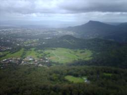
Mount Kembla is a suburb and a mountain in the Illawarra region of New South Wales, Australia.
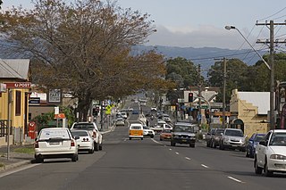
Albion Park is a suburb situated in the Macquarie Valley in the City of Shellharbour, which is in turn one of the three local government areas that comprise the Wollongong Metropolitan Area, New South Wales, Australia. Although it is surrounded by a 'green belt' of farms, Albion Park had a population of 13,316 at the 2016 census.

Noel Spencer is a former Australian football (soccer) player who coaches Dapto Dandaloo Fury in the Illawarra Premier League.

Albion Park railway station is a heritage-listed railway station located on the South Coast railway line on the Princes Highway in Albion Park Rail, New South Wales, Australia. The station was designed by New South Wales Government Railways and built during 1887 by William Monie & Company, with the single line railway line built by David Proudfoot and Thomas Logan. The complex is also known as the Albion Park Railway Station Group. The property was added to the New South Wales State Heritage Register on 2 April 1999. The station is located close to Shellharbour Airport.

Dapto railway station is located on the South Coast railway line in the Wollongong suburb of Dapto, New South Wales, Australia.

Unanderra railway station is located on the South Coast railway line in the Wollongong suburb of Unanderra, New South Wales, Australia.

The Illawarra escarpment, or officially the Illawarra Range, is the fold-created cliffs and plateau-eroded outcrop mountain range west of the Illawarra coastal plain south of Sydney, in the state of New South Wales, Australia. The range encloses the Illawarra region which stretches from Stanwell Park in the north to Kiama, Gerringong and the Shoalhaven River in the south.

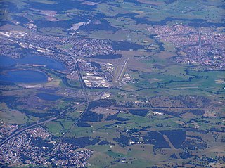
The City of Shellharbour is a local government area in the Illawarra region of New South Wales, Australia. The city is located about 100 kilometres (62 mi) south of Sydney and covers the southern suburbs of the Wollongong urban area centred on Shellharbour and it had an estimated population of 68,460 at the 2016 census.

The Illawarra Rugby League is a rugby league competition in Wollongong, NSW. It is one of the oldest rugby league competitions in Australia, founded in 1911 with five clubs. The area provides a nursery of juniors for the Illawarra Steelers and St George Illawarra Dragons. The season is contested by seven teams and concludes with a finals series involving the top four teams.

Dapto Mall is a shopping centre in the suburb of Dapto, a suburb of Wollongong in the Illawarra region, New South Wales, Australia.
Kembla Heights is a village west of Wollongong, New South Wales in the Parish of Kembla County of Camden. It is situated along Harry Graham Drive and upper Cordeaux Road and is part of a tourist route that runs along the Illawarra escarpment for a distance between Mount Kembla and Mount Keira. The Dendrobium Colliery is located in Kembla Heights.
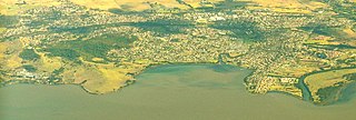
Yallah is a western suburb in the City of Wollongong, New South Wales, Australia, located on the western shore of Lake Illawarra. It contains a mixture of rural, commercial and light industrial areas.

Henry Osborne was an Australian pastoralist, collier and politician. He was a member of the New South Wales Legislative Council between 1851 and 1856. He was also a member of the New South Wales Legislative Assembly for one term from 1856 until 1857.
Ryan John Park is an Australian politician. He has been a Labor Party member of the New South Wales Legislative Assembly since March 2011, representing the electorate of Keira. He is the current Minister for Health. He previously served as the NSW Shadow Minister for Health since 2019, and the Shadow Minister for the Illawarra since 2013. He is the third most senior Labor MP in the NSW Legislative Assembly.
James Osborne was an Australian politician.
Pat Hill Osborne was an Australian politician.
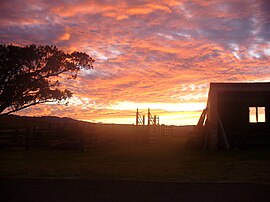
Horsley Homestead is a heritage-listed residence at Horsley Drive, Dapto, City of Wollongong, New South Wales, Australia. It was built from 1842 to 1909. The homestead has also previously served as a museum (1972-1985) and as a function venue (1985-1992). It was added to the New South Wales State Heritage Register on 4 August 2000.