
The Yass River, a perennial river that is part of the Murrumbidgee catchment within the Murray–Darling basin, is located in the Southern Tablelands and South Western Slopes districts of New South Wales, Australia.
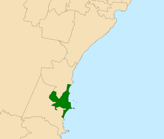
Wollongong is an electoral district of the Legislative Assembly in the Australian state of New South Wales. It is represented by Paul Scully of the Labor Party. Since a redistribution in 2013, it has covered an area of 79.25 square kilometres and includes the localities of Berkeley, Coachwood Park, Coniston, Cordeaux Heights, Corrimal, Cringila, Fairy Meadow, Farmborough Chase, Farmborough Heights, Figtree, Gwynneville, Kembla Grange, Kembla Heights, Kemblawarra, Lake Heights, Lindsay Heights, Mangerton, Mount Kembla, Mount Saint Thomas, North Wollongong, Port Kembla, Primbee, Spring Hill, Towradgi, Unanderra, Warrawong, West Wollongong, Windang, Wollongong.

The Watagan Mountains or Watagans or Wattagan Mountains, a mountain range that is part of the Great Dividing Range, is located on the Lower Hunter region of New South Wales, Australia. The range is situated between the Upper Hunter River catchment and the Tuggerah Lakes with close proximity to Lake Macquarie. The Watagans are a popular tourist location and are close to Newcastle, Sydney and the Central Coast.
The Bemboka River, a perennial stream of the Bega River catchment, is located in the Monaro and South Coast regions of New South Wales, Australia.

Boorowa River, a perennial stream that is part of the Lachlan catchment within the Murray–Darling basin, is located in the central–western region of New South Wales, Australia.

The Kedumba River, a perennial river that is part of the Hawkesbury-Nepean catchment, is located in the Blue Mountains and Macarthur regions of New South Wales, Australia.
Little Murray River, an anabranch of the Murray River and part of the Murray–Darling basin, is located in the western Riverina region of south western New South Wales, Australia.
The Peak River, a perennial stream that is part of the Murrumbidgee catchment within the Murray–Darling basin, is located in the Snowy Mountains region of New South Wales, Australia.
Phils River, a watercourse that is part of the Lachlan catchment within the Murray–Darling basin, is located in the central western region of New South Wales, Australia.
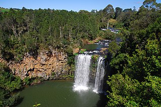
Bielsdown River, a perennial stream that is part of the Clarence River catchment, is located in the Northern Tablelands of New South Wales, Australia.
The Clouds Creek, a perennial stream that is part of the Clarence River catchment, is located in the Northern Tablelands region of New South Wales, Australia.
The Georges Creek, a perennial stream that is part of the Macleay River catchment, is located in the Northern Tablelands and Mid North Coast regions of New South Wales, Australia.
The Adelong Creek, a perennial river that is part of the Murrumbidgee catchment within the Murray–Darling basin, is located in the South West Slopes, and Riverina regions of New South Wales, Australia.
Bowning Creek, a mostly–perennial river that is part of the Murrumbidgee catchment in the Murray–Darling basin, is in the South West Slopes and Riverina regions of New South Wales, Australia.
The Burra Creek, a mostly–perennial river that is part of the Murrumbidgee catchment within the Murray–Darling basin, is located in the South West Slopes region of New South Wales, Australia.
The Burra Creek, a mostly–perennial river that is part of the Murrumbidgee catchment within the Murray–Darling basin, is located in the Monaro and Southern Tablelands regions of New South Wales, Australia.
The Cooma Creek, a mostly–perennial river that is part of the Murrumbidgee catchment within the Murray–Darling basin, is located in the Monaro region of New South Wales, Australia.
The Cooma Back Creek, a mostly–perennial river that is part of the Murrumbidgee catchment within the Murray–Darling basin, is located in the Monaro region of New South Wales, Australia.
The Kindra Creek, a watercourse that is part of the Murrumbidgee catchment within the Murray–Darling basin, is located in the Riverina and South West Slopes regions of New South Wales, Australia.
The Pinchgut Creek, a non–perennial stream that is part of the Murrumbidgee catchment within the Murray–Darling basin, is located in the South West Slopes region of New South Wales, Australia.

