A shield volcano is a type of volcano named for its low profile, resembling a warrior's shield lying on the ground. It is formed by the eruption of highly fluid lava, which travels farther and forms thinner flows than the more viscous lava erupted from a stratovolcano. Repeated eruptions results in the steady accumulation of broad sheets of lava, building up the shield volcano's distinctive form.

The geology of the Lassen volcanic area presents a record of sedimentation and volcanic activity in the area in and around Lassen Volcanic National Park in Northern California, U.S. The park is located in the southernmost part of the Cascade Mountain Range in the Pacific Northwest region of the United States. Pacific Oceanic tectonic plates have plunged below the North American Plate in this part of North America for hundreds of millions of years. Heat from these subducting plates has fed scores of volcanoes in California, Oregon, Washington and British Columbia over at least the past 30 million years and is also responsible for activities in the Lassen volcanic area.

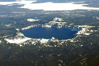
Mount Mazama is a complex volcano in the state of Oregon, United States, in a segment of the Cascade Volcanic Arc and Cascade Range. Most of the mountain collapsed following a major eruption approximately 7,700 years ago. The volcano is in Klamath County, in the southern Cascades, 60 miles (97 km) north of the Oregon-California border. Its collapse formed a caldera that holds Crater Lake. The mountain is in Crater Lake National Park. Mount Mazama originally had an elevation of 12,000 feet (3,700 m), but following its climactic eruption this was reduced to 8,157 feet (2,486 m). Crater Lake is 1,943 feet (592 m) deep, the deepest freshwater body in the US and the second deepest in North America after Great Slave Lake in Canada.

Mount Katmai is a large stratovolcano on the Alaska Peninsula in southern Alaska, located within Katmai National Park and Preserve. It is about 6.3 miles (10 km) in diameter with a central lake-filled caldera about two by three miles in size, formed during the Novarupta eruption of 1912. The caldera rim reaches a maximum elevation of 6,716 feet (2,047 m). In 1975 the surface of the crater lake was at an elevation of about 4,220 feet (1,286 m), and the estimated elevation of the caldera floor is about 3,400 ft (1,040 m). The mountain is located in Kodiak Island Borough, very close to its border with Lake and Peninsula Borough.

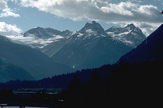
The Garibaldi Volcanic Belt is a northwest–southeast trending volcanic chain in the Pacific Ranges of the Coast Mountains that extends from Watts Point in the south to the Ha-Iltzuk Icefield in the north. This chain of volcanoes is located in southwestern British Columbia, Canada. It forms the northernmost segment of the Cascade Volcanic Arc, which includes Mount St. Helens and Mount Baker. Most volcanoes of the Garibaldi chain are dormant stratovolcanoes and subglacial volcanoes that have been eroded by glacial ice. Less common volcanic landforms include cinder cones, volcanic plugs, lava domes and calderas. These diverse formations were created by different styles of volcanic activity, including Peléan and Plinian eruptions.

Masaya is a caldera located in Masaya, Nicaragua, 20 km south of the capital Managua. It is Nicaragua's first and largest national park, and one of 78 protected areas of Nicaragua. The complex volcano is composed of a nested set of calderas and craters, the largest of which is Las Sierras shield volcano and caldera. Within this caldera lies a sub-vent, which is Masaya Volcano sensu stricto. The vent is a shield type composing of basaltic lavas and tephras and includes a summit crater. This hosts Masaya caldera, formed 2,500 years ago by an 8-km³ basaltic ignimbrite eruption. Inside this caldera a new basaltic complex has grown from eruptions mainly on a semi-circular set of vents that include the Masaya and Nindiri cones. The latter host the pit craters of Masaya, Santiago, Nindiri and San Pedro. Observations in the walls of the pit craters indicate that there have been several episodes of cone and pit crater formation.

Cerro Azul, sometimes referred to as Quizapu, is an active stratovolcano in the Maule Region of central Chile, immediately south of Descabezado Grande. Part of the South Volcanic Zone of the Andes, its summit is 3,788 meters (12,428 ft) above sea level, and is capped by a summit crater that is 500 meters (1,600 ft) wide and opens to the north. Beneath the summit, the volcano features numerous scoria cones and flank vents.

Quetrupillán is a stratovolcano located in the La Araucanía Region of Chile. It is situated between Villarrica and Lanín volcanoes, within Villarrica National Park. Geologically, Quetrupillán is located in a tectonic basement block between the main traces of Liquiñe-Ofqui Fault and Reigolil-Pirihueico Fault.

The Cascade Volcanoes are a number of volcanoes in a volcanic arc in western North America, extending from southwestern British Columbia through Washington and Oregon to Northern California, a distance of well over 700 miles (1,100 km). The arc formed due to subduction along the Cascadia subduction zone. Although taking its name from the Cascade Range, this term is a geologic grouping rather than a geographic one, and the Cascade Volcanoes extend north into the Coast Mountains, past the Fraser River which is the northward limit of the Cascade Range proper.

Namarunu is a shield volcano located in the Great Rift Valley, Kenya.

Volcanic activity is a major part of the geology of Canada and is characterized by many types of volcanic landform, including lava flows, volcanic plateaus, lava domes, cinder cones, stratovolcanoes, shield volcanoes, submarine volcanoes, calderas, diatremes, and maars, along with less common volcanic forms such as tuyas and subglacial mounds.

The geology of the Pacific Northwest includes the composition, structure, physical properties and the processes that shape the Pacific Northwest region of North America. The region is part of the Ring of Fire: the subduction of the Pacific and Farallon Plates under the North American Plate is responsible for many of the area's scenic features as well as some of its hazards, such as volcanoes, earthquakes, and landslides.

The Silverthrone Caldera is a potentially active caldera complex in southwestern British Columbia, Canada, located over 350 kilometres (220 mi) northwest of the city of Vancouver and about 50 kilometres (31 mi) west of Mount Waddington in the Pacific Ranges of the Coast Mountains. The caldera is one of the largest of the few calderas in western Canada, measuring about 30 kilometres (19 mi) long (north-south) and 20 kilometres (12 mi) wide (east-west). Mount Silverthrone, an eroded lava dome on the caldera's northern flank that is 2,864 metres (9,396 ft) high, may be the highest volcano in Canada.

The Mount Edziza volcanic complex is a large and potentially active north-south trending complex volcano in Stikine Country, northwestern British Columbia, Canada, located 38 kilometres (24 mi) southeast of the small community of Telegraph Creek. It occupies the southeastern portion of the Tahltan Highland, an upland area of plateau and lower mountain ranges, lying east of the Boundary Ranges and south of the Inklin River, which is the east fork of the Taku River. As a volcanic complex, it consists of many types of volcanoes, including shield volcanoes, calderas, lava domes, stratovolcanoes, and cinder cones.

Puyehue and Cordón Caulle are two coalesced volcanic edifices that form a major mountain massif in Puyehue National Park in the Andes of Ranco Province, in the South of Chile. In volcanology this group is known as the Puyehue-Cordón Caulle Volcanic Complex (PCCVC). Four volcanoes constitute the volcanic group or complex, the Cordillera Nevada caldera, the Pliocene Mencheca volcano, Cordón Caulle fissure vents and the Puyehue stratovolcano.

The volcanic history of the Northern Cordilleran Volcanic Province presents a record of volcanic activity in northwestern British Columbia, central Yukon and the U.S. state of easternmost Alaska. The volcanic activity lies in the northern part of the Western Cordillera of the Pacific Northwest region of North America. Extensional cracking of the North American Plate in this part of North America has existed for millions of years. Continuation of this continental rifting has fed scores of volcanoes throughout the Northern Cordilleran Volcanic Province over at least the past 20 million years and occasionally continued into geologically recent times.

The Canadian Cascade Arc, also called the Canadian Cascades, is the Canadian segment of the North American Cascade Volcanic Arc. Located entirely within the Canadian province of British Columbia, it extends from the Cascade Mountains in the south to the Coast Mountains in the north. Specifically, the southern end of the Canadian Cascades begin at the Canada–United States border. However, the specific boundaries of the northern end are not precisely known and the geology in this part of the volcanic arc is poorly understood. It is widely accepted by geologists that the Canadian Cascade Arc extends through the Pacific Ranges of the Coast Mountains. However, others have expressed concern that the volcanic arc possibly extends further north into the Kitimat Ranges, another subdivision of the Coast Mountains, and even as far north as Haida Gwaii.

Anyuyskiy is an extinct volcano in the Anyuy Mountains, Chukotka Autonomous Okrug, Far Eastern Russia. It is formed by two systems: one is formed by long lava flows which disrupted the valley of the Monni River. Later, a volcanic cone formed, experiencing explosive activity and eventually extruding a long lava flow.

Calabozos is a Holocene caldera in central Chile's Maule Region. Part of the Chilean Andes' volcanic segment, it is considered a member of the Southern Volcanic Zone (SVZ), one of the three distinct volcanic belts of South America. This most active section of the Andes runs along central Chile's western edge, and includes more than 70 of Chile's stratovolcanoes and volcanic fields. Calabozos lies in an extremely remote area of poorly glaciated mountains.

Cerro Chao is a lava flow complex associated with the Cerro del León volcano in the Andes. It is the largest known Quaternary silicic volcano body and part of the most recent phase of activity in the Altiplano–Puna volcanic complex.


