Barton Turf is a village and civil parish in the English county of Norfolk. It is 20 km north-east of the city of Norwich, on the northwestern edge of Barton Broad, the second largest of the Norfolk Broads. In primary local government the area is in the district of North Norfolk.

Blakeney is a coastal village and civil parish in the English county of Norfolk. Blakeney lies within the Norfolk Coast AONB and the North Norfolk Heritage Coast. The North Norfolk Coastal Path travels along its quayside. The village is 21.1 mi (34 km) north west of Norwich, 4.6 mi (7.4 km) NNW of the larger settlement of Holt, 11.5 mi (18.5 km) west of Cromer and 112 mi (180 km) NNE of London.

Denver is a village and civil parish in the English county of Norfolk. The village is situated on the River Great Ouse, approximately 1 mile (1.6 km) south of the small town of Downham Market, 14 miles (23 km) south of the larger town of King's Lynn, and 37 miles (60 km) west of the city of Norwich.

Brancaster is a village and civil parish on the north coast of the English county of Norfolk. The civil parish of Brancaster comprises Brancaster itself, together with Brancaster Staithe and Burnham Deepdale. The three villages form a more or less continuous settlement along the A149 at the edge of the Brancaster Manor marshland and the Scolt Head Island National Nature Reserve. The villages are located about 3 miles (4.8 km) west of Burnham Market, 22 miles (35 km) north of the town of King's Lynn and 31 miles (50 km) north-west of the city of Norwich. The civil parish has an area of 8.27 square miles (21.4 km2) and in the 2011 census had a population of 797 in 406 households. For the purposes of local government, the parish falls within the district of King's Lynn and West Norfolk. In 2016, Janet Lake, the clerk to Brancaster Parish Council, reached 50 years of service in the post.

Ashwellthorpe and Fundenhall is a civil parish in the English county of Norfolk, situated some 6 km south-east of Wymondham and 20 km south-west of Norwich. The parish includes the villages of Ashwellthorpe and Fundenhall, which lie about 1 km apart, although rather farther by road.

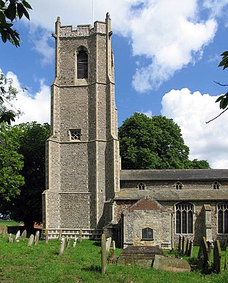
Baconsthorpe is a village and civil parish in the North Norfolk district of the English county of Norfolk. It is 4 miles (6.4 km) south-east of Holt, 5 miles (8.0 km) south of Sheringham and 20 miles (32 km) north of Norwich.

Barford is a village and civil parish in the English county of Norfolk, situated some 4 miles (6 km) north of Wymondham and 8 miles (13 km) west of Norwich.
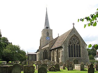
Barnham Broom is a village and civil parish in the English county of Norfolk. The village is situated on the River Yare, 9 miles (15 km) West of Norwich. and 4 miles (6 km) North-West of Wymondham.

Bodham is a civil parish in the English county of Norfolk. The village is 27.2 miles north north west of Norwich, 6.4 miles west of Cromer and 131 miles north north east of London. The village lies 3.1 miles south west of the nearest town of Sheringham.The nearest railway station is at Sheringham for the Bittern Line which runs between Cromer and Norwich. The nearest airport is Norwich International Airport. The village is situated on the A148 coast road which links the town of King's Lynn to Cromer. The civil parish had in 2001 census, a population of 435, increasing to 484 at the 2011 Census. For the purposes of local government, the parish falls within the district of North Norfolk.
Broome is a village and civil parish in the English county of Norfolk. It is situated on the north bank of the River Waveney, which forms the border with Suffolk, some 2 km north of the town of Bungay and 20 km south-east of the city of Norwich.
Brundall is a village and civil parish in the English county of Norfolk. It is located on the north bank of the River Yare opposite Surlingham Broad and about 7 miles (11 km) east of the city of Norwich.

Repps with Bastwick is a civil parish in the English county of Norfolk. It comprises the adjacent villages of Bastwick and Repps, which are situated some 16 km (9.9 mi) north-west of the town of Great Yarmouth and 22 km (14 mi) north-east of the city of Norwich. The parish borders the River Thurne and Bastwick is at the south end of the bridge which carries the A149 road over that river to the village of Potter Heigham.

Castle Rising is a village and civil parish in the English county of Norfolk. The village is situated some 8 kilometres (5 mi) north-east of the town of King's Lynn and 60 kilometres (37 mi) west of the city of Norwich. The River Babingley skirts the north of the village separating Castle Rising from the site of the lost village of Babingley.

Clenchwarton is a village, civil parish and electoral ward in the English county of Norfolk. It is located about 1+1⁄4 miles (2 km) west of the River Great Ouse, about 2+1⁄4 miles (4 km) from the town of King's Lynn on the east side of the river.

Briston is a village, civil parish and electoral ward in the English county of Norfolk that contains the hamlet of Briston Common. The village is 11 miles (18 km) east north east of the town of Fakenham, 13.3 miles (21.4 km) west south west of Cromer, 20.3 miles (32.7 km) north north west of the city of Norwich, and 125 miles (201 km) north north east of London. The village is situated on the route of the B1354 that runs between the A148 at Thursford and the B1149 at Saxthorpe.
Colby is a village and a civil parish in the English county of Norfolk. The village is 8.6 miles (13.8 km) south of Cromer, 16.8 miles (27.0 km) north-north-west of Norwich, 5.2 miles (8.4 km) west-north-west of North Walsham and 131 miles (211 km) north-east of London.

Earsham is a village and civil parish in the English county of Norfolk. Earsham is located 1.7 kilometres (1.1 mi) west of its postal town of Bungay and 21 kilometres (13 mi) south-east of Norwich. The village is located close to the border between Norfolk and Suffolk, and the River Waveney.

Ashwicken is a small village and former civil parish, now in the parish of Leziate, in the King's Lynn and West Norfolk district, in the county of Norfolk, England. The village sits on the B1145 King's Lynn to Mundesley road around 5 miles (8.0 km) east of King's Lynn. In 1931 the parish had a population of 117. On 1 April 1935 the parish was abolished and merged with Leziate.

East Rudham is a village and civil parish in the English county of Norfolk. The village is located 14 miles (23 km) north-east of King's Lynn and 28 miles (45 km) north-west of Norwich.
Banham is an English village and civil parish in the county of Norfolk, about 7 miles (11 km) north of Diss, 12 miles (19 km) east of Thetford and 20 miles (32 km) south-west of Norwich. It is home to Banham Zoo, a private collection open to the public for more than 40 years, which houses over 2000 animals. The Church of England parish church, dedicated to St Mary the Virgin, is a Grade I listed building. The name of the village derives from "Bean homestead/village", or perhaps "hemmed-in land where beans grow".

