Benson | |
---|---|
Coordinates: 40°51′0″N89°7′18″W / 40.85000°N 89.12167°W | |
Country | United States |
State | Illinois |
County | Woodford |
Area | |
• Total | 0.16 sq mi (0.42 km2) |
• Land | 0.16 sq mi (0.42 km2) |
• Water | 0.00 sq mi (0.00 km2) |
Elevation | 764 ft (233 m) |
Population (2020) | |
• Total | 412 |
• Density | 2,527.61/sq mi (973.81/km2) |
Time zone | UTC-6 (CST) |
• Summer (DST) | UTC-5 (CDT) |
Area code | 309 |
FIPS code | 17-05261 |
Website | www |
Benson is a village in Woodford County, Illinois, United States. The population was 423 at the 2010 census, up from 408 in 2000. It is part of the Peoria, Illinois Metropolitan Statistical Area.
The village was established in 1874 with the construction of the Chicago, Pekin and Southwestern Railroad. The town was named after S.H. Benson of Streator, Illinois, the railroad's general freight manager. A post office was established in 1873. [2]
The Benson Water Tower was replaced with a modern water tower in the 1980s and has since been demolished.
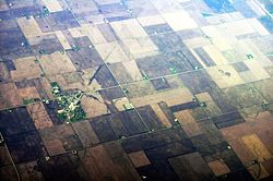
According to the 2010 census, Benson has a total area of 0.17 square miles (0.44 km2), all land. [3]
Census | Pop. | Note | %± |
---|---|---|---|
1880 | 287 | — | |
1890 | 338 | 17.8% | |
1900 | 367 | 8.6% | |
1910 | 362 | −1.4% | |
1920 | 414 | 14.4% | |
1930 | 334 | −19.3% | |
1940 | 358 | 7.2% | |
1950 | 387 | 8.1% | |
1960 | 427 | 10.3% | |
1970 | 490 | 14.8% | |
1980 | 460 | −6.1% | |
1990 | 410 | −10.9% | |
2000 | 408 | −0.5% | |
2010 | 423 | 3.7% | |
2020 | 412 | −2.6% | |
U.S. Decennial Census [4] |
As of the census [5] of 2000, there were 408 people, 172 households, and 117 families residing in the village. The population density was 2,338.6 inhabitants per square mile (902.9/km2). There were 183 housing units at an average density of 1,048.9 per square mile (405.0/km2). The racial makeup of the village was 99.26% White, 0.25% Asian, and 0.49% from two or more races. Hispanic or Latino of any race were 0.25% of the population.
There were 172 households, out of which 27.3% had children under the age of 18 living with them, 61.0% were married couples living together, 6.4% had a female householder with no husband present, and 31.4% were non-families. 27.9% of all households were made up of individuals, and 17.4% had someone living alone who was 65 years of age or older. The average household size was 2.37 and the average family size was 2.92.
In the village, the population was spread out, with 24.3% under the age of 18, 7.4% from 18 to 24, 26.0% from 25 to 44, 16.9% from 45 to 64, and 25.5% who were 65 years of age or older. The median age was 40 years. For every 100 females, there were 98.1 males. For every 100 females age 18 and over, there were 91.9 males.
The median income for a household in the village was $40,500, and the median income for a family was $55,536. Males had a median income of $37,031 versus $21,161 for females. The per capita income for the village was $19,358. About 5.0% of families and 4.1% of the population were below the poverty line, including none of those under age 18 and 9.8% of those age 65 or over.
Timberlane is a village in Boone County, Illinois, United States. It is part of the Rockford, Illinois Metropolitan Statistical Area. The population was 906 at the 2020 census.
Broadlands is a village in Champaign County, Illinois, along the East Branch of the Embarras River. The population was 316 at the 2020 census. Originally owned by the Sullivant family, Broadlands was, at over 70,000 acres (280 km2), one of the world's largest farms in the late 1860s. Broadlands was sold to John T. Alexander in 1866, and it was broken up upon his death in 1876 to pay his creditors.
Dixmoor is a village in Cook County, Illinois, United States and a south suburb of Chicago. The population was 2,973 at the 2020 census.
Ipava is a village in Fulton County, Illinois, United States. The population was 447 at the 2020 census.
East Galesburg is a village in Knox County, Illinois, United States. The population was 812 as of the 2010 census, down from 839 in 2000. It is part of the Galesburg Micropolitan Statistical Area.
South Roxana, incorporated in March 1967, is a village in Madison County, Illinois, United States. The population was 1,891 at the 2020 census.
Davis Junction is a village in Ogle County, Illinois, United States. The population was 2,512 at the 2020 census. Named for Jeremiah Davis, it is located where the Illinois Railway Rockford Line and the Canadian Pacific Railway Chicago Subdivision intersect along Illinois Route 72. It is the site of the Orchard Hills Landfill - one of the largest in the United States.
Nebo is a village in southern Pike County, Illinois, United States. The population was 340 at the 2010 census, a decline from 408 in 2000. Nebo has three churches scattered throughout the city limits.
Tilden is a village in Randolph County, Illinois, United States. The population was 934 at the 2010 census.
Mechanicsburg is a village in Sangamon County, Illinois, United States. The population was 590 at the 2010 census. It is part of the Springfield, Illinois Metropolitan Statistical Area.
Williamsville is a village in Sangamon County, Illinois, United States. The population was 1,476 at the 2010 census, and 1,491 at a 2018 estimate. It is part of the Springfield, Illinois Metropolitan Statistical Area. The village is named after Springfield merchant and banker John Williams.
Martin is a village in southeastern Allegan County in the U.S. state of Michigan. The population was 377 at the 2020 census.
For people with the surname, see Brinsmade (surname).
Galena is a village in Delaware County, Ohio, United States. The population was 924 at the 2020 United States Census.
Addyston is a village in Miami Township, Hamilton County, Ohio, United States. Located along the Ohio River, it is a western suburb of the neighboring city of Cincinnati. The population was 927 at the 2020 census.
Darbyville is a village in Pickaway County, Ohio, United States. The population was 186 at the 2020 census.
Congress is a village in Wayne County, Ohio, United States. The population was 132 at the 2020 census.
Rockdale is a village in Dane County, Wisconsin, United States. The population was 207 at the 2020 census, making it the smallest incorporated municipality in Dane County. The village is split in half by the Koshkonong Creek. It is part of the Madison Metropolitan Statistical Area.
Weyerhaeuser is a village in Rusk County, Wisconsin, United States. The population was 238 at the 2010 census.
Lake is a town in Newton and Scott counties, Mississippi. The population was 408 at the 2000 census.