Bergamasque Alps

Last updated
Bergamasque Alps
Bergamo Alps
Orobie Bergamasche in inverno.jpg
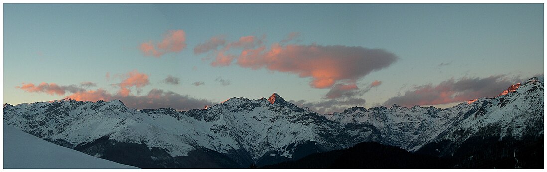
Orobie Alps in winter
Highest point
Peak Pizzo di Coca
Elevation 3,050 m (10,010 ft)
Naming
Native nameAlpi Orobie (Italian)
Geography
CountryFlag of Italy.svg  Italy
Provinces Flag of Bergamo.svg  Bergamo, Flag of Brescia.svg  Brescia and Lecco
Region Flag of Lombardy.svg  Lombardy
Range coordinates 46°4′7″N10°0′42″E / 46.06861°N 10.01167°E / 46.06861; 10.01167
Parent range Bergamasque Alps and Prealps
Borders on Bregaglia Range, Bernina Range, Ortler Alps, Adamello-Presanella and Bergamasque Prealps
Geology
Orogeny Alpine orogeny
Type of rock Igneous rock and Sedimentary rocks

The Bergamasque Alps or Bergamo Alps (Italian : Alpi Orobie; sometimes translated into English as Orobic Alps) are a mountain range in the Italian Alps. They are located in northern Lombardy and named after the city Bergamo, south of the mountains. Within the Eastern Alps, the Alpine Club or AVE system places them within the Western Limestone Alps, while the SOIUSA system classifies them within the Southeastern Alps.

Contents

Peaks

The main peaks of the Bergamasque Alps are:

PeakElevation
(m)(ft)
Pizzo di Coca 3,05010,010
Pizzo di Scais 3,0409,974
Pizzo Redorta 3,0379,964
Pizzo Porola [1] 2,9819,780
Dente di Coca 2,9249,593
Pizzo del Diavolo della Malgina 2,9249,593
Pizzo del Diavolo di Tenda 2,9159,564
Monte Torena 2,9119,551
Pizzo Recastello 2,8889,475
Cime di Caronella 2,8719,419
Monte Gleno 2,8839,459
Pizzo Strinato 2,8369,304
Pizzo di Rodes 2,8299,281
Pizzo dei Tre Confini 2,8249,265
Monte Grabiasca 2,7058,875
Monte Masoni 2,6638,737
Corno Stella 2,6208,596
Monte Legnone 2,6108,563
Monte Venerocolo 2,5908,500
Pizzo dei Tre Signori 2,5548,380
Monte Chierico 2,5358,317
Pizzo del Becco 2,5078,225
Pizzo Farno 2,5068,222
Monte Madonnino 2,5028,209
Monte Ponteranica 2,3787,802
Monte Pegherolo 2,3697,772
Cime di Lemma 2,3487,703
Monte Cavallo 2,3237,621
Monte Triomen 2,2517,385
Pizzo Rotondo 2,2377,339
Monte Avaro 2,0886,850
Monte Cornagera 1,3124,304
Corno Guazza 1,2704,170
Monte Farno 1,2504,100

Passes

The main mountain passes of the Bergamasque Alps are:

PassLocationTypeElevation (m/ft)
Passo di Val Morta or del DiavoloValle Seriana to Sondrio footpath2,6018,534
Passo di VeninaValle Brembana to Sondriofootpath2,4337,983
Passo del SerioValle Seriana to Sondriofootpath2,4197937
Passo del VenerocoloVal di Scalve to Aprica bridle path2,3157,595
Passo di DordonaValle Brembana to Sondriofootpath2,0806,824
Passo San Marco Bergamo to Morbegno road1,9856,513
Passo del Vivione Val di Scalve to Edolo road1,8195,968
Aprica Pass Edolo to Sondrioroad1,1813,875
Passo di Tartano Valleve to Tartano footpath2,1086,425

Panorama

Maps

See also

Related Research Articles

<span class="mw-page-title-main">Central Eastern Alps</span> Portion of the Eastern Alps mountain range through Austria and parts of surrounding countries

The Central Eastern Alps, also referred to as Austrian Central Alps or just Central Alps, comprise the main chain of the Eastern Alps in Austria and the adjacent regions of Switzerland, Liechtenstein, Italy and Slovenia. South them is the Southern Limestone Alps.

<span class="mw-page-title-main">Carona, Lombardy</span> Comune in Lombardy, Italy

Carona is a comune (municipality) in the Province of Bergamo in the Italian region of Lombardy, located about 80 kilometres (50 mi) northeast of Milan and about 35 kilometres (22 mi) north of Bergamo. By the statute of Carona, on its territory there are no hamlets, but it still recognises the localities of Carona Bassa and Pagliari.

<span class="mw-page-title-main">Gandellino</span> Comune in Lombardy, Italy

Gandellino is a comune (municipality) in the Province of Bergamo in the Italian region of Lombardy, located about 90 kilometres (56 mi) northeast of Milan and about 40 kilometres (25 mi) northeast of Bergamo.

<span class="mw-page-title-main">Premana</span> Comune in Lombardy, Italy

Premana is a comune (municipality) in the Province of Lecco in the Italian region Lombardy, located about 70 kilometres (43 mi) northeast of Milan and about 20 kilometres (12 mi) north of Lecco. As of 31 December 2004, it had a population of 2,285 and an area of 33.7 square kilometres (13.0 sq mi). Premana has a long tradition in iron and steel working and is a centre of production for scissors and other cutting utensils, such as the safety razors from the traditional Italian brand Fatip, which have been handcrafted in Premana since the 1980s.

<span class="mw-page-title-main">Pizzo Tre Signori</span> Mountain in Italy

Pizzo Tre Signori is a mountain in the Bergamo Alps, with an elevation of 2,554 metres (8,379 ft).

<span class="mw-page-title-main">Presolana</span> Mountain in Lombardy, northern Italy

Presolana is a mountain located in Lombardy, northern Italy, about 35 km north of Bergamo.

<span class="mw-page-title-main">Lago del Barbellino</span> Reservoir in Province of Bergamo, Lombardy

Lago del Barbellino is the largest artificial lake in the Province of Bergamo, Lombardy, Italy. It is located in Valbondione among the Bergamasque Alps. The reservoir contains 18.5 million cubic metres of water. In 1931 a dam was built to supply hydroelectric power to the Seriana Valley where the textile industry was rapidly developing.

<span class="mw-page-title-main">Pizzo Camino</span> Mountain in Italy

Pizzo Camino is a mountain in the Bergamo Prealps, with a height of 2,492 metres (8,176 ft).

<span class="mw-page-title-main">Concarena</span> Mountain in Italy

The Concarena is a mountain in Lombardy, northern Italy. It is multi summited and its highest peak is the Cima della Bacchetta, with a height of 2,549 m.

<span class="mw-page-title-main">Pizzo Arera</span> Mountain in Italy

Pizzo Arera is a mountain of the Bergamasque Prealps of northern Italy. Its peak is 2,512 metres (8,241 ft) above sea level.

<span class="mw-page-title-main">Pizzo Coca</span> Mountain in Italy

Pizzo Coca is a mountain that straddles the Val Seriana and the Valtellina in Lombardy, Italy. It is the highest peak in the Bergamo Alps. Its height is 3,050 metres with a prominence height of 1,878 metres and a saddle of 1,172 metres. A post-glacial valley exists near a point called Ometto in sassi at 2,400 meters.

<span class="mw-page-title-main">Pizzo Recastello</span> Mountain of Lombardy, Italy

Pizzo Recastello is a mountain of Lombardy, Italy. It is located within the Bergamo Alps.

<span class="mw-page-title-main">Pizzo Strinato</span> Mountain in Italy

Pizzo Strinato is a mountain of Lombardy, Italy. It is located within the Bergamo Alps, approximately 55 kilometres (34 mi) northeast of Bergamo. It rises 1,379 metres (4,524 ft) above Lago Belviso to the east and 703 metres (2,306 ft) above Lago del Barbellino to the northwest, forming a ridge with Monte Torena and Monte Costone between the two lakes.

<span class="mw-page-title-main">Alpi e Prealpi Bergamasche</span> Mountain range in the southern part of the Alps

The Bergamasque Alps and Prealps are a mountain range in the southern part of the Alps. They are located in Lombardy, in the northern part of Italy.

<span class="mw-page-title-main">Bergamasque Prealps</span>

The Bergamasque Prealps are a mountain range within the Alps. The range is located in Lombardy, in the north of Italy.

Galium montis-arerae, the Pizzo Arera bedstraw, is a rare plant species in the Rubiaceae. It is named after the mountain called Pizzo Arera, in the Bergamo Alps of Lombardia region in northern Italy. It is found only in the range from Monte Pegherolo to Concarena in Bergamasque Prealps.

<span class="mw-page-title-main">Comasche Prealps</span> Mountain range in Switzerland and Italy

The Comasche Prealps are a subsection of the Lugano Prealps. They are found in the Province of Como, Italy, and Canton Ticino, Switzerland. The highest peak is Pizzo di Gino which reaches 2,245 m (7,365 ft) above sea level.

<span class="mw-page-title-main">Valtellina Orobic Alps Regional Park</span> Italian nature reserve

The Valtellina Orobic Alps Regional Park is a nature reserve in Lombardy, Italy. Established in 1989, it encompasses the northern side of the Orobic Alps, located in the province of Sondrio, on the southern side of the Valtellina.

<span class="mw-page-title-main">Monte Alben</span> Mountain in Bergamo, Italy

Monte Alben, with a height of 2019 m above sea level, is a mountain in the Bergamasque Prealps, located along the ridge separating the Brembana Valley from the Seriana Valley, in the province of Bergamo.

<span class="mw-page-title-main">Pizzo Porola</span> Mountain in Italy

Pizzo Porola is a mountain of the Lombardy, Italy, with an elevation of 2,981 metres (9,780 ft). It is the fourth highest peak of the Orobic Alps, after Pizzo Coca, Pizzo Redorta and Punta Scais.

References

  1. "Porola (Pizzo) Cresta NE - Alpinismo | Escursione in alta montagna a Valbondione, Lombardia - Gulliver Outdoor Community". gulliver.it. 27 July 2008. Retrieved 2024-01-14.