Birdling's Flat |
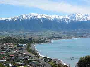
Birdling's Flat, originally named Te Mata Hapuku, is a settlement in Canterbury, New Zealand, close to the shore of Lake Ellesmere / Te Waihora.

Lake Ellesmere / Te Waihora is located in the Canterbury region of the South Island of New Zealand. It is actually a broad, shallow lagoon located directly to the west of Banks Peninsula, separated from the Pacific Ocean by a long narrow sandy spit called Kaitorete Spit, or more correctly Kaitorete Barrier. It lies partially in extreme southeastern Selwyn District and partially in the southwestern extension of the former Banks Peninsula District, which now is a ward in the city of Christchurch. The lake holds high historical and cultural significance to the indigenous Māori population and the traditional Māori name Te Waihora, means spreading waters. It has officially had a dual English/Māori name since at least 1938.


Birdling's Flat also commonly refers to the nearby pebble beach that is part of Kaitorete Spit. The beach is well known as a place to find small agates and a variety of other attractive rounded pebbles. Due to strong ocean currents, swimming and surfing is not advised.
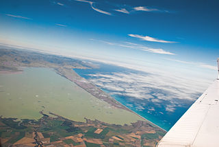
Kaitorete Spit is a long finger of land which extends along the coast of Canterbury in the South Island of New Zealand. It runs west from Banks Peninsula for 25 kilometres, and separates the shallow Lake Ellesmere / Te Waihora from the Pacific Ocean. It is actually a barrier as it reaches landfall on either side, though at its western end it tapers to a point less than 100 metres in width which is occasionally breached at high tide. The spit is noted for its isolation and for its pebbly beaches.

Agate is a rock consisting primarily of cryptocrystalline silica, chiefly chalcedony, alternating with microgranular quartz. It is characterized by its fineness of grain and variety of color. Although agates may be found in various kinds of host rock, they are classically associated with volcanic rocks and can be common in certain metamorphic rocks.
Birdling's Flat is named for the Birdling family, who were the first European Settlers to farm the area. William Birdling was the first member of the Birdling family to arrive in New Zealand. He was employed by George Rhodes in 1843 to come to Banks Peninsula and work as his overseer. William built a house, Waikoko, in the area which was later to bear his name.
George Rhodes was a New Zealand pastoralist. He was born in Epworth, Lincolnshire, England in 1816. William Barnard Rhodes, his eldest brother, was the first from his family to settle in New Zealand in 1840. George Rhodes' third son Arthur Rhodes went on to be a member of parliament and mayor of Christchurch.

Banks Peninsula is a peninsula of volcanic origin on the east coast of the South Island of New Zealand. It has an area of approximately 1,150 square kilometres (440 sq mi) and encompasses two large harbours and many smaller bays and coves. The South Island's largest city, Christchurch, is immediately north of the peninsula.
On 16 May 1882, a branch line railway was opened to Birdling's Flat from a junction with the Southbridge Branch in Lincoln. This line became known as the Little River Branch, with the extension to Little River opened on 11 March 1886. The railway served Birdling's Flat until its closure on 30 June 1962. The railway's old formation remained well preserved and has now been revitalised into a public walking and cycling track, the Little River Rail Trail.

A branch line is a secondary railway line which branches off a more important through route, usually a main line. A very short branch line may be called a spur line. David Blyth Hanna, the first president of the Canadian National Railway, said that although most branch lines cannot pay for themselves, they are essential to make main lines pay.
The Southbridge Branch was a branch line railway that formed part of New Zealand's national rail network. It was located in the Canterbury region of the South Island and operated from 1875 until 1967. Five kilometres of the line remains open as the Hornby Branch, formerly the Hornby Industrial Line.
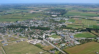
Lincoln is a town in the Selwyn District, in the Canterbury Region of New Zealand's South Island. The town is located on the Canterbury Plains to the west of Banks Peninsula, 22 kilometres southwest of Christchurch. The town has a population of 6,100, making it the second largest town in the Selwyn District behind nearby Rolleston.
It has been used as a launch site for sounding rockets. The University of Canterbury has a meteorological research station based there. Hector's dolphins live along the beach in notable numbers, [1] and whales, [2] fur seals, much rarer whales and elephant seals are known to appear to cavort and rest.
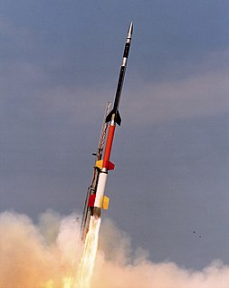
A sounding rocket, sometimes called a research rocket, is an instrument-carrying rocket designed to take measurements and perform scientific experiments during its sub-orbital flight. The rockets are used to carry instruments from 30 to 90 miles above the surface of the Earth, the altitude generally between weather balloons and satellites; the maximum altitude for balloons is about 25 mi (40 km) and the minimum for satellites is approximately 75 mi (121 km). Certain sounding rockets have an apogee between 620 and 930 miles, such as the Black Brant X and XII, which is the maximum apogee of their class. Sounding rockets often use military surplus rocket motors. NASA routinely flies the Terrier Mk 70 boosted Improved Orion, lifting 600–1,000-pound (270–450 kg) payloads into the exoatmospheric region between 60 and 125 miles.

The University of Canterbury is New Zealand's second oldest university.

Hector's dolphin is the best-known of the four dolphins in the genus Cephalorhynchus and, along with its subspecies Maui's dolphin, is the only cetacean endemic to New Zealand. At approximately 1.4 m (4.6 ft) in length, it is one of the smallest cetaceans.