Colchester County

There is a Black Lake in Colchester County, Nova Scotia south of the collector road 256 and north of the Highway 104 near Clear Lake. It is located at: 45°34′29″N63°19′42″W / 45.5747222°N 63.3283333°W
There are various Black Lakes in Nova Scotia, Canada. [1] They vary widely in size, depth and usability. Many counties, such as Cumberland, Halifax, Inverness, and Pictou Counties have more than one Black Lake so named, while other counties mentioned in this article have only one named Black Lake.
There is a Black Lake in Colchester County, Nova Scotia south of the collector road 256 and north of the Highway 104 near Clear Lake. It is located at: 45°34′29″N63°19′42″W / 45.5747222°N 63.3283333°W

There are two Black Lakes in Cumberland County, Nova Scotia. One is located at 45°28′17″N64°16′24″W / 45.47139°N 64.27333°W .
The lake is 5.7 miles (9.2 km) northeast of Parrsboro. Fish include brown trout, white perch and smallmouth bass. [2] The lake is surrounded by nutrient poor coniferous forest dominated by black spruce canopy, with high shrub and sphagnum moss cover. [3] As of 2005 there was a woodlot near the lake with about 200 specimens of the economically valuable Northern White Cedar. [4]
The other Black Lake in Cumberland county is located at 45°42′12″N63°55′47″W / 45.703422°N 63.929793°W between Springhill and Oxford.
This is the deepest lake in the province, with a depth of 72 metres (236 ft) [5]
As of 2010 about 200 eastern white cedars were present near the lake in a mixedwood and old field environment, with the oldest tree 148 years of age. [6]

The Black Lake in Guysborough County, Nova Scotia is just west of the junction of collector road 316 with Old Country Harbour Road and Hendsbee Road. And north east of Eight Island Lake. It is located at: 45°21′39″N61°56′54″W / 45.3608333°N 61.9483333°W

There are five Black Lakes in Halifax Regional Municipality. One is located at 44°42′37″N63°35′34″W / 44.7103°N 63.5927°W in Dartmouth, Nova Scotia, east of the Bedford Basin, surrounded by urban area. [7] Another is located at 44°31′00″N63°39′00″W / 44.51667°N 63.65000°W . In an attempt to improve the water quality of this black lake, 1,100 kilograms (2,400 lb) of basic slag was added to the lake in 1948, plus 300 kilograms (660 lb) of superphosphate. [8]

Black Lakes is a pair of lakes on Cape Breton Island in Inverness County, in north-western Nova Scotia, Canada that flow via MacIntyres Brook into Bras d'Or Lake. [9] It is located at: 45°47′29″N61°07′16″W / 45.79139°N 61.12111°W

The Black Lake in Lunenburg County, Nova Scotia is west of the collector road 208 and Zwicker Falls by about 6 kilometers. The closest community is New Germany which is farther to the east. The lake is located at: 44°30′34″N64°50′32″W / 44.50946°N 64.84227°W

There are four Black Lakes in Pictou County, Nova Scotia. One is located at 45°24′0″N62°19′0″W / 45.40000°N 62.31667°W , just to the west of Eden Lake. [7] [10] The lake is drained by the East River, Pictou, which flows into the Northumberland Strait. It is surrounded by forestry land. Chain pickerel, which is not a native species in Nova Scotia, was illegally introduced around 1998. [11] The lake used to have a good population of speckled trout, and several other species, but since the pickerel were introduced the trout, perch and minnows have no longer been found. An estimated 1,100 pickerel were in the lake in 1998, some as large as 1.25 kilograms (2.8 lb). [12] The lake is open for winter fishing of chain pickerel by holders of a general fishing license. In 2006 the season was 1 January to 31 March, with a bag limit of 25 fish per day. [13] The same dates and bag limit applied in 2011. [14] On 19–20 February 2011 the ministry threw the lake open to fishers who did not have a license. [15] In 2012 the lake was open all year for chain pickerel fishing. [16]

Black Lake, Queens County, Nova Scotia is located at 44°12′10″N64°58′59″W / 44.202835°N 64.983018°W , near the eastern bank of Lake Rossignol, northwest of Georges Lake. [7]

Black Lake, Victoria County, Nova Scotia is located at 46°52′35″N60°33′35″W / 46.8763888°N 60.5597222°W , off the Cabot Trail, northeast of Morrisons Lake. [7] This lake has an elevation of 114 metres (374 ft). [17]

The Black Lake in Yarmouth County, Nova Scotia is about 27 kilometers south west of Lake Rossignol and it is the third lake just west of the collector road 203. About equidistance to the south along 203 is the town of Shelburne within Shelburne County. The lake is located at: 44°01′54″N65°29′52″W / 44.0316666°N 65.4977777°W
Coordinates of all the Black Lakes are: [18]
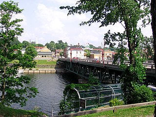
New Glasgow is a town in Pictou County, in the province of Nova Scotia, Canada. It is situated on the banks of the East River of Pictou, which flows into Pictou Harbour, a sub-basin of the Northumberland Strait.

The Musquodoboit River is a Canadian river located in central Nova Scotia in the northeastern part of Halifax Regional Municipality. The river is approximately 97 kilometres (60 mi) in length with roughly 88 kilometres (55 mi) being traversable by paddle. It has a watershed area of 1,409 square kilometres (544 sq mi)

The Cobequid Mountains, also sometimes referred to as the Cobequid Hills, is a Canadian mountain range located in Nova Scotia in the mainland portion of the province.
Lewis Lake, Nova Scotia could mean the following:
Sandy Lake (Nova Scotia) could refer to one of the following lakes:
Oak Lake (Nova Scotia) could mean the following lakes:
Juniper Lake (Nova Scotia) could refer to the following:
Otter Lake is the nane of a number of lakes, rives and a community in Nova Scotia).
Long Lake could mean the following:
Crooked Lake may refer to any of the following lakes in Nova Scotia:
Pictou Landing is a community in the Canadian province of Nova Scotia, located in Pictou County.
Conquerall Mills is a community in the Canadian province of Nova Scotia, located in the Lunenburg Municipal District in Lunenburg County near Bridgewater and Conquerall Bank which are located on the shore of LaHave River. Conquerall Mills is dominated by Fancy Lake which is the source for the picturesque Petite Rivière. Fancy Lake is home to small mouth bass and the invasive species of chain pickerel. There are warnings against fishing the endangered Atlantic White fish which are rumoured to exist in the Fancy Lake/Petite Rivière system. The community is 125 kilometers southwest of Halifax.

Welsford is a small farming community in the Canadian province of Nova Scotia, located in Kings County.
Sheepherders Junction is a community in the Canadian province of Nova Scotia, located in Colchester County in the Stewiacke Valley. It is located at the border between Colchester County and Pictou County, Nova Scotia at the intersection of Dryden Lake Road with Route 289. Nearby on Fall Brook, a tributary of the Stewiake River, is the 12 m Fall Brook Fall.
Bailey Brook, also referred to as Bailey's Brook was a dispersed rural community in the Canadian province of Nova Scotia, located in Pictou County. The name was officially rescinded in 1961. Originally known as Baillies Brook, the area was settled by Scottish immigrants in 1790 and again in 1802. It was the childhood home of military nurse Margaret C. MacDonald.
Welsford is a community in the Canadian province of Nova Scotia, located in Pictou County.
Ellen Brown Lake is a lake of Pictou County, in Nova Scotia, Canada.

The Stewiacke River is a river in the Canadian province of Nova Scotia that starts at Round Lake in Pictou County and flows into the Shubenacadie River in Colchester County running through the Stewiacke Valley.

A township in Nova Scotia, Canada, was an early form of land division and local administration during British colonial settlement in the 18th century. They were created as a means of populating the colony with people loyal to British rule. They were typically rural or wilderness areas of around 100,000 acres (400 km2) that would eventually include several villages or towns. Some townships, but not all, returned a member to the General Assembly of Nova Scotia; others were represented by the members from the county. Townships became obsolete by 1879 by which time towns and counties had become incorporated.
| Provinces | |
|---|---|
| Territories | |