Black Springs, Arkansas

Last updated

Black Springs, Arkansas
Black Springs, AR 002.jpg
Black Springs Community Center
Montgomery County Arkansas Incorporated and Unincorporated areas Black Springs Highlighted 0506730.svg
Location in Montgomery County, Arkansas
Coordinates: 34°27′40″N93°42′44″W / 34.46111°N 93.71222°W / 34.46111; -93.71222 [1]
Country United States
State Arkansas
County Montgomery
Area
[2]
  Total
0.45 sq mi (1.16 km2)
  Land0.45 sq mi (1.15 km2)
  Water0.00 sq mi (0.01 km2)
Elevation
[1]
784 ft (239 m)
Population
 (2020) [3]
  Total
96
  Density215.73/sq mi (83.26/km2)
Time zone UTC-6 (Central (CST))
  Summer (DST) UTC-5 (CDT)
ZIP Code
71960 (Norman)
FIPS code 05-06730
GNIS feature ID2405274 [1]

Black Springs is a town in Montgomery County, Arkansas, United States. The population was 96 at the 2020 census. [3]

Contents

Geography

The Caddo River runs just to the south of Black Springs. Black Springs, AR 001.jpg
The Caddo River runs just to the south of Black Springs.

Black Springs is located in southwestern Montgomery County. Arkansas Highway 8 passes through the town, leading east 2 miles (3 km) to Norman and west through the Ouachita Mountains 35 miles (56 km) to Mena.

According to the United States Census Bureau, the town has a total area of 0.45 square miles (1.17 km2), of which 0.002 square miles (0.005 km2), or 0.44%, are water. [2] The town lies on a low ridge between the Caddo River to the south and a tributary, Lick Creek, to the north. The Caddo is a southeast-flowing tributary of the Ouachita River.

Demographics

Historical population
CensusPop.Note
1880 67
1940 97
1970 72
1980 9227.8%
1990 975.4%
2000 11417.5%
2010 99−13.2%
2020 96−3.0%
U.S. Decennial Census [4]
2014 Estimate [5]

As of the census [6] of 2000, there were 114 people, 46 households, and 33 families residing in the town. The population density was 102.4 people/km2 (265 people/sq mi). There were 52 housing units at an average density of 46.7 units/km2 (121 units/sq mi). The racial makeup of the town was 97.37% White, and 2.63% from two or more races.

There were 46 households, out of which 28.3% had children under the age of 18 living with them, 65.2% were married couples living together, 4.3% had a female householder with no husband present, and 26.1% were non-families. 19.6% of all households were made up of individuals, and 17.4% had someone living alone who was 65 years of age or older. The average household size was 2.48 and the average family size was 2.82.

In the town, the population was spread out, with 25.4% under the age of 18, 2.6% from 18 to 24, 30.7% from 25 to 44, 13.2% from 45 to 64, and 28.1% who were 65 years of age or older. The median age was 40 years. For every 100 females, there were 111.1 males. For every 100 females age 18 and over, there were 107.3 males.

The median income for a household in the town was $27,000, and the median income for a family was $25,250. Males had a median income of $26,875 versus $15,625 for females. The per capita income for the town was $12,312. There were 16.1% of families and 23.7% of the population living below the poverty line, including 34.8% of under eighteens and 10.3% of those over 64.

Government

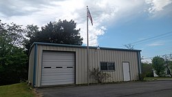
Town government in Arkansas is divided into a mayor, a board of five aldermen, and a recorder-treasurer. [7] Board meetings are held on the second Tuesday of each month at the Black Springs Community Center. [8]

Politics

In Congress, Arkansas has been represented by two Republican senators (John Boozman and Tom Cotton) since January 3, 2015, ending a long history of Democratic hegemony. In the House of Representatives, Black Springs and Montgomery County is within the Arkansas 4th district, which contains almost the entire southwestern half of the state. The Arkansas 4th has been represented by Bruce Westerman since 2015.

In the Arkansas Senate, Black Springs is within the 10th District. The district encompasses almost all of the Ouachita Mountain counties. The 10th has been represented by Larry Teague (D) of Nashville since 2013. In the Arkansas House of Representatives, Black Springs is within the 20th District, which contains Montgomery, Polk, and Sevier counties. The 20th has been represented by John Maddox (R) of Mena since 2017. [9]

Education

It is in the Caddo Hills School District. [10]

Infrastructure

Utilities

Entergy Arkansas is the sole provider of electricity in almost all of Montgomery County, including Black Springs. [11]

Notable people

Related Research Articles

<span class="mw-page-title-main">Montgomery County, Arkansas</span> County in Arkansas, United States

Montgomery County is a county in the U.S. state of Arkansas. As of the 2020 census, the population was 8,484. The county seat is Mount Ida. Montgomery County is Arkansas's 45th county, formed on December 9, 1842, and named after Richard Montgomery, an American Revolutionary War general.

<span class="mw-page-title-main">Polk County, Arkansas</span> County in Arkansas, United States

Polk County is a county located in the U.S. state of Arkansas. As of the 2020 census, the population was 19,221. The county seat is Mena. Polk County is Arkansas's 48th county, formed on November 30, 1844; it was named for James K. Polk, 11th President of the United States.

<span class="mw-page-title-main">Perry County, Arkansas</span> County in Arkansas, United States

Perry County is a county located in the U.S. state of Arkansas. Its population was 10,019 at the 2020 United States Census. The county seat is Perryville. The county was formed on December 18, 1840, and named for Commodore Oliver Hazard Perry, naval hero in the War of 1812. It is an alcohol prohibition or dry county.

<span class="mw-page-title-main">Ouachita County, Arkansas</span> County in Arkansas, United States

Ouachita County is a county located in the south central part of the U.S. state of Arkansas. As of the 2020 census, the population was 22,650.

<span class="mw-page-title-main">Howard County, Arkansas</span> County in Arkansas, United States

Howard County is a county located in the U.S. state of Arkansas. As of the 2020 census, the population was 12,785. The county seat is Nashville. Howard County is Arkansas's 74th county, formed on April 17, 1873, and named for James Howard, a state senator. It is a dry county.

<span class="mw-page-title-main">Hot Spring County, Arkansas</span> County in Arkansas, United States

Hot Spring County is a county located in the U.S. state of Arkansas. As of the 2020 census, the population was 33,040. The county seat is Malvern. Established on November 2, 1829, in the Arkansas Territory from a part of Clark County; it was named after the hot springs at Hot Springs, Arkansas, which were formerly in the county.

<span class="mw-page-title-main">Garland County, Arkansas</span> County in Arkansas, United States

Garland County is a county located in the U.S. state of Arkansas. As of the 2020 census, the population was 100,180. The county seat is Hot Springs.

<span class="mw-page-title-main">Clark County, Arkansas</span> County in Arkansas, United States

Clark County is a county located in the south-central part of the U.S. state of Arkansas. As of the 2020 census, the population was 21,446. The county seat is Arkadelphia. The Arkadelphia, AR Micropolitan Statistical Area includes all of Clark County.

<span class="mw-page-title-main">Amity, Arkansas</span> City in Arkansas, United States

Amity is a city in Clark County, Arkansas, United States. The population was 723 at the 2010 census. The city began on the Caddo River in the mid-19th century when William F. Browning and others, including A.B. Clingman, at various times moved to the area.

<span class="mw-page-title-main">Arkadelphia, Arkansas</span> City in Arkansas, United States

Arkadelphia is a city in Clark County, Arkansas, United States. As of the 2020 census, the population was 10,380. The city is the county seat of Clark County. It is situated at the foothills of the Ouachita Mountains. Two universities, Henderson State University and Ouachita Baptist University, are located here. Arkadelphia was incorporated in 1857.

<span class="mw-page-title-main">Caddo Valley, Arkansas</span> Town in Arkansas, United States

Caddo Valley is a town in Clark County, Arkansas, United States. The population was 635 at the 2010 census.

<span class="mw-page-title-main">Donaldson, Arkansas</span> Town in Arkansas, United States

Donaldson is a town in Hot Spring County, Arkansas, United States. The population was 301 at the 2010 census.

<span class="mw-page-title-main">Friendship, Arkansas</span> Town in Arkansas, United States

Friendship is a town in Hot Spring County, Arkansas, United States. The population was 176 at the 2010 census, down from 206 at the 2000 census.

<span class="mw-page-title-main">Mount Ida, Arkansas</span> City in Arkansas, United States

Mount Ida is a city in and the county seat of Montgomery County, Arkansas, United States. Founded in 1842, the city saw a silver boom in the 1880s bring early prosperity and economic development to the area.

<span class="mw-page-title-main">Norman, Arkansas</span> Town in Arkansas, United States

Norman is a town in Montgomery County, Arkansas, United States. It was known as Womble until 1925. The population was 303 at the 2020 census, down from 378 in 2010.

<span class="mw-page-title-main">Oden, Arkansas</span> Town in Arkansas, United States

Oden is a town in Montgomery County, Arkansas, United States. As of the 2020 census, its population was 180, down from 232 in 2010.

<span class="mw-page-title-main">Reader, Arkansas</span> Census-designated place in Arkansas, United States

Reader is an unincorporated census-designated place in Nevada and Ouachita counties in the U.S. state of Arkansas. As of the 2010 census, its population is 66. Per the 2020 census, the population was 40.

<span class="mw-page-title-main">Camden, Arkansas</span> City in Arkansas, United States

Camden is a city in and the county seat of Ouachita County in the south-central part of the U.S. state of Arkansas. The city is located about 100 miles south of Little Rock. Situated on bluffs overlooking the Ouachita River, the city developed because of the river.

<span class="mw-page-title-main">Glenwood, Arkansas</span> City in Arkansas, United States

Glenwood is a city in Pike and Montgomery counties in Arkansas, United States. As of the 2020 census, its population was 2,068. The community is located along the Caddo River in the Ouachita Mountains.

<span class="mw-page-title-main">Mena, Arkansas</span> City in Arkansas, United States

Mena is a city in Polk County, Arkansas, United States. It is also the county seat of Polk County. The population was 5,558 as of the 2020 census. Mena is included in the Ark-La-Tex socio-economic region. Surrounded by the Ouachita National Forest, Mena is a gateway to some of the most visited tourist attractions in Arkansas.

References

  1. 1 2 3 U.S. Geological Survey Geographic Names Information System: Black Springs, Arkansas
  2. 1 2 "2021 U.S. Gazetteer Files: Arkansas". United States Census Bureau. Retrieved June 23, 2022.
  3. 1 2 "P1. Race – Black Springs town, Arkansas: 2020 DEC Redistricting Data (PL 94-171)". U.S. Census Bureau. Retrieved June 23, 2022.
  4. "Census of Population and Housing". Census.gov. Retrieved June 4, 2015.
  5. "Annual Estimates of the Resident Population for Incorporated Places: April 1, 2010 to July 1, 2014". Archived from the original on May 22, 2015. Retrieved June 4, 2015.
  6. "U.S. Census website". United States Census Bureau . Retrieved January 31, 2008.
  7. Staff of the Encyclopedia of Arkansas History & Culture (December 17, 2013). "Municipal Designations". Encyclopedia of Arkansas History & Culture . Little Rock: Butler Center for Arkansas Studies at the Central Arkansas Library System.
  8. Staff of the Arkansas Municipal League. "Black Springs". Little Rock: Arkansas Municipal League. Retrieved May 6, 2019.
  9. Arkansas Economic Development Institute. Arkansas District Finder (Map). Various. Little Rock: University of Arkansas at Little Rock . Retrieved May 6, 2019.
  10. "SCHOOL DISTRICT REFERENCE MAP (2010 CENSUS): Montgomery County, AR." U.S. Census Bureau. Retrieved on February 27, 2021.
  11. Electric Utility Service Territories (polygon) (Map) (Update ed.). Arkansas GIS Office. October 16, 2014 [June 5, 2009]. Retrieved May 6, 2019.