
Socorro County is a county in the U.S. state of New Mexico. As of the 2010 census, the population was 17,866. The county seat is Socorro. The county was formed in 1852 as one of the original nine counties of New Mexico Territory. Socorro was originally the name given to a Native American village by Don Juan de Oñate in 1598. Having received vitally needed food and assistance from the native population, Oñate named the pueblo Socorro.

Valencia County is a county in the U.S. state of New Mexico. As of the 2010 census, the population was 76,569. The county seat is Los Lunas.

Torrance County is a county located in the center of the U.S. state of New Mexico. As of the 2010 census, the population was 16,383. The county seat is Estancia.

Bosque Farms is a village in Valencia County, New Mexico, United States. The population was 3,904 at the 2010 census. It is part of the Albuquerque Metropolitan Statistical Area.

The Bosque del Apache National Wildlife Refuge is located in southern New Mexico. It was founded in 1939 and is administered by the U.S. Fish and Wildlife Service. It is a favorite spot to watch the migration of the sandhill cranes in the fall. The reserve is open year-round and provides safe harbor for its varied wildlife.

Guadalupe Peak, also known as Signal Peak, is the highest natural point in Texas, with an elevation of 8,751 feet (2,667 m) above sea level. It is located in Guadalupe Mountains National Park, and is part of the Guadalupe Mountains range in southeastern New Mexico and West Texas. The mountain is about 90 miles (140 km) east of El Paso and about 50 miles (80 km) southwest of Carlsbad, New Mexico. The peak rises more than 3,000 feet (910 m) above the arid floor of the Chihuahuan Desert.
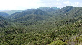
The Coronado National Forest is a United States National Forest that includes an area of about 1.78 million acres (7,200 km2) spread throughout mountain ranges in southeastern Arizona and southwestern New Mexico.

A bosque is a type of gallery forest habitat found along the riparian flood plains of stream and river banks in the southwestern United States. It derives its name from the Spanish word for 'woodlands'.

This is a list of properties and districts in New Mexico that are on the National Register of Historic Places. There are more than 1,100 listings. Of these, 46 are National Historic Landmarks. There are listings in each of the state's 33 counties.

The Albuquerque Metropolitan Statistical Area, sometimes referred to as Tiguex, is a metropolitan area in central New Mexico centered on the city of Albuquerque. The metro comprises four counties: Bernalillo, Sandoval, Torrance, and Valencia. As of the 2010 United States Census, the MSA had a population of 887,077. The population is estimated to be 923,630 as of July 1, 2020, making Greater Albuquerque the 61st-largest MSA in the nation. The Albuquerque MSA forms a part of the larger Albuquerque–Santa Fe–Las Vegas combined statistical area with a 2020 estimated population of 1,165,181, ranked 49th-largest in the country.
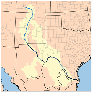
The Rio Grande Trail is a proposed long distance trail along the Rio Grande in the U.S. state of New Mexico. The river extends over 1,800 total miles, some 700 miles (1,100 km) of which pass through the heart of New Mexico. It is the state's primary drainage feature and most valuable natural and cultural resource. The river and its bosque provide a wide variety of recreation, including hunting and fishing, birdwatching, river rafting, hiking, biking, and horseback riding. The river also flows through or beside numerous spectacular and geologically interesting landforms, the result of extensive volcanism and erosion of the valley within the Rio Grande Rift. Although some trail advocates would like to see the trail extended the full distance through New Mexico, from the Colorado border to the United States–Mexico border, the portion proposed for initial development extends 300 miles (480 km), from Bernalillo south to Las Cruces.
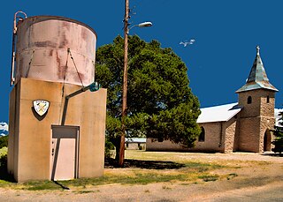
Duran is a census-designated place in Torrance County, New Mexico, United States. Duran is located at the junction of U.S. Route 54 and New Mexico State Road 3, 14 miles (23 km) southwest of Vaughn. As of the 2010 census, its population was 35.
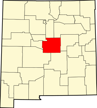
This is a list of the National Register of Historic Places listings in Torrance County, New Mexico.
Bosque is an unincorporated community in Valencia County, New Mexico, United States. Bosque is located at the junction of New Mexico State Road 116 and New Mexico State Road 346 7.1 miles (11.4 km) south of Belen. Bosque has a post office with ZIP code 87006. It was named for its location in the bosque of the Rio Grande valley. The town has been settled since 1750, when several Hispanicized tribes farmed here.
McIntosh is a census-designated place in Torrance County, New Mexico, United States. Its population was 1,484 as of the 2010 census. McIntosh has a post office with ZIP code 87032, which opened on August 28, 1906. New Mexico State Road 41 passes through the community.
Indian Hills is an unincorporated community and census-designated place in Torrance County, New Mexico, United States. Its population was 892 as of the 2010 census.
Lyden is an unincorporated community and census-designated place in Rio Arriba County, New Mexico, United States. Its population was 245 as of the 2010 census. The community is located on the west bank of the Rio Grande. It was formerly known as "El Bosque." A post office operated in Lyden between 1902 and 1957.
Deer Canyon is a census-designated place (CDP) in Torrance County, New Mexico, United States. It was first listed as a CDP prior to the 2020 census.
Punta de Agua is an unincorporated community and census-designated place (CDP) in Torrance County, New Mexico, United States. It was first listed as a CDP prior to the 2020 census.
Armijo Peak is located 1 mile (1.6 km) north east of Derramadero in Torrance County, New Mexico. Armijo Peak rises from the north bank of the Pintada Arroyo.


