Southeast Alaska, colloquially referred to as the Alaska Panhandle or Alaskan Panhandle, is the southeastern portion of the U.S. state of Alaska, bordered to the east by the northern half of the Canadian province of British Columbia. The majority of Southeast Alaska's area is part of the Tongass National Forest, the United States' largest national forest. In many places, the international border runs along the crest of the Boundary Ranges of the Coast Mountains. The region is noted for its scenery and mild, rainy climate.

The Trans-Canada Highway is a transcontinental federal–provincial highway system that travels through all ten provinces of Canada, from the Pacific Ocean on the west coast to the Atlantic Ocean on the east coast. The main route spans 7,476 km (4,645 mi) across the country, one of the longest routes of its type in the world. The highway system is recognizable by its distinctive white-on-green maple leaf route markers, although there are small variations in the markers in some provinces.

Hyder is a census-designated place in Prince of Wales-Hyder Census Area, Alaska, United States. The population was 87 at the 2010 census, down from 97 in 2000. Hyder is accessible by road only from Stewart, British Columbia, and is popular with motorists wishing to visit Alaska without driving the length of the Alaska Highway and is otherwise landlocked. It is the southernmost community in the state that can be reached via car. Hyder is Alaska's easternmost town.
Highway 1 is the main route of the Trans-Canada Highway (TCH) through British Columbia, Canada. Its total accumulated distance through British Columbia is 1,039 km (646 mi), including the distance travelled on ferries. It is the westernmost portion of the "Highway 1" designation of the TCH through Western Canada, which extends to the Manitoba–Ontario boundary. The section of Highway 1 in the Lower Mainland is the second-busiest freeway in Canada, after the section of Ontario Highway 401 in Toronto.
Highway 97 is the longest continuously numbered route in the Canadian province of British Columbia, running 2,081 km (1,293 mi) from the Canada–United States border near Osoyoos in the south to the British Columbia/Yukon boundary in the north at Watson Lake, Yukon. The route takes its number from U.S. Route 97, with which it connects at the international border. The highway was initially designated '97' in 1953.
Highway 5 is a 543 km (337 mi) north–south route in southern British Columbia, Canada. Highway 5 connects the southern Trans-Canada route with the northern Trans-Canada/Yellowhead route, providing the shortest land connection between Vancouver and Edmonton. Despite the entire route being signed as part of the Yellowhead Highway, the portion of Highway 5 south of Kamloops is also known as the Coquihalla Highway while the northern portion is known as the Southern Yellowhead Highway. The Coquihalla section was a toll road until 2008.

The Stewart–Cassiar Highway, also known as the Dease Lake Highway and the Stikine Highway as well as the Terrace–Kitimat Highway from Kitimat to Terrace, is the northwesternmost highway in the Canadian province of British Columbia. A scenic route through some of the province's most isolated areas, the highway first gained designation as British Columbia Highway 37 in the year 1975. At that time, its southern terminus was at the community of New Hazelton on the BC Highway 16. In 1975, with the completion of a new bridge over the Kitimat River, the highway's Yellowhead junction was relocated to a point on Highway 16 just south of the site of Kitwanga. Highway 37 was then extended south to Kitimat in 1986 superseding what was then designated Highway 25. At the north end, the highway briefly stretches into the Yukon, becoming Yukon Highway 37.

The Stikine River is a major river in northern British Columbia, Canada and southeastern Alaska in the United States. Draining a large, remote upland area known as the Stikine Country east of the Coast Mountains, it flows west and south for 610 kilometres (379 mi), emptying into various straits of the Inside Passage near Wrangell, Alaska. About 90 percent of the river's length and 95 percent of its drainage basin are in Canada. Considered one of the last truly wild large rivers in British Columbia, the Stikine flows through a variety of landscapes including boreal forest, steep canyons and wide glacial valleys.

The Skeena River is the second-longest river entirely within British Columbia, Canada. Since ancient times, the Skeena has been an important transportation artery, particularly for the Tsimshian and the Gitxsan—whose names mean "inside the Skeena River" ,and "people of the Skeena River," respectively. The river and its basin sustain a wide variety of fish, wildlife, and vegetation, and communities native to the area depend on the health of the river. The Tsimshian migrated to the Lower Skeena River, and the Gitxsan occupy territory of the Upper Skeena.

Stewart is a district municipality at the head of the Portland Canal in northwestern British Columbia, Canada near the Alaskan panhandle. In 2011, its population was about 494.

The Salmon River is a braided stream that flows through Hyder, Alaska, and empties into the Portland Canal. It is fed by meltwater from the Salmon Glacier, which is located within British Columbia approximately 13 miles north of its confluence into the Canal and is road-accessible from the town of Stewart, British Columbia. The river crosses the Canada–United States border at 56°02′00″N130°02′00″W.

The Salmon Glacier is a glacier located ~25 km (16 mi) north of Stewart, British Columbia, and Hyder, Alaska, just on the Canadian side of the border. The glacier, one of hundreds in the Boundary Ranges, is notable for its major potential as a natural hazard. Summit Lake is located at the northern end of the glacier and every year around mid-July the lake breaks an ice-dam and then flows under the Salmon Glacier into the Salmon River. This causes the river to rise approximately 4–5 ft (1.2–1.5 m) for several days.
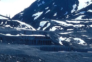
Premier was a large gold mining camp in British Columbia, Canada some 18 miles from Stewart. It ran from the years 1918 to 1953 and was a large employer in the area. Huge bunkhouses, generators, concentrators, machine and cookhouses sat on the hillside. A road provided access to the area, snowfall pending. Horses and cart tractors were used.
Walter Muma is a Canadian man who is on record for completing a 3-month 11,500-mile (18,660 km) journey across Canada and Alaska by moped. The journey took place during the summer of 1978, began in Toronto, passed through Yukon and Alaska, continued up the Dempster Highway to Inuvik, Northwest Territories, and finally back to Toronto.
Meziadin Junction is a work camp in northwest British Columbia, Canada, near the border with Alaska, United States. It is about 14 kilometres (9 mi) north of the Nass River crossing and 156 kilometres (97 mi) north of Kitwanga on Highway 37. The highway splits in its journey north from Terrace to Dease Lake, with one branch heading west over Bear Pass to Stewart and terminating at Hyder, Alaska.

Overlooking the Salmon Glacier, the Granduc Mine is a large copper mine which is situated on a rock ridge between a glacier and a cliff, some 22 miles (35 km) north of Stewart, BC at the north end of Summit Lake. It was an active mine from 1964 to 1984, having closed due to low copper prices.

The Hyder–Stewart Border Crossing connects the communities of Hyder, Alaska and Stewart, British Columbia on the Canada–United States border. International Street on the American side joins British Columbia Highway 37A on the Canadian side.

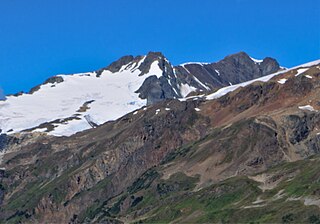
Mount Bayard is a 1,999-metre (6,558 ft) glaciated mountain located in the Boundary Ranges on the international boundary line of Alaska and British Columbia. It is situated 22 kilometres (14 mi) north-northwest of Stewart, 10 km (6 mi) southeast of Mount White-Fraser, and 3.4 km (2 mi) east of Mount Lindeborg, which is its nearest higher peak. Precipitation runoff from the peak and meltwater from the Boundary and Salmon Glaciers that surround the peak drains into the Salmon River. Mount Lindeborg was the name adopted for this feature in 1921, however by 1924 it was renamed Mount Bayard in lieu of Lindeborg. The Mount Lindeborg name was transferred to the peak 3.4 km (2 mi) immediately west. Mount Bayard was named by the International Boundary Commission for Thomas F. Bayard (1828-1898), a diplomat and United States Senator. The mountain's name was officially adopted July 31, 1927, by the Geographical Names Board of Canada. The mountain is also known as Boundary Peak 15. Weather permitting, the mountain can be seen from the gravel Granduc Mine Road at Hyder, Alaska.

Mount White-Fraser is a 2,331 metres (7,648 ft) glaciated mountain located in the Boundary Ranges of British Columbia, Canada. It is situated 31 kilometres (19 mi) north-northwest of Stewart, and 10 km (6 mi) northwest of Mount Bayard. Precipitation runoff from the peak and meltwater from the surrounding Salmon Glacier drains into the Salmon River. The mountain was named by the International Boundary Survey for one of its own members, George White-Fraser (1872-1920), who also served with the Canadian Infantry in France during World War I. The mountain's name was officially adopted March 31, 1924. Weather permitting, the mountain can be seen from the gravel Granduc Mine Road near Hyder, Alaska, which is seasonally open in summer.


