Site of Special Scientific Interest | |
Area of Search | Avon |
---|---|
Grid reference | ST665906 |
Coordinates | 51°36′48″N2°28′59″W / 51.613215°N 2.483144°W Coordinates: 51°36′48″N2°28′59″W / 51.613215°N 2.483144°W |
Interest | Geological |
Area | 1.7 hectares (4.2 acres) |
Notification | 1967 |
Natural England website |
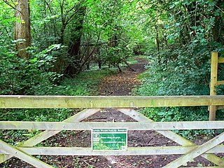
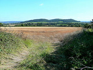
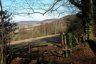
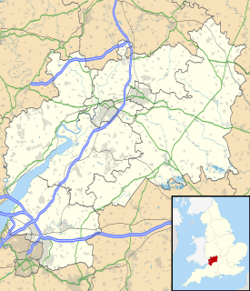
Buckover Road Cutting (grid reference ST665906 ) is a 1.7 hectare geological Site of Special Scientific Interest near the town of Thornbury, South Gloucestershire, notified in 1967.
The Ordnance Survey National Grid reference system is a system of geographic grid references used in Great Britain, distinct from latitude and longitude. It is often called British National Grid (BNG).
The hectare is an SI accepted metric system unit of area equal to a square with 100-metre sides, or 10,000 m2, and is primarily used in the measurement of land. There are 100 hectares in one square kilometre. An acre is about 0.405 hectare and one hectare contains about 2.47 acres.
The site shows an unconformity between Silurian rocks and quartz conglomerate of the Devonian period. [1]
An unconformity is a buried erosional or non-depositional surface separating two rock masses or strata of different ages, indicating that sediment deposition was not continuous. In general, the older layer was exposed to erosion for an interval of time before deposition of the younger, but the term is used to describe any break in the sedimentary geologic record. The significance of angular unconformity was shown by James Hutton, who found examples of Hutton's Unconformity at Jedburgh in 1787 and at Siccar Point in 1788.
The Silurian is a geologic period and system spanning 24.6 million years from the end of the Ordovician Period, at 443.8 million years ago (Mya), to the beginning of the Devonian Period, 419.2 Mya. As with other geologic periods, the rock beds that define the period's start and end are well identified, but the exact dates are uncertain by several million years. The base of the Silurian is set at a series of major Ordovician–Silurian extinction events when 60% of marine species were wiped out.
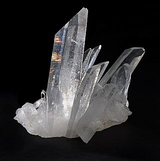
Quartz is a mineral composed of silicon and oxygen atoms in a continuous framework of SiO4 silicon–oxygen tetrahedra, with each oxygen being shared between two tetrahedra, giving an overall chemical formula of SiO2. Quartz is the second most abundant mineral in Earth's continental crust, behind feldspar.
Gloucestershire is a county in South West England. The county comprises part of the Cotswold Hills, part of the flat fertile valley of the River Severn, and the entire Forest of Dean.
The Gloucestershire Wildlife Trust is the Gloucestershire local partner in a conservation network of 47 Wildlife Trusts. The Wildlife Trusts are local charities with the specific aim of protecting the United Kingdom's natural heritage. The Gloucestershire Wildlife Trust is managed by a Board of Trustees elected from its membership who provide overall direction for the development of the Trust and there are Advisory Committees. The work of the trust is carried out through staff and volunteers.
The Severn Estuary is the estuary of the River Severn, the longest river in Great Britain. It is the confluence of four major rivers, being the Severn, Wye, Usk and Avon, and other smaller rivers. Its high tidal range, approximately 50 feet (15 m), means that it has been at the centre of discussions in the UK regarding renewable energy.
Aust Cliff is a 5.3 hectare geological Site of Special Scientific Interest adjacent to the Severn Estuary, near the village of Aust, South Gloucestershire, notified in 1954. The Severn Bridge crosses the cliff.
Barnhill Quarry is a 3.1 hectare geological Site of Special Scientific Interest near Chipping Sodbury, South Gloucestershire, notified in 1966.
Damery Road Section is a 0.5-hectare (1.2-acre) geological Site of Special Scientific Interest north of Tortworth, South Gloucestershire, notified in 1974.
Hawkesbury Quarry is a 0.25-hectare (0.62-acre) geological Site of Special Scientific Interest near the village of Hawkesbury Upton, South Gloucestershire, notified in 1967.
Slickstones Quarry, Cromhall is a 2.7 hectare geological Site of Special Scientific Interest near the village of Cromhall, South Gloucestershire, notified in 1966.
Tytherington Quarry is a 0.9 hectare geological Site of Special Scientific Interest near the village of Tytherington, South Gloucestershire, notified in 1989.
Lower Woods is a 280.1-hectare (692-acre) biological and geological Site of Special Scientific Interest near the village of Wickwar, South Gloucestershire, notified in 1966 and renotified in 1985. The site area has increased at last revision in 1974 to a 284.1-hectare (702-acre) site. The site is a nature reserve managed by the Gloucestershire Wildlife Trust.
Stenders Quarry is a 2.8-hectare (6.9-acre) biological and geological Site of Special Scientific Interest in the Forest of Dean Gloucestershire, notified in 1966 and renotified in 1990. The site is designated as an SSSI for its important geological features, although there is also a diversity of plants and animals recorded.
Hobbs Quarry, Longhope is a 1-hectare (2.5-acre) geological and biological Site of Special Scientific Interest in Gloucestershire, notified in 1966. It is situated midway between Longhope and Dursley Cross in the Forest of Dean. Adjacent woods are Kiln Wood and Coleman's Wood. The site is managed by the Gloucestershire Wildlife Trust.
Alderton Hill Quarry is a 0.34-hectare (0.84-acre) geological Site of Special Scientific Interest in Gloucestershire, notified in 1997. It is a Geological Conservation Review (GCR) site.
Bull Cross, The Frith and Juniper Hill is a 42.33-hectare (104.6-acre) biological and geological Site of Special Scientific Interest in Gloucestershire, notified in 1954. The site is listed in the ‘Stroud District’ Local Plan, adopted November 2005, Appendix 6 as an SSSI and Regionally Important Geological Site (RIGS).
Crickley Hill and Barrow Wake is a 56.8-hectare (140-acre) biological and geological Site of Special Scientific Interest in Gloucestershire, notified in 1974.
Devil's Chapel Scowles is a 44.79-hectare (110.7-acre) biological Site of Special Scientific Interest in Gloucestershire, notified England, in 1998. The site lies in the Forest of Dean and has four units of assessment by Natural England.
Minchinhampton Common is a 182.7-hectare (451-acre) biological and geological Site of Special Scientific Interest in Gloucestershire, notified in 1972.
Stony Furlong Railway Cutting is a 2.7-hectare (6.7-acre) geological Site of Special Scientific Interest in Gloucestershire, notified in 1987. The site is listed in the 'Cotswold District' Local Plan 2001-2011 as a Key Wildlife Site (KWS) and a Regionally Important Geological Site (RIGS).
This article about a Site of Special Scientific Interest in England is a stub. You can help Wikipedia by expanding it. |