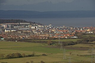
Eye Green is a village in the unitary authority of Peterborough, England. It lies north of Eye and south of Crowland.

Gravel is a loose aggregation of rock fragments. Gravel is classified by particle size range and includes size classes from granule- to boulder-sized fragments. In the Udden-Wentworth scale gravel is categorized into granular gravel and pebble gravel. ISO 14688 grades gravels as fine, medium, and coarse with ranges 2 mm to 6.3 mm to 20 mm to 63 mm. One cubic metre of gravel typically weighs about 1,800 kg.

Maurice Robert "Mike" Gravel is an American politician who served as a United States Senator from Alaska from 1969 to 1981. A member of the Democratic Party, he was a candidate in the 2008 U.S. presidential election and is a candidate in the 2020 U.S. presidential election.

A gravel road is a type of unpaved road surfaced with gravel that has been brought to the site from a quarry or stream bed. They are common in less-developed nations, and also in the rural areas of developed nations such as Canada and the United States. In New Zealand, and other Commonwealth countries, they may be known as 'metal roads'. They may be referred to as 'dirt roads' in common speech, but that term is used more for unimproved roads with no surface material added. If well constructed and maintained, a gravel road is an all-weather road.

Sevenoaks Gravel Pits is a 73.7-hectare (182-acre) biological Site of Special Scientific Interest on the northern outskirts of Sevenoaks in Kent. It is managed by Kent Wildlife Trust as the Sevenoaks Wildlife Reserve and Jeffery Harrison Visitor Centre.

Felmersham Gravel Pits is a 21.6 hectare Site of Special Scientific Interest between the villages of Felmersham and Sharnbrook in Bedfordshire. It was notified under Section 28 of the Wildlife and Countryside Act 1981 in 1986 and the local planning authority is Bedford Borough Council. The site is managed by the Wildlife Trust for Bedfordshire, Cambridgeshire and Northamptonshire.

Ruxley Gravel Pits is an 18.7-hectare (46-acre) biological Site of Special Scientific Interest in Ruxley, Orpington, in the London Borough of Bromley, and originally dug between 1929 and 1951. It is also a Site of Metropolitan Importance for Nature Conservation. It is owned by the Environment Agency and managed by Kent Wildlife Trust. Natural England has assessed its condition as "unfavourable recovering".

Fern House Gravel Pit is a 1.3 hectare geological Site of Special Scientific Interest in Fern, near Bourne End in Buckinghamshire. It is also a Geological Conservation Review site.

Ardleigh Gravel Pit is a 1.2 hectare geological Site of Special Scientific Interest south of Ardleigh in Essex. It is a Geological Conservation Review site.

Wivenhoe Gravel Pit is a 2.1 hectare geological Site of Special Scientific Interest north of Wivenhoe in Essex. It is a Geological Conservation Review site.
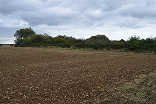
Eye Gravel Pit is a 0.4 hectare geological Site of Special Scientific Interest in Eye Green in Cambridgeshire. It is a Geological Conservation Review site, and part of it overlaps Eye Green Local Nature Reserve.

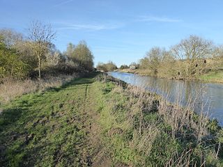
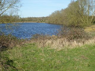
Upper Nene Valley Gravel Pits is a 1,382.4 hectare biological Site of Special Scientific Interest in a chain of flooded gravel pits along 35 kilometres of the valley of the River Nene between Northampton and Thorpe Waterville in Northamptonshire. It is a Ramsar wetland site of international importance, a Special Protection Area under the European Communities Birds Directive and part of the Nene Valley Nature Improvement Area. It is also part of the River Nene Regional Park. Two areas are managed by the Wildlife Trust for Bedfordshire, Cambridgeshire and Northamptonshire, Summer Leys and Titchmarsh Nature Reserve.

Titchmarsh Nature Reserve is a 72.7 hectare Local Nature Reserve north of Thrapston in East Northamptonshire. It is owned and managed by the Wildlife Trust for Bedfordshire, Cambridgeshire and Northamptonshire. It is part of the Upper Nene Valley Gravel Pits Site of Special Scientific Interest.

Ditchford Lakes and Meadows is a 31.1 hectare nature reserve Northamptonshire. It is managed by the Wildlife Trust for Bedfordshire, Cambridgeshire and Northamptonshire. It is part of the Upper Nene Valley Gravel Pits Site of Special Scientific Interest, Ramsar wetland site of international importance, and Special Protection Area under the European Communities Birds Directive.
Higham Ferrers Pits is a 10 hectare nature reserve Northamptonshire. It is managed by the Wildlife Trust for Bedfordshire, Cambridgeshire and Northamptonshire. It is part of the Upper Nene Valley Gravel Pits Site of Special Scientific Interest, Ramsar internationally important wetland site and Special Protection Area under the EC Birds Directive.
Wilson's Pits is a 32 hectare nature reserve west of Higham Ferrers in Northamptonshire. It is managed by the Wildlife Trust for Bedfordshire, Cambridgeshire and Northamptonshire. It is part of the Upper Nene Valley Gravel Pits Site of Special Scientific Interest, Ramsar internationally important wetland site and Special Protection Area under the EC Birds Directive.

Waldringfield Pit is a 0.8 hectare geological Site of Special Scientific Interest between Martlesham Heath and Waldringfield in Suffolk. It is a Geological Conservation Review site.

Barrow Gravel Pits is a 35.6 hectares biological Site of Special Scientific Interest in Barrow upon Soar in Leicestershire.

Briton's Lane Gravel Pit is a 21.5-hectare (53-acre) geological Site of Special Scientific Interest east of Sheringham in Norfolk. It is a Geological Conservation Review site and it is in the Norfolk Coast Area of Outstanding Natural Beauty.