The Carboniferous is a geologic period and system of the Paleozoic that spans 60 million years from the end of the Devonian Period 358.9 million years ago (Mya), to the beginning of the Permian Period, 298.9 million years ago. The name Carboniferous means "coal-bearing", from the Latin carbō ("coal") and ferō, and refers to the many coal beds formed globally during that time.

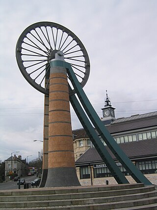
Radstock is a town and civil parish on the northern slope of the Mendip Hills in Somerset, England, about 9 miles (14 km) south-west of Bath and 8 miles (13 km) north-west of Frome. It is within the area of the unitary authority of Bath and North East Somerset. The Radstock built-up area had a population of 9,419 at the 2011 Census.

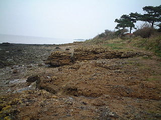
Brean Down is a promontory off the coast of Somerset, England, standing 318 feet (97 m) high and extending 1.5 miles (2 km) into the Bristol Channel at the eastern end of Bridgwater Bay between Weston-super-Mare and Burnham-on-Sea.

The geology of India is diverse. Different regions of India contain rocks belonging to different geologic periods, dating as far back as the Eoarchean Era. Some of the rocks are very deformed and altered. Other deposits include recently deposited alluvium that has yet to undergo diagenesis. Mineral deposits of great variety are found in the Indian subcontinent in huge quantities. Even India's fossil record is impressive in which stromatolites, invertebrates, vertebrates and plant fossils are included. India's geographical land area can be classified into the Deccan Traps, Gondwana and Vindhyan.

Cockroaches are a paraphyletic group of insects belonging to Blattodea, containing all members of the group except termites. About 30 cockroach species out of 4,600 are associated with human habitats. Some species are well-known as pests.

Ebbor Gorge is a limestone gorge in Somerset, England, designated and notified in 1952 as a 63.5-hectare (157-acre) biological Site of Special Scientific Interest in the Mendip Hills. It was donated to the National Trust in 1967 and is now managed by Natural England as a national nature reserve.

Somerset is a rural county in the southwest of England, covering 4,171 square kilometres (1,610 sq mi). It is bounded on the north-west by the Bristol Channel, on the north by Bristol and Gloucestershire, on the north-east by Wiltshire, on the south-east by Dorset, and on the south west and west by Devon. It has broad central plains with several ranges of low hills. The landscape divides into four main geological sections from the Silurian through the Devonian and Carboniferous to the Permian which influence the landscape, together with water-related features.
The most recent understanding of the evolution of insects is based on studies of the following branches of science: molecular biology, insect morphology, paleontology, insect taxonomy, evolution, embryology, bioinformatics and scientific computing. It is estimated that the class of insects originated on Earth about 480 million years ago, in the Ordovician, at about the same time terrestrial plants appeared. Insects are thought to have evolved from a group of crustaceans. The first insects were landbound, but about 400 million years ago in the Devonian period one lineage of insects evolved flight, the first animals to do so. The oldest insect fossil has been proposed to be Rhyniognatha hirsti, estimated to be 400 million years old, but the insect identity of the fossil has been contested. Global climate conditions changed several times during the history of Earth, and along with it the diversity of insects. The Pterygotes underwent a major radiation in the Carboniferous while the Endopterygota underwent another major radiation in the Permian.
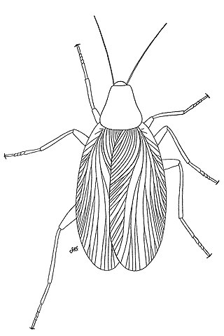
Archimylacris is an extinct genus of cockroach-like blattopterans, a group of insects ancestral to cockroaches, mantids, and termites.

Portishead Pier to Black Nore SSSI is a 71.8 hectare geological Site of Special Scientific Interest near the town of Portishead in North Somerset, notified in 1952.

Crook Peak to Shute Shelve Hill is a 332.2 hectare (820.9 acre) geological and biological Site of Special Scientific Interest near the western end of the Mendip Hills, Somerset. The line of hills runs for approximately 5 kilometres (3.1 mi) from west to east and includes: Crook Peak, Compton Hill, Wavering Down, Cross Plain and Shute Shelve Hill. Most of the site is owned by the National Trust, which bought 725 acres (293 ha) in 1985, and much of it has been designated as common land. It was notified as an SSSI by Natural England in 1952.

The Somerset Coalfield in northern Somerset, England is an area where coal was mined from the 15th century until 1973. It is part of a larger coalfield which stretched into southern Gloucestershire. The Somerset coalfield stretched from Cromhall in the north to the Mendip Hills in the south, and from Bath in the east to Nailsea in the west, a total area of about 240 square miles (622 km2). Most of the pits on the coalfield were concentrated in the Cam Brook, Wellow Brook and Nettlebridge Valleys and around Radstock and Farrington Gurney. The pits were grouped geographically, with clusters of pits close together working the same coal seams often under the same ownership. Many pits shared the trackways and tramways which connected them to the Somerset Coal Canal or railways for distribution.

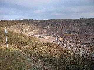
Colemans Quarry, grid reference ST726452 is a limestone quarry at Holwell, near Nunney on the Mendip Hills, Somerset, England.

Walchia is a fossil conifer, cypress-like genus found in upper Pennsylvanian (Carboniferous) and lower Permian rocks of Europe and North America. A forest of in-situ Walchia tree-stumps is located on the Northumberland Strait coast at Brule, Nova Scotia.

Writhlington is a suburb of Radstock and 6 miles (10 km) north-west of Frome in the Bath and North East Somerset district of Somerset, England.

Adelophthalmus is a genus of eurypterid, an extinct group of aquatic arthropods. Fossils of Adelophthalmus have been discovered in deposits ranging in age from the Early Devonian to the Early Permian, which makes it the longest lived of all known eurypterid genera, with a total temporal range of over 120 million years. Adelopththalmus was the final genus of the Eurypterina suborder of eurypterids and consisted the only known genus of swimming eurypterids from the Middle Devonian until its extinction during the Permian, after which the few surviving eurypterids were all walking forms of the suborder Stylonurina.

"Roachoids", also known as "Roachids" or "Blattoids" are members of the stem group of Dictyoptera. They generally resemble cockroaches, but most members, unlike modern dictyopterans, have generally long external ovipositors, and are thought not to have laid ootheca like modern dictyopterans.

The Carboniferous rainforest collapse (CRC) was a minor extinction event that occurred around 305 million years ago in the Carboniferous period. It altered the vast coal forests that covered the equatorial region of Euramerica. This event may have fragmented the forests into isolated refugia or ecological 'islands', which in turn encouraged dwarfism and, shortly after, extinction of many plant and animal species. Following the event, coal-forming tropical forests continued in large areas of the Earth, but their extent and composition were changed.

Paleontology in Rhode Island refers to paleontological research occurring within or conducted by people from the U.S. state of Rhode Island. Rhode Island has a relatively sparse fossil record. Among its more common fossils are plant remains that are frequently associated with the state's coal beds. During the early Paleozoic, Rhode Island was at least partially submerged under a sea inhabited by trilobites. During the Carboniferous period the state became a swampy environment where lush vegetation included trees more than 50 feet high. Local animal life included arachnids and insects like cockroaches. Rift basins formed locally during the Permian. The ensuing Triassic and Jurassic periods are absent from the state's rock record. Little is known about the state's Cretaceous history. The Paleogene and Neogene periods are also missing from Rhode Island's rock record. During the Pleistocene the state was subjected to glacial activity. Notable local fossil finds have included previously unknown kinds of insect and abundant ancient amphibian trackways.
The Bajo de Véliz Formation is stratigraphic formation of the Paleozoic located in the Paganzo Basin, Argentina. This formation lies in the northwestern sector of San Luis, about 25 km west of Santa Rosa de Conlara. Containing a slice of the Carboniferous-Permian transition, it is one of the key upper Paleozoic successions characterizing that era in westernmost Gondwana, which South America was a part of in the Paleozoic.


