
Thoroughbred horse racing is a spectator sport in Australia, and gambling on horse races is a very popular pastime with A$14.3 billion wagered in 2009/10 with bookmakers and the Totalisator Agency Board (TAB). The two forms of Thoroughbred horseracing in Australia are flat racing, and races over fences or hurdles in Victoria and South Australia. Thoroughbred racing is the third most attended spectator sport in Australia, behind Australian rules football and rugby league, with almost two million admissions to 360 registered racecourses throughout Australia in 2009/10. Horseracing commenced soon after European settlement, and is now well-appointed with automatic totalizators, starting gates and photo finish cameras on nearly all Australian racecourses.
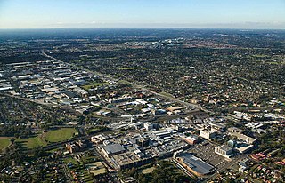
Blacktown is a suburb in the City of Blacktown local government area, in the state of New South Wales, Australia. Blacktown is located 34 km (21 mi) west of the Sydney central business district. It is one of the most multicultural places within Greater Sydney.

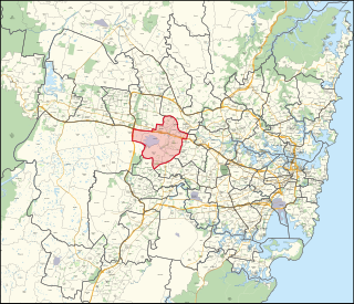
Eastern Creek is a suburb of Sydney, in the state of New South Wales, Australia. Eastern Creek is located 35 kilometres (22 mi) west of the Sydney central business district, in the Blacktown local government area and is part of the Greater Western Sydney region.

Doonside is a suburb in the metropolis of Sydney, in the state of New South Wales, Australia. Doonside is located 40 kilometres west of the Sydney central business district, in the local government area of the City of Blacktown and is part of the Greater Western Sydney region. Featherdale Wildlife Park and the Nurragingy Nature Reserve are popular local tourist attractions.

Westmead is a suburb in Sydney, in the state of New South Wales, Australia. Westmead is located 26 kilometres west of the Sydney central business district in the local government areas of City of Parramatta and Cumberland Council and is part of the Greater Western Sydney region.

Rooty Hill is a suburb of Sydney, in the state of New South Wales, Australia. Rooty Hill is located 42 kilometres west of the Sydney central business district, in the local government area of the City of Blacktown and is part of the Greater Western Sydney region.

Seven Hills is a suburb in the Greater Western Sydney region of Sydney, in the state of New South Wales, Australia, located 33 kilometres North West of the Sydney central business district. Seven Hills is within the local government areas of the City of Parramatta and Blacktown City councils.

Wentworthville is a suburb in Sydney, in the state of New South Wales, Australia. Wentworthville is located 27 kilometres west of the Sydney central business district and is part of the Greater Western Sydney region. Wentworthville is split between the local government areas of the City of Parramatta and the Cumberland Council. Wentworthville is colloquially known as 'Wenty'.

Acacia Gardens is a suburb of Sydney, in the state of New South Wales, Australia, 40 kilometres north-west of the Sydney central business district, in the local government area of the City of Blacktown. Acacia Gardens is part of the Greater Western Sydney region.

Winston Hills is a suburb of Sydney, in the state of New South Wales, Australia. Winston Hills is located 28 kilometres west of the Sydney central business district in the local government areas of the City of Parramatta and The Hills Shire. Winston Hills is part of the Hills District region of Greater Western Sydney.
Glenwood is a suburb of Sydney, in the state of New South Wales, Australia. Glenwood is located 33 kilometres north-west of the Sydney central business district in the local government area of the City of Blacktown and part of the Greater Western Sydney region.

Kellyville Ridge is a suburb of Sydney, in the state of New South Wales, Australia. Kellyville Ridge is located 41 kilometres north-west of the Sydney central business district in the local government area of City of Blacktown. It is part of Greater Western Sydney.
Riverstone is a suburb of Sydney in the state of New South Wales, Australia. Riverstone is located 48 kilometres (30 mi) north-west of the Sydney central business district, in the Blacktown local government area and part of the Greater Western Sydney region. Originally settled in 1803 as part of a government stock farm, Riverstone is one of the oldest towns in Australia.
Schofields is a suburb on the fringe of Sydney's urban sprawl, in the state of New South Wales, Australia. Schofields is located 45 kilometres (28 mi) north-west of the Sydney central business district, in the Blacktown local government area. It is part of Greater Western Sydney's North West Growth Area.
Charles James Fox Campbell was a grazier and early settler of Adelaide, South Australia, whose name is commemorated in the Adelaide suburb of Campbelltown, South Australia and the municipality, the City of Campbelltown, South Australia.
The Western Sydney Parklands is an urban park system and a nature reserve located in Sydney, New South Wales, Australia. The NSW government has spent around $400 million for the park. The park is governed by the NSW National Parks and Wildlife Service and is listed under the National Parks and Wildlife Act 1974. The Parklands begin in the north in the City of Blacktown, cross the City of Fairfield, and end in the City of Liverpool.
Prospect is an electoral district of the Legislative Assembly in the Australian state of New South Wales. An urban electorate in Western Sydney, it is centred on the suburb of Prospect from which it takes its name.

Eastern Creek, a watercourse that is part of the Hawkesbury-Nepean catchment, is located in Greater Western Sydney, New South Wales, Australia.

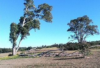
The Bungarribee Homestead Site is a heritage-listed archaeological site at the location of the former Bungarribee Homestead. The site is located at Doonside Road, Doonside, New South Wales, a suburb of Sydney, Australia. It was added to the New South Wales State Heritage Register on 8 December 2000.
Tallawong is a suburb of Sydney in the state of New South Wales, Australia. Tallawong is in north-west Greater Sydney Area in the local government area of Blacktown. It is named after the metro station located within its boundaries, which opened in May 2019. Tallawong is a Darug word meaning apple gum tree.

