
Liverpool is a suburb of South Western Sydney, in the state of New South Wales, Australia. It is located approximately 31 kilometres (19 mi) south-west of the Sydney CBD. Liverpool is the administrative seat of the local government area of the City of Liverpool and is situated in the Cumberland Plain.

Homebush is a suburb in the Inner West of Sydney in the state of New South Wales, Australia. It is located 12 kilometres west of the Sydney central business district, in the local government area of the Municipality of Strathfield.

The Westlink M7 is a 40-kilometre (25 mi) tolled urban motorway in Sydney, New South Wales that is part of the Sydney Orbital Network. Owned by the NorthWestern Roads (NWR) Group, it connects three motorways: the M5 South-West Motorway at Prestons, the M4 Western Motorway at Eastern Creek, and the M2 Hills Motorway at Baulkham Hills.
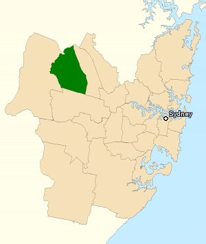
The Division of Chifley is an Australian electoral division in the state of New South Wales.

Rooty Hill is a suburb of Sydney, in the state of New South Wales, Australia. Rooty Hill is located 42 kilometres west of the Sydney central business district, in the local government area of the City of Blacktown and is part of the Greater Western Sydney region.

Mount Druitt is a suburb of Sydney, in the state of New South Wales, Australia. It is located 43 kilometres (27 mi) west of the Sydney central business district, in the local government area of the City of Blacktown, and is part of the Greater Western Sydney region.

Bidwill is a suburb of Sydney, in the state of New South Wales, Australia. Bidwill is located 48 kilometres west of the Sydney central business district, in the local government area of the City of Blacktown and is part of the Greater Western Sydney region.

Dharruk is a suburb of Sydney, in the state of New South Wales, Australia. It is located 46 kilometres west of the Sydney central business district, in the local government area of the City of Blacktown and is part of the Greater Western Sydney region.

Emerton is a suburb of Sydney, in the state of New South Wales, Australia. Emerton is located 46 kilometres west of the Sydney central business district, in the local government area of the City of Blacktown and is part of the Greater Western Sydney region.

Plumpton is located 45 kilometres west of the Sydney central business district, in the local government area of the City of Blacktown and is part of the Greater Western Sydney region.

Shalvey is a suburb of Blacktown, in the state of New South Wales, Australia. Shalvey is located 48 kilometres west of the Sydney central business district, in the local government area of the City of Blacktown and is part of the Greater Western Sydney region.

Whalan is a suburb of Sydney, in the state of New South Wales, Australia. Whalan is located 45 kilometres west of the Sydney central business district, in the local government area of the City of Blacktown and is part of the Greater Western Sydney region.

Werrington is a suburb of Sydney, in the state of New South Wales, Australia. It is 49.3 kilometres (30.6 mi) west of the Sydney central business district, in the local government area of the City of Penrith and is part of the Greater Western Sydney region.

Prestons is a suburb of Sydney, in the state of New South Wales, Australia 37 kilometres south-west of the Sydney central business district, in the local government area of the City of Liverpool.

Croydon Park is a suburb in the Inner West of Sydney, in the state of New South Wales, Australia. Croydon Park is 10 kilometres south-west of the Sydney central business district and is divided between the local government areas of the City of Canterbury-Bankstown, Municipality of Burwood and Inner West Council. Croydon is a separate suburb, to the north.

Erskine Park is a suburb of Sydney in the state of New South Wales, Australia. Erskine Park is located 42 kilometres west of the Sydney central business district, in the local government area of the City of Penrith and is part of the Greater Western Sydney region.

Colyton is a suburb of Sydney, in the state of New South Wales, Australia 43 kilometres west of the Sydney central business district, in the local government area of the City of Penrith. It is part of the Greater Western Sydney region.

The Norwest Business Park is a business park in the suburbs of Norwest and Bella Vista in the local government area of The Hills Shire in Sydney, New South Wales, Australia. Norwest Business Park is bordered by Windsor Road to the east, and Old Windsor Road to the west, with Norwest Boulevard stretching the length of the park between the two main arterial roads. Over 400 companies are located in the park, employing more than 25,000 people. The complex consists of a mix of commercial, professional and health-care services provided to the population of Sydney's Hills District.

The Ponds is a suburb of Sydney, in the state of New South Wales, Australia. The Ponds is about 40 kilometres (25 mi) west-northwest of the Sydney central business district in the Blacktown local government area. The 2016 census recorded the resident population of The Ponds as 11,731.
Caddens is a suburb of Sydney, in the state of New South Wales in Australia. It is a new masterplanned residential neighborhood located 48 kilometres west of the Sydney central business district, in the local government area of the City of Penrith featuring views of the scenic Blue Mountains. The suburb's postcode is 2747.

