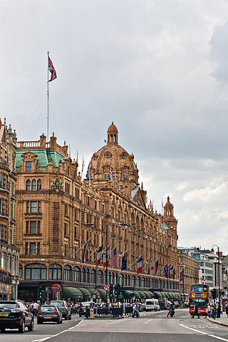
Knightsbridge is a residential and retail district in central London, south of Hyde Park. It is identified in the London Plan as one of two international retail centres in London, alongside the West End.

Mayfair is an affluent area in the West End of London towards the eastern edge of Hyde Park, in the City of Westminster, between Oxford Street, Regent Street, Piccadilly and Park Lane. It is one of the most expensive districts in the world.

Wardour Street is a street in Soho, City of Westminster, London. It is a one-way street that runs north from Leicester Square, through Chinatown, across Shaftesbury Avenue to Oxford Street. Throughout the 20th century the street became a centre for the British film industry and the popular music scene.

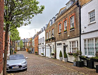
A mews is a row or courtyard of stables and carriage houses with living quarters above them, built behind large city houses before motor vehicles replaced horses in the early twentieth century. Mews are usually located in desirable residential areas, having been built to cater for the horses, coachmen and stable-servants of prosperous residents.

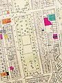
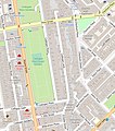
Hans Place is a garden square in the Knightsbridge district of the Royal Borough of Kensington and Chelsea, London, immediately south of Harrods in SW1. It is named after Sir Hans Sloane, 1st Baronet, PRS, physician and collector, notable for his bequest, which became the foundation of the British Museum.
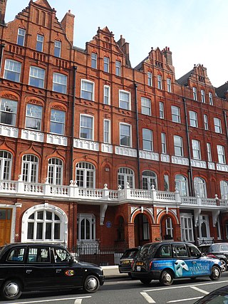
Pont Street is a fashionable street in the Royal Borough of Kensington and Chelsea, London, traversing the areas of Knightsbridge and Belgravia. The street is not far from the Knightsbridge department store Harrods to its north-west. The street crosses Sloane Street in the middle, with Beauchamp Place to the west and Cadogan Place, and Chesham Place, to the east, eventually leading to Belgrave Square. On the west side, Hans Place leads off the street to the north and Cadogan Square to the south.
Great Scotland Yard is a street in Westminster, London, connecting Northumberland Avenue and Whitehall. By the 16th century, this 'yard', which was then an open space for the Palace of Whitehall, was fronted by buildings used by diplomatic representatives of the Kingdom of Scotland. In the 19th century, it was a street and open space, which was the location of a public entrance to the original headquarters of the Metropolitan Police Service of London, causing the name "Scotland Yard" to become synonymous with the police service.

Marylebone is a district in the West End of London, in the City of Westminster. Oxford Street, Europe's busiest shopping street, forms its southern boundary.
Hallam Street is a road situated in the Parish of St Marylebone and London's West End. In administrative terms it lies within the City of Westminster's Marylebone High Street Ward as well as the Harley Street Conservation Area. Formerly named both Charlotte Street and Duke Street, it was renamed in the early 1900s after Henry Hallam (1777–1859), a noted historian who had been a local resident, and his son Arthur Henry Hallam (1811–1833), poet and the subject of Tennyson's elegy In Memoriam.

Bolsover Street is in the Parish of St Marylebone in London’s West End. In administrative terms it lies within the City of Westminster's Marylebone High Street Ward and is partly in the Harley Street Conservation Area whilst also sitting on the edges of the Regents Park and East Marylebone Conservation Areas.

Weymouth Street lies in the Marylebone district of the City of Westminster and connects Marylebone High Street with Great Portland Street. The area was developed in the late 18th century by Henrietta Cavendish Holles and her husband Edward Harley, 2nd Earl of Oxford. This part of Marylebone originally belonged to the Manor of Tyburn which existed at the time of the Domesday Book (1086).

Westmoreland Street is in the Marylebone district of the City of Westminster in London, England. The street was built from the 1760s by William Franks and runs from Beaumont Street and Weymouth Street in the north to New Cavendish Street in the south. It was formerly the location of the Welbeck Chapel, which became St James's Church. In 1968, it was the site of Britain's first heart transplant when the National Heart Hospital was located there. The hospital is now known as University College Hospital at Westmoreland Street.
Devonshire Close, originally known as Devonshire Mews East, is a mews street in the City of Westminster, London, accessed from Devonshire Street. The Close is on a distinctive H plan with a middle downwards leg. It dates from the 1770s and originally contained a timber yard, stables, and accommodation for domestic servants who worked in the larger houses surrounding it. Access was limited to the north side in order to divert traffic from the grander north–south streets around it. The Close was gentrified in the 20th century and its buildings converted to mews houses which, like other mews in London, have become desirable in the modern era because they are quiet and have little traffic. The Close is now part of the Howard de Walden Estate.

Marylebone Lane is one of the original streets of the Marylebone district of the City of Westminster, London. It runs from Oxford Street in the south to Marylebone High Street in the north, its winding shape following the course of the River Tyburn that it once ran alongside and pre-dating the grid pattern of the other streets in the area. Today the lane is largely composed of small shops, cafes and restaurants with some small apartment blocks. There are some larger commercial buildings at the southern end near Oxford Street.
This is a list of the etymology of street names in the London district of Marylebone. The following utilises the generally accepted boundaries of Marylebone viz. Marylebone Road to the north, Great Portland Street to the east, Marble Arch and Oxford Street to the south and Edgware Road to the west.
This is a list of the etymology of street names in the London district of Belgravia. The following utilises the generally accepted boundaries of the area viz. South Carriage Drive to the north, Grosvenor Gardens/Place/Square to the east, Buckingham Palace Road/Victoria railway line to the south-east and Chelsea Bridge Road, Lower Sloane Street/Sloane Square/Sloane Street to the west.

Russia Row is a street in the City of London that runs between Milk Street and Trump Street on the northern side of the former Honey Lane Market. Russia Court, formerly Robin Hood Court, the home of the Russia Company, was once located on the northern side of the street and the City of London School on the south side. The street is thought to have received its name around 1804, shortly before Russia decided to enter the Napoleonic Wars on the same side as Britain. It was damaged by German bombing during the Second World War and has since been completely rebuilt.

Trump Street is a street in the City of London that was originally known as Trumpadere Street, probably after the trumpet or horn makers who once worked there or in the adjacent Trump Alley. It was built after the Great Fire of London (1666) but completely destroyed by bombing during the Second World War and has since been entirely rebuilt.
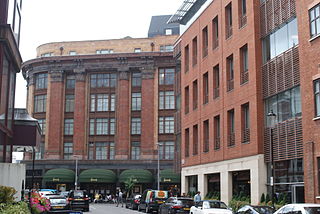
Basil Street, originally known as North Street, is a street in London's Knightsbridge. It was laid out in the second half of the eighteenth century on land belonging to Lord Cadogan and runs between Sloane Street in the north and the junction of Walton Place and Hans Road in the south. It is joined on its east side by Pavilion Road and Rysbrack Street and crossed by Hans Crescent. Architecturally, it is notable for the design of its blocks of mansion flats. Fashion designer Charles Creed had his premises there after the war and in the 1960s, the first meetings that led to Monty Python's Flying Circus were held at a flat in the street.

Hesper Mews is a mews street in the Earl's Court district of London, England. It runs between Bramham Gardens and Collingham Gardens and was laid-out in 1884-85 as part of the Gunter Estate, developed in the nineteenth century by James Gunter and his descendants.