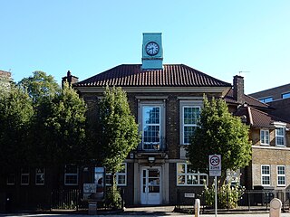
Yiewsley is a large suburban village in the London Borough of Hillingdon, England, 2 miles (3 km) south of Uxbridge, the borough's commercial and administrative centre. Yiewsley was a chapelry in the ancient parish of Hillingdon, Middlesex. The population of the ward was 12,979 at the 2011 Census.
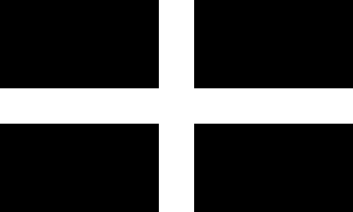
Saint Piran's Flag is the flag of Cornwall. The earliest known description of the flag, referred to as the Standard of Cornwall, was written in 1838. It is used by some Cornish people as a symbol of their identity.

Market Drayton is a market town and electoral ward in north Shropshire, England, close to the Cheshire and Staffordshire borders. It is on the River Tern.

Drayton Parslow is a village and civil parish in Buckinghamshire, England, about 3.5 miles (5.6 km) south of Bletchley, within the Buckinghamshire Council unitary authority area. In the 2001 census the parish had a population of 596, increasing at the 2011 census to 614.

West Drayton is a suburban town in the London Borough of Hillingdon. It was an ancient parish in the county of Middlesex and from 1929 was part of the Yiewsley and West Drayton Urban District, which became part of Greater London in 1965. The settlement is near the Colne Valley Regional Park and its centre lies 1.9 miles (3 km) north of Heathrow Airport.

William Henry Drayton was an American Founding Father, planter, and lawyer from Charleston, South Carolina. He served as a delegate for South Carolina to the Continental Congress in 1778-79 and signed the Articles of Confederation.

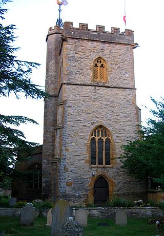
Drayton is a small village and civil parish in the Harborough district of south-east Leicestershire, bordering Northamptonshire and Rutland. It is situated 6.7 miles (11 km) northeast of Market Harborough and 5 miles (7.5 km) southwest of Uppingham on the north side of the Welland valley. Nearby villages are Bringhurst, Great Easton and Nevill Holt. The church of St James in Drayton is one of the smallest churches in England.
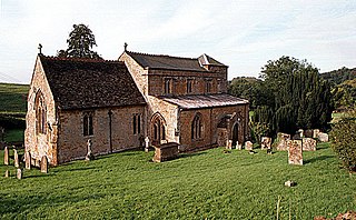
Drayton is a village and civil parish in Somerset, England, focussed less than a mile from Curry Rivel and five miles southwest of Somerton in the South Somerset district. It adjoins the River Isle, near its confluence with the Parrett, and the former Westport Canal. The parish includes the hamlet of Midelney.

Barton Stacey is a village and undulating civil parish, which includes the hamlets of Bransbury, Newton Stacey, Drayton and Cocum, in the Test Valley district of Hampshire, England, centred about 7 miles (11 km) south-east of Andover. It is bounded to the north by the estate of Drayton Lodge, and, to the south, by the minor A30 road; both being east–west routes, and connected by The Street/Cocum Road, the main road that bisects the village. The distance between the A303 and A30 at this point is 2 miles (3.2 km), which is twice the width of the parish.

Chudleigh is an ancient wool town located within the Teignbridge District Council area of Devon, England between Newton Abbot and Exeter. The electoral ward with the same name had a population of 6,125 at the 2011 census.

Drayton is a village and civil parish about 2 miles (3 km) south of Abingdon, Oxfordshire. It was part of Berkshire until the 1974 boundary changes transferred it to Oxfordshire. The parish includes the hamlet of Sutton Wick. The 2011 Census recorded the parish population as 2,353.

Drayton St. Leonard is a village and civil parish on the River Thame in Oxfordshire, about 8 miles (13 km) southeast of Oxford.

Drayton Bassett is a village and civil parish since 1974 in Lichfield District in Staffordshire, England. The village is on the Heart of England Way, a footpath. Much of the housing is clustered together but more than half is 20th century in the parish as a whole. In the parish is Drayton Manor Theme Park, occupying a large minority of its land.
Brereton Hall is an Elizabethan prodigy house north of Brereton Green, next to St Oswald's Church in the civil parish of Brereton, Cheshire, England. It is recorded in the National Heritage List for England as a designated Grade I listed building. Brereton is not open to the public.
Drayton is a village and civil parish in the valley of the Sor Brook in Oxfordshire, about 2 miles (3 km) northwest of Banbury. The 2011 Census recorded the parish's population as 242.

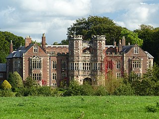
Buntingsdale Hall is a historic country house in the parish of Sutton upon Tern, to the southwest of Market Drayton in Shropshire, England. It became a Grade II* listed building on 14 February 1979.
Sir Henry Green, JP was a courtier and councillor to king Richard II of England.
Market Drayton is a town and a civil parish in Shropshire, England. It contains 80 listed buildings that are recorded in the National Heritage List for England. Of these, four are at Grade II*, the middle of the three grades, and the others are at Grade II, the lowest grade. Most of the listed buildings are grouped around the town centre, and many of them are houses, shops or public houses that are timber framed, or have a timber-framed core. Other types of listed buildings include churches, memorials and other structures in a churchyard, restaurants and cafés, hotels, a former grammar school and schoolmaster's house, mills, bridges, a war memorial, and a pillbox.