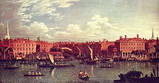
The River Fleet is the largest of London's subterranean rivers, all of which today contain foul water for treatment. It has been used as a sewer since the development of Joseph Bazalgette's London sewer system in the mid 19th century with the water being treated at Beckton Sewage Treatment Works. Its headwaters are two streams on Hampstead Heath, each of which was dammed into a series of ponds—the Hampstead Ponds and the Highgate Ponds—in the 18th century. At the southern edge of Hampstead Heath these descend underground as sewers and join in Camden Town. The waters flow 4 miles (6 km) from the ponds.

White Conduit Fields in Islington was an early venue for cricket and several major matches are known to have been played there in the 18th century. It was the original home of the White Conduit Club, forerunner of Marylebone Cricket Club (MCC). Later it was used by The Islington Albion Cricket Club, who played their last game at the ground in 1834. Maps from the time show that the cricket field was a few hundred metres north of the White Conduit House, in the land surrounding the modern Richmond Crescent, and paintings suggest it was also possibly on the adjacent field to the south at the modern Barnard Park.

The Lamb is a Grade II listed pub at 94 Lamb's Conduit Street, in the London Borough of Camden, London.
Lamb's Conduit Field, also known as Lamb's Conduit Fields was an open area in what is now the London Borough of Camden. The fields lay north of the Lamb's Conduit water feature that gave it its name, and lay mostly in the parish of St Pancras. It was a noted cricket venue in the first half of the 18th century.

Lamb's Conduit Street is a street in Holborn in the West End of London. The street takes its name from Lambs Conduit, originally known as the Holborn Conduit, a dam across a tributary of the River Fleet.

The Lamb and Flag is a Grade II listed public house at Rose Street, Covent Garden, London, WC2.

Cartwright Gardens is a crescent shaped park and street located in Bloomsbury, London.
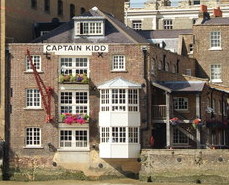
The Captain Kidd is a pub in Wapping, East London, that is named after the seventeenth century pirate William Kidd, who was executed at the nearby Execution Dock. The pub is a Grade II listed building, and was historically used as a coffee warehouse.

Guilford Place is a street in the London Borough of Camden.

White Lodge, 68 Silver Street is a grade II listed building in Silver Street, Enfield, London. It was built in around the 17th century with later amendments. It was the home of Jacob Vale Asbury, Charles Lamb's doctor, and later of Joseph Whitaker, the publisher and founder of Whitaker's Almanack who lived at the house from 1862 until his death in 1895.
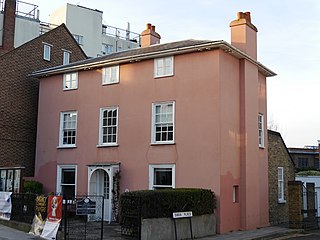
70 Barnes High Street, also known as the Rose House, is a Grade II listed house in Barnes, London SW13, which dates from the 17th century. It is now used by the Barnes Community Association as office accommodation.

The Cheshire Cheese is a public house at 5 Little Essex Street, London WC2, on the corner with Milford Lane.

The Harrow is a pub at 22 Whitefriars Street, London.

Carter Lane is a historic street in the City of London, running slightly south of Ludgate Hill and St. Paul's Cathedral. The modern Carter Lane is shown in three sections, named Shoe Makers Row, Great Carter Lane, and Little Carter Lane, on a London map of 1746.

The Duke of Wellington is a pub at 63 Eaton Terrace, Belgravia, London.
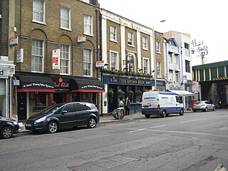
The Brown Bear is a pub at 139 Leman Street, Whitechapel, London E1.
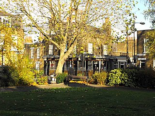
The Queen's Head is a pub at 8 Flamborough Street, Stepney, London E14.

The Fox is a pub at 39 Church Street, Twickenham, London TW1.

Kensington New Town is an area of housing in Kensington, London, which was developed in the early 19th century. It lies to the south of Kensington High Street and to the southwest of Kensington Gardens.


