Lemon Tree Passage is a suburb of the Port Stephens Local Government Area in the Hunter Region of New South Wales, Australia, located at the end of the Tilligerry Peninsula and surrounded by the waters of Port Stephens. At the 2021 census it had a population of 2,686. It is a haven for koalas due to it being densely wooded. The town has a small marina and the local industry is oyster farming.
Medowie is a suburb of the Port Stephens local government area in the Hunter Region of New South Wales, Australia. It is located approximately 34 km (21 mi) by road north of Newcastle, not far from RAAF Base Williamtown and is home to many of the personnel stationed there. The Worimi people are the traditional owners of the Port Stephens area.

Salamander Bay is a suburb of the Port Stephens local government area in the Hunter Region of New South Wales, Australia. The Worimi people are the traditional owners of the Port Stephens area. Named after the adjacent shallow bay, itself named after Salamander, a convict ship from the Third Fleet, which was the first European vessel to enter Port Stephens (1791), it is a mainly residential suburb with a large shopping centre. At the 2021 census, Salamander Bay had a population of 4,991. It is home to Tomaree High School, a TAFE facility and St Phillips Christian College.

Morpeth is a suburb of the city of Maitland in the Hunter Region of New South Wales, Australia. It is on the southern banks of the Hunter River at the border between the City of Maitland and Port Stephens Council LGAs. The major population centre, where almost all residents of the suburb reside, is the historical town of Morpeth which takes its name from Morpeth, Northumberland, near Newcastle upon Tyne, in England.

Raymond Terrace, locally known as "The Terrace”, is a town in the Hunter Region of New South Wales, Australia, about 26 km (16 mi) by road north of Newcastle on the Pacific Highway. Established in 1837 it is situated at the confluence of the Hunter and Williams rivers. The town was named after Lieutenant Raymond, who had explored the Hunter River in 1797 and described the terraced appearance of trees in the area. Governor Lachlan Macquarie camped in the area in 1818, using "Raymond's Terrace" as the name for the place where his party had camped.
Nelson Bay is a significant township of the Port Stephens local government area in the Hunter Region of New South Wales, Australia. It is located on a bay of the same name on the southern shore of Port Stephens about 60 kilometres (37 mi) by road north-east of Newcastle, its nearest rail link. At the 2021 census, Nelson Bay had a population of 6,141.

Woodville is a rural suburb in the Hunter Region of New South Wales, Australia that is shared between the Port Stephens and Maitland local government areas (LGA). Most of the suburb lies to the east of the Paterson River in the Port Stephens LGA while a small area of approximately 1.3 square kilometres (0.5 sq mi), to the west of the Paterson, is within the boundaries of the Maitland LGA.

Salt Ash is a rural suburb of the Port Stephens local government areas in the Hunter Region of New South Wales, Australia. It is located on the main road between Newcastle and Nelson Bay but is largely undeveloped, partly because it is the location of the Salt Ash Air Weapons Range which is used by pilots from RAAF Base Williamtown for training purposes.

Bobs Farm is a sparsely populated rural suburb of the Port Stephens local government area in the Hunter Region of New South Wales, Australia. It is on the main road between Newcastle and Nelson Bay and is home to a number of small, boutique style vineyards and wineries and a thriving aquaculture industry. Bobs Farm Public School on Marsh Road is a co-educational government primary school which was established in 1918.

Williamtown is a rural suburb of the Port Stephens local government area in the Hunter Region of New South Wales, Australia. It is located on the main road between Newcastle and Nelson Bay.

Tomago is a combined industrial/semi-rural suburb of the Port Stephens local government area in the Hunter Region of New South Wales, Australia. It is located just north of the Hunter River and west of the body of water known as Fullerton Cove. Tomago means "sweet water" in the local Aboriginal language. In 2016 277 lived in Tomago with a median age of 55, 72.7% born in Australia and 80.4% only speaking English at home.

Soldiers Point is a suburb of the Port Stephens local government area in the Hunter Region of New South Wales, Australia. Located on the southern shores of Port Stephens it is almost entirely surrounded by the port and is a popular location for fishing and boating. While primarily residential, like other suburbs around Port Stephens, it is a popular tourist destination, especially in summer months. It also has numerous community events and family fun days for locals and tourists alike.

One Mile is a suburb of the Port Stephens local government area in the Hunter Region of New South Wales, Australia. The Worimi people are the traditional owners of the Port Stephens area. The suburb is semi-rural with a small urban settlement, several eco-resorts and back-packer accommodations to the west of Gan Gan Road. On the beach side there is a residential land-lease community and three tourist parks. The parks, two of which have licensed restaurants, are positioned to provide quick access to the suburb's two beaches. Since late 2017 Port Stephens Koala Hospital has been operating in the grounds of Treescape resort.

Fern Bay is the southernmost suburb of the Port Stephens local government area in the Hunter Region of New South Wales, Australia. It is located just north of Stockton, which is the only suburb of Newcastle that lies north of the Hunter River and to the east of the north arm of the Hunter River at the entrance to Fullerton Cove, a large body of water. To the east is the Tasman Sea. Despite the suburb only being 6 kilometres (3.7 mi) in a direct line from Newcastle, the need to cross the Hunter River results in Fern Bay being 16 km (9.9 mi) by road from the centre of the city.

Mallabula is a primarily residential suburb of the Port Stephens local government area in the Hunter Region of New South Wales, Australia. It is located on the Tilligerry Peninsula between Lemon Tree Passage and Tanilba Bay. The origin of the name may mean "three swamps" in the local Aboriginal language.
Osterley is a small rural suburb of the Port Stephens local government area in the Hunter Region of New South Wales, Australia. Most of the small population lives in the elevated part of the suburb along Hinton Road, east of Barties Creek which is a tributary of the Hunter River. The area to the west of Barties creek is low-lying and subject to periodic flooding. .In 2016 117 people live there with a median age of 46.

Nelsons Plains is a primarily rural suburb of the Port Stephens local government area in the Hunter Region of New South Wales, Australia. It is situated on Seaham Road between the Hunter and Williams rivers. At the 2016 census the suburb had a population of 362.

East Seaham is a primarily rural suburb of the Port Stephens local government area in the Hunter Region of New South Wales, Australia. It is situated on the east bank of the Williams River, opposite Glen Oak and Seaham. At the 2011 census, the population of East Seaham and the adjacent suburb of Balickera was 359, with the two suburbs having an average population density of 5.5/km2 (14/sq mi).

Heatherbrae is a suburb of the Port Stephens local government area in the Hunter Region of New South Wales, Australia. The suburb lies to the east of the Hunter River and to the south of the town of Raymond Terrace. It is bisected by the Pacific Highway. At the 2016 census it had a population of 512. Most of the population lives to the west of the Pacific Highway in a housing subdivision while some residents live to the east of the highway in a semi-industrial area. Remaining residents live in rural and semi-rural areas adjacent to the highway and throughout the rest of the suburb. The Worimi people are the traditional owners of the Port Stephens area. In 2016 the median age of the population was 54. 80% were born in Australia, 2.6% New Zealand, 2.2% Pakistan, 2.0% England, 1% Germany and 0.8% China. In terms of religion, 26.1% were Anglican, 21.4% No Religion, 19.0% Catholic, 12.0% Not Stated and 4.5% Uniting Church. In terms of languages spoken other than English, 2.2% speak Urdu, 0.8% Tagalog, 0.6% Italian, 0.6% Serbo-Croatian/Yugoslavian and 0.6% Bengali.
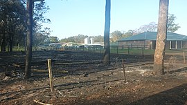
Ferodale is a sparsely populated rural suburb of the Port Stephens local government area in the Hunter Region of New South Wales, Australia. A large portion of the suburb is occupied by Grahamstown Dam, the lower Hunter Region's main water storage reservoir.