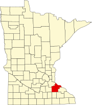
Cannon Falls Township, Goodhue County, Minnesota

Last updated

Cannon Falls Township, Minnesota
USA Minnesota location map.svg
Red pog.svg
Cannon Falls Township, Minnesota
Location within the state of Minnesota
Usa edcp location map.svg
Red pog.svg
Cannon Falls Township, Minnesota
Cannon Falls Township, Minnesota (the United States)
Coordinates: 44°29′55″N92°52′16″W / 44.49861°N 92.87111°W / 44.49861; -92.87111
Country United States
State Minnesota
County Goodhue
Area
  Total33.9 sq mi (87.8 km2)
  Land33.9 sq mi (87.8 km2)
  Water0.0 sq mi (0.0 km2)
Elevation
965 ft (294 m)
Population
 (2000)
  Total4k
  Density36.5/sq mi (14.1/km2)
Time zone UTC-6 (Central (CST))
  Summer (DST) UTC-5 (CDT)
ZIP code
55009
Area code 507
FIPS code 27-09748 [1]
GNIS feature ID0663744 [2]

Cannon Falls Township is a township in Goodhue County, Minnesota, United States. The population was 1,236 at the 2000 census.

Contents

Cannon Falls Township was organized in 1858, and named for the falls on the Cannon River. [3]

Geography

Cannon Falls Township, named for the Big Cannon river and its branch, the Little Cannon, has a falls in its western region. The city of Cannon Falls is situated at this locale. The Big Cannon river traverses the northern territory of the township from west to east, presenting a varied topography in its valley. The river's outer bluffs stand distantly apart and rise significantly above the water level, encompassing broad terraces, farms, and timber regions. Certain areas feature sandy soil but the land supports agriculture, with dairying emerging as a key industry. The river bottom, varying in width, is characterized by gravelly soil. [4]

According to the United States Census Bureau, the township has a total area of 33.9 square miles (88 km2), all land.

Demographics

As of the census [1] of 2000, there were 1,236 people, 417 households, and 354 families residing in the township. The population density was 36.5 inhabitants per square mile (14.1/km2). There were 427 housing units at an average density of 12.6 per square mile (4.9/km2). The racial makeup of the township was 99.43% White, 0.16% African American, 0.16% Native American and 0.24% Asian. Hispanic or Latino of any race were 0.73% of the population.

There were 417 households, out of which 40.0% had children under the age of 18 living with them, 76.5% were married couples living together, 4.6% had a female householder with no husband present, and 14.9% were non-families. 10.6% of all households were made up of individuals, and 2.9% had someone living alone who was 65 years of age or older. The average household size was 2.96 and the average family size was 3.19.

In the township the population was spread out, with 29.3% under the age of 18, 7.2% from 18 to 24, 26.4% from 25 to 44, 28.6% from 45 to 64, and 8.5% who were 65 years of age or older. The median age was 38 years. For every 100 females, there were 108.1 males. For every 100 females age 18 and over, there were 106.1 males.

The median income for a household in the township was $66,250, and the median income for a family was $69,375. Males had a median income of $48,472 versus $30,595 for females. The per capita income for the township was $29,568. About 0.8% of families and 1.5% of the population were below the poverty line, including none of those under age 18 and 5.6% of those age 65 or over.

Related Research Articles

<span class="mw-page-title-main">Rice County, Minnesota</span> County in Minnesota, United States

Rice County is a county located in the south central portion of the U.S. state of Minnesota. As of the 2020 census, the population was 67,097. Its county seat is Faribault.

<span class="mw-page-title-main">Goodhue County, Minnesota</span> County in Minnesota, United States

Goodhue County is a county in the U.S. state of Minnesota. As of the 2020 census, the population was 47,582. Its county seat is Red Wing. Nearly all of Prairie Island Indian Community is within the county.

Crow Wing Township is a township in Crow Wing County, Minnesota, United States. The population was 1,212 at the 2000 census.

<span class="mw-page-title-main">Randolph, Minnesota</span> City in Minnesota, United States

Randolph is a city in Dakota County, Minnesota, United States. The population was 436 at the 2010 census.

<span class="mw-page-title-main">Cannon Falls, Minnesota</span> City in Minnesota, United States

Cannon Falls is a city in Goodhue County, Minnesota, United States. The population was 4,083 at the 2010 census. Located along U.S. Route 52, southeast of the Twin Cities, Cannon Falls is the home of Pachyderm Studio, where many famous musicians have recorded, including Nirvana, which recorded its 1993 album In Utero there.

Cherry Grove Township is a township in Goodhue County, Minnesota, United States. The population was 430 at the 2000 census.

Featherstone Township is a township in Goodhue County, Minnesota, United States. The population was 785 at the 2000 census.

<span class="mw-page-title-main">Florence Township, Goodhue County, Minnesota</span> Township in Minnesota, United States

Florence Township is a township in Goodhue County, Minnesota, United States. The population was 1,450 at the 2000 census. A small part of the city of Lake City extends geographically within the township, but is a separate entity. The unincorporated area of Frontenac is also located within the township.

Goodhue Township is a township in Goodhue County, Minnesota, United States. The population was 530 at the 2000 census.

Hay Creek Township is a township in Goodhue County, Minnesota, United States. The population was 862 at the 2000 census. The unincorporated community of Hay Creek is located within the township.

Holden Township is a township in Goodhue County, Minnesota, United States. The population was 457 at the 2000 census.

Kenyon Township is a township in Goodhue County, Minnesota. The population was 437 at the time of the 2000 census. The township was organized in 1858 and named for an early storekeeper.

<span class="mw-page-title-main">Minneola Township, Goodhue County, Minnesota</span> Township in Minnesota, United States

Minneola Township is a township in Goodhue County, Minnesota, United States. The population was 657 at the 2000 census.

<span class="mw-page-title-main">Wacouta Township, Goodhue County, Minnesota</span> Township in Minnesota, United States

Wacouta Township is a township in Goodhue County, Minnesota, United States. The population was 410 at the 2000 census.

<span class="mw-page-title-main">Wanamingo Township, Goodhue County, Minnesota</span> Township in Minnesota, United States

Wanamingo Township is a township in Goodhue County, Minnesota, United States. The population was 504 at the 2000 census.

Warsaw Township is a township in Goodhue County, Minnesota, United States. The population was 603 at the 2000 census.
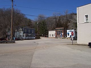
<span class="mw-page-title-main">Welch Township, Goodhue County, Minnesota</span> Township in Minnesota, United States

Welch Township is a township in Goodhue County, Minnesota, United States. It lies about halfway between the cities of Hastings and Red Wing and 36 miles southeast of Saint Paul. The population was 697 at the 2000 census. It is centered on the small community of Welch on the Cannon River. Like many river towns in the Driftless Area, it is situated at the base of the steep bluffs of the river valley.

River Falls Township is a township in Pennington County, Minnesota, United States. The population was 194 at the 2000 census.

Cannon City Township is a township in Rice County, Minnesota, United States. The population was 1,212 at the 2000 census.
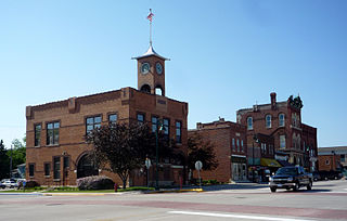
<span class="mw-page-title-main">Pine Island, Minnesota</span> City in Minnesota, United States

Pine Island is a city in Goodhue and Olmsted counties in the U.S. state of Minnesota. Most of Pine Island is in Goodhue County, but a small part extends into Olmsted County, making that portion part of the Rochester metropolitan area. As of the 2020 census, the population was 3,769.

References

  1. 1 2 "U.S. Census website". United States Census Bureau . Retrieved January 31, 2008.
  2. "US Board on Geographic Names". United States Geological Survey. October 25, 2007. Retrieved January 31, 2008.
  3. Upham, Warren (1920). Minnesota Geographic Names: Their Origin and Historic Significance. Minnesota Historical Society. p.  206.
  4. Franklyn, Curtiss-Wedge (1910). History of Dakota and Goodhue counties, Minnesota. Volume II (1st ed.). H. C. Cooper, Jr., & Co. pp. 167–168.