Canton City, North Dakota

Last updated

Canton City, North Dakota
ND Pembina County Canton City.svg
Coordinates: 48°41′17″N97°39′58″W / 48.68806°N 97.66611°W / 48.68806; -97.66611
CountryUnited States
State North Dakota
County Pembina
Founded1882
Area
[1]
  Total0.25 sq mi (0.65 km2)
  Land0.25 sq mi (0.65 km2)
  Water0.00 sq mi (0.00 km2)
Elevation
[2]
922 ft (281 m)
Population
 (2020) [3]
  Total31
  Estimate 
(2022) [4]
33
  Density124.50/sq mi (48.04/km2)
Time zone UTC-6 (Central (CST))
  Summer (DST) UTC-5 (CDT)
ZIP code
58241
Area code 701
FIPS code [5] 38-12060
GNIS feature ID1035953 [2]

Canton City, also known as Hensel, is a town located on the east edge of Park Township in Pembina County, North Dakota, United States. The population was 31 at the 2020 census. [3]

Contents

History

The city was founded as Canton Village [6] in 1882. [7] The post office was relocated from a location named Hensel a short distance away, and retained its name. The result is that Hensel Post Office is located in Canton City, and the town is most frequently referred to as Hensel and is marked as such on highway signs and maps. However the proper and legal name is Canton, whether as a city or a village. Although no documents have been found to locate the original Hensel Post Office, it is likely that it was just over two miles southwest of Canton City, on the land in the northeast quarter of Section 22 in Park Township that was homesteaded (granted 31 Dec 1890) by Joseph Erwin (or Irwin), whom records identify as the first postmaster, appointed 5 Feb 1884. [8]

Geography

According to the United States Census Bureau, the city has a total area of 0.14 square miles (0.36 km2), all land. [9]

Demographics

Historical population
CensusPop.Note
1900 98
1910 11517.3%
1920 101−12.2%
1930 12523.8%
1940 14818.4%
1950 139−6.1%
1960 130−6.5%
1970 81−37.7%
1980 68−16.0%
1990 64−5.9%
2000 42−34.4%
2010 457.1%
2020 31−31.1%
2022 (est.)33 [4] 6.5%
U.S. Decennial Census [10]
2020 Census [3]

2010 census

As of the census of 2010, there were 45 people, 26 households, and 12 families residing in the city. The population density was 321.4 inhabitants per square mile (124.1/km2). There were 32 housing units at an average density of 228.6 per square mile (88.3/km2). The racial makeup of the city was 97.8% White and 2.2% from two or more races.

There were 26 households, of which 15.4% had children under the age of 18 living with them, 34.6% were married couples living together, 7.7% had a female householder with no husband present, 3.8% had a male householder with no wife present, and 53.8% were non-families. 53.8% of all households were made up of individuals, and 11.5% had someone living alone who was 65 years of age or older. The average household size was 1.73 and the average family size was 2.50.

The median age in the city was 51.1 years. 13.3% of residents were under the age of 18; 8.8% were between the ages of 18 and 24; 20% were from 25 to 44; 42.2% were from 45 to 64; and 15.6% were 65 years of age or older. The gender makeup of the city was 60.0% male and 40.0% female.

2000 census

As of the census of 2000, there were 42 people, 22 households, and 13 families residing in the city. The population density was 288.1 inhabitants per square mile (111.2/km2). There were 29 housing units at an average density of 198.9 per square mile (76.8/km2). The racial makeup of the city was 100.00% White.

There were 22 households, out of which 18.2% had children under the age of 18 living with them, 40.9% were married couples living together, 13.6% had a female householder with no husband present, and 36.4% were non-families. 31.8% of all households were made up of individuals, and 4.5% had someone living alone who was 65 years of age or older. The average household size was 1.91 and the average family size was 2.36.

In the city, the population was spread out, with 16.7% under the age of 18, 2.4% from 18 to 24, 38.1% from 25 to 44, 23.8% from 45 to 64, and 19.0% who were 65 years of age or older. The median age was 41 years. For every 100 females, there were 147.1 males. For every 100 females age 18 and over, there were 118.8 males.

The median income for a household in the city was $31,250, and the median income for a family was $36,875. Males had a median income of $28,750 versus $13,750 for females. The per capita income for the city was $21,511. None of the population and none of the families were below the poverty line.

Related Research Articles

<span class="mw-page-title-main">Canton, Minnesota</span> City in Minnesota, United States

Canton is a city in Fillmore County, Minnesota, United States. The population was 346 at the 2010 census.

<span class="mw-page-title-main">Mabel, Minnesota</span> City in Minnesota, United States

Mabel is a city in Fillmore County, Minnesota, United States. The population was 780 at the 2010 census.

<span class="mw-page-title-main">St. Vincent, Minnesota</span> City in Minnesota, United States

St. Vincent is a hamlet in Kittson County, Minnesota, United States. The population was 57 at the 2020 census.

Pembina Township is a township in Mahnomen County, Minnesota in the United States. The population was 471 at the 2000 census.

<span class="mw-page-title-main">New Germany, Minnesota</span> City in Minnesota, United States

New Germany is a city in Carver County, Minnesota, United States. The population was 372 at the 2010 census. A large proportion of the early settlers being natives of Germany caused the name to be selected.

<span class="mw-page-title-main">Bathgate, North Dakota</span> City in North Dakota, United States

Bathgate is a city in Pembina County, North Dakota, United States. It sits on the banks of the Tongue River. The population was 47 at the 2020 census. Bathgate was founded in 1881. In 1908, the North Dakota School for the Blind was placed in Bathgate. The building still stands and is now occupied by a publishing company. Bathgate was the childhood home of former world-champion speed skater and figure skater Norval Baptie.

<span class="mw-page-title-main">Cavalier, North Dakota</span> City in North Dakota, United States

Cavalier is the largest city in Pembina County, North Dakota, United States. It is the county seat of Pembina County. The population was 1,246 at the 2020 census. Cavalier was founded in 1875 and became the county seat in 1911.

<span class="mw-page-title-main">Crystal, North Dakota</span> City in North Dakota, United States

Crystal is a city in Pembina County, North Dakota, United States. The population was 116 at the 2020 census. Crystal was founded in 1879.

<span class="mw-page-title-main">Hamilton, North Dakota</span> City in North Dakota, United States

Hamilton is a city in Pembina County, North Dakota, United States. The population was 46 at the 2020 census.

<span class="mw-page-title-main">Mountain, North Dakota</span> City in North Dakota, United States

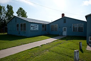
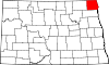
Mountain is a city in Thingvalla Township, Pembina County, North Dakota, United States. The population was 80 at the 2020 census. Mountain was founded in 1884.

<span class="mw-page-title-main">Neche, North Dakota</span> City in North Dakota, United States

Neche is a city in Pembina County, North Dakota, United States. It sits on the banks of the Pembina River. The population was 344 at the 2020 census.

<span class="mw-page-title-main">Walhalla, North Dakota</span> City in North Dakota, United States

Walhalla is a city in Pembina County, North Dakota, United States. It sits on the banks of the Pembina River, five miles from the border with Manitoba (Canada) and approximately 45 mi (72 km) from the border with Minnesota. The population was 893 at the 2020 census.

<span class="mw-page-title-main">Dunseith, North Dakota</span> City in North Dakota, United States

Dunseith is a city in Rolette County, North Dakota, United States. The population was 632 at the 2020 census. Dunseith is best known for its proximity to the International Peace Garden. The port of entry at the Peace Garden is one of three 24-hour ports in North Dakota. Dunseith is also the home of the world's largest turtle sculpture, the "W'eel Turtle", made of more than 2,000 wheels painted green.

<span class="mw-page-title-main">Beach City, Ohio</span> Village in Ohio, United States

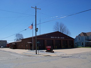
Beach City is a village in southwestern Stark County, Ohio, United States. The population was 940 at the 2020 census. It is part of the Canton–Massillon metropolitan area.

<span class="mw-page-title-main">East Canton, Ohio</span> Village in Ohio, United States

East Canton is a village in central Stark County, Ohio, United States. The population was 1,521 at the 2020 census. It is part of the Canton–Massillon metropolitan area.

<span class="mw-page-title-main">East Sparta, Ohio</span> Village in Ohio, United States

East Sparta is a village in southern Stark County, Ohio, United States. The population was 749 at the 2020 census. It is part of the Canton–Massillon metropolitan area.

<span class="mw-page-title-main">Hills and Dales, Ohio</span> Village in Ohio, United States

Hills and Dales is a village in central Stark County, Ohio, United States. It is a suburban enclave near Canton. Hills and Dales is part of the Canton–Massillon metropolitan area. The population was 250 at the 2020 census.

<span class="mw-page-title-main">North Canton, Ohio</span> City in Ohio, United States

North Canton is a city in central Stark County, Ohio, United States. The population was 17,842 at the 2020 census. It is a suburb of the Canton–Massillon metropolitan area.

<span class="mw-page-title-main">Canton Township, Washington County, Pennsylvania</span> Township in Pennsylvania, United States

Canton Township is a township in Washington County, Pennsylvania, United States. The population was 8,201 at the 2020 census.

<span class="mw-page-title-main">Rittman, Ohio</span> City in Ohio, United States

Rittman is a city in Medina and Wayne counties in the U.S. state of Ohio. All but a small portion of the city is in Wayne County, within commuting distance of Akron, Canton and Cleveland. The population was 6,131 at the 2020 census.

References

  1. "ArcGIS REST Services Directory". United States Census Bureau. Retrieved September 20, 2022.
  2. 1 2 U.S. Geological Survey Geographic Names Information System: Canton City, North Dakota
  3. 1 2 3 "Explore Census Data". United States Census Bureau . Retrieved December 14, 2023.
  4. 1 2 "City and Town Population Totals: 2020-2022". United States Census Bureau. December 14, 2023. Retrieved December 14, 2023.
  5. "U.S. Census website". United States Census Bureau . Retrieved January 31, 2008.
  6. "Feature Detail Report for: Hensel (incorporated as Canton City)". Geographic Names Information System . United States Geological Survey, United States Department of the Interior.
  7. "Cities". County of Pembina, North Dakota. Archived from the original on February 18, 2015. Retrieved October 26, 2015.
  8. Steinolfson, Arlan, unpublished documents.
  9. "US Gazetteer files 2010". United States Census Bureau. Archived from the original on July 2, 2012. Retrieved June 14, 2012.
  10. United States Census Bureau. "Census of Population and Housing" . Retrieved August 30, 2013.