
The Bitterroot Range is a mountain range and a subrange of the Rocky Mountains that runs along the border of Montana and Idaho in the northwestern United States. The range spans an area of 24,223 square miles (62,740 km2) and is named after the bitterroot, a small pink flower that is the state flower of Montana.

The Spokane River is a tributary of the Columbia River, approximately 111 miles (179 km) long, in northern Idaho and eastern Washington in the United States. It drains a low mountainous area east of the Columbia, passing through the Spokane Valley and the city of Spokane, Washington.

Cardamine is a large genus of flowering plants in the mustard family, Brassicaceae, known as bittercresses and toothworts. It contains more than 200 species of annuals and perennials. Species in this genus can be found in diverse habitats worldwide, except the Antarctic. The name Cardamine is derived from the Greek kardaminē, water cress, from kardamon, pepper grass.

Clearwater National Forest with headquarters on the Nez Perce Reservation at Kamiah is located in North Central Idaho in the northwestern United States. The forest is bounded on the east by the state of Montana, on the north by the Idaho Panhandle National Forest, and on the south and west by the Nez Perce National Forest and Palouse Prairie.
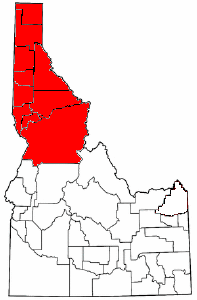
The Idaho panhandle—locally known as North Idaho, Northern Idaho, or simply the Panhandle—is a salient region of the U.S. state of Idaho encompassing the state's 10 northernmost counties: Benewah, Bonner, Boundary, Clearwater, Idaho, Kootenai, Latah, Lewis, Nez Perce, and Shoshone. The panhandle is bordered by the state of Washington to the west, Montana to the east, and the Canadian province of British Columbia to the north. The Idaho panhandle, along with Eastern Washington, makes up the region known as the Inland Northwest, headed by its largest city, Spokane, Washington.
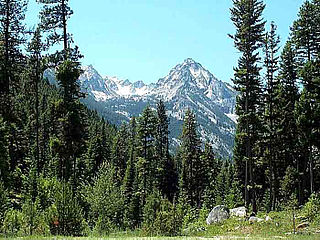
Bitterroot National Forest comprises 1.587 million acres (6,423 km2) in west-central Montana and eastern Idaho of the United States. It is located primarily in Ravalli County, Montana, but also has acreage in Idaho County, Idaho (29.24%), and Missoula County, Montana (0.49%).

Cardamine hirsuta, commonly called hairy bittercress, is an annual or biennial species of plant in the family Brassicaceae, and is edible as a salad green. It is common in moist areas around the world.

The Silver Valley is a region in the northwest United States, in the Coeur d'Alene Mountains in northern Idaho. It is noted for its mining heritage, dating back to the 1880s.

The Coeur d'Alene salamander is a species of woodland salamander (Plethodon) in the family of lungless salamanders (Plethodontidae) found in northern Idaho, western Montana, and southeastern British Columbia. This species was discovered in 1939 by James R. Slater and John W. Slipp on the south shore of Lake Coeur d'Alene in northern Idaho. It was once considered to be a subspecies of Van Dyke's salamander, as P. vandykei idahoensis, but appears to be a distinct and separate species as originally suggested by Slater and Slipp (1940).
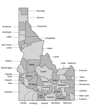
The U.S. state of Idaho borders six other U.S. states and one Canadian province. The states of Washington and Oregon are to the west, Nevada and Utah are to the south, and Montana and Wyoming are to the east. Idaho also shares a short border with the Canadian province of British Columbia to the north.
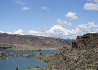
The Columbia Plateau ecoregion is a Level III ecoregion designated by the United States Environmental Protection Agency (EPA) encompassing approximately 32,100 square miles (83,139 km2) of land within the U.S. states of Washington, Oregon, and Idaho. The ecoregion extends across a wide swath of the Columbia River Basin from The Dalles, Oregon to Lewiston, Idaho to Okanogan, Washington near the Canada–U.S. border. It includes nearly 500 miles (800 km) of the Columbia River, as well as the lower reaches of major tributaries such as the Snake and Yakima Rivers and the associated drainage basins. It is named for the Columbia Plateau, a flood basalt plateau formed by the Columbia River Basalt Group during the late Miocene and early Pliocene.

Cardamine pachystigma is a species of Cardamine known by the common name serpentine bittercress. It is endemic to California, where it grows in rocky mountainous areas, often on serpentine and volcanic soils.

Heyburn State Park is a public recreation area in the U.S. state of Idaho. It is located almost entirely in Benewah County, with a small portion extending into southern Kootenai County. The park was founded in 1908 and is the oldest state or provincial park in the Pacific Northwest. The park has 5,744 acres (23.2 km2) of land and 2,332 acres (9.4 km2) of water on three lakes: Benewah, Chatcolet, and Hidden. A dam constructed on the Spokane River in Post Falls in 1906 raised the level of Lake Coeur d'Alene, connecting it to the park's three lakes. The surface elevation of the lakes is 2,125 feet (648 m) above sea level. The park's year-round recreational opportunities include camping, boating, hiking, horseback riding, fishing, and picnicking.
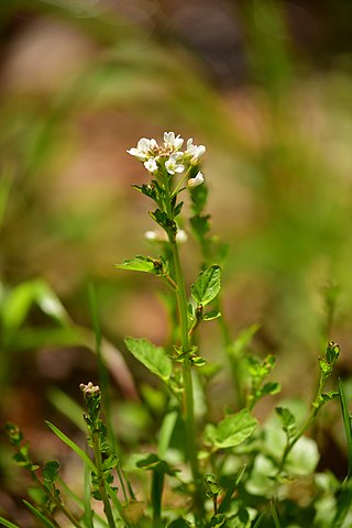
Cardamine micranthera is a rare species of flowering plant in the mustard family known by the common names small-anthered bittercress and streambank bittercress. It is endemic to the Piedmont region around the border between Virginia and North Carolina, and is today restricted to the Dan River watershed. It is in decline mainly because its habitat has been disturbed and destroyed by a number of processes. By the 1960s the only known populations of the plant had disappeared and in the 1970s it was feared extinct. The plant was rediscovered in the 1980s and for a while was presumed to be a rare North Carolina endemic; populations in Virginia have been confirmed since. The plant was federally listed as an endangered species in 1989 when it was known from only four tiny populations on unprotected private land. Today there are about 32 occurrences; one occurrence in North Carolina has been extirpated and five others there had no specimens found at the most recent survey.

Cardamine douglassii, the limestone bittercress or purple cress, is a perennial forb native to the eastern and central United States as well as the province of Ontario in Canada, that produces white to pink or purple flowers in early spring.
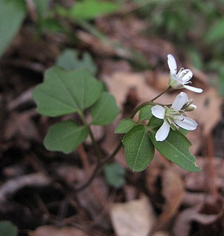
Cardamine flagellifera, commonly known as Blue Ridge bittercress, is a species of herbaceous plant in the mustard family. It is native to eastern North America, where it is found primarily in the southern Blue Ridge. It is a perennial that produces white flowers in the spring.

Cardamine bulbifera, known as coralroot bittercress or coral root, is a species of flowering plant in the family Brassicaceae. It is a perennial with upright, mostly unbranched, stems to 70 cm (28 in) tall, and leaves made up of between three and 13 leaflets. The flowers have petals that are 10–15 mm (0.4–0.6 in) long collected in corymbose few-flowered racemes and are generally light purple, pink or almost white. It is found in damp places.

The Tubbs Hill Natural Area is a 165-acre (0.67 km2) public park and natural area in Coeur d'Alene, Idaho. The park is located on a peninsula, with Lake Coeur d'Alene bordering the park on its west, south, and east sides and McEuen Park to the north with its main entrance and trail head at 210 South 3rd Street. An additional trail head is located at the southern terminus of 10th Street. The parks main attraction is the 2.2-mile (3.5 km) Interpretive Trail that takes visitors passed scenic vantage points and natural and historical sites of interest that takes about 52 minutes to complete. Other activities such as climbing, cliff jumping, kayaking, fishing, sun bathing, bird watching and flower viewing are also popular things to do in the park.
Anguispira nimapuna, also known as the nimapuna or nimapu tigersnail, is a rare, range-restricted species of pulmonate land snail endemic to north-central Idaho. The species is listed as critically endangered in the United States.


