Caroga, New York | |
---|---|
Coordinates: 43°8′36″N74°29′24″W / 43.14333°N 74.49000°W | |
Country | United States |
State | New York |
County | Fulton |
Government | |
• Type | Town Council |
• Town Supervisor | Scott Horton (R) |
• Town Council | Members' List |
Area | |
• Total | 54.28 sq mi (140.58 km2) |
• Land | 50.63 sq mi (131.12 km2) |
• Water | 3.65 sq mi (9.46 km2) |
Elevation | 1,637 ft (499 m) |
Population (2010) | |
• Total | 1,205 |
• Estimate (2016) [2] | 1,162 |
• Density | 22.95/sq mi (8.86/km2) |
Time zone | UTC-5 (Eastern (EST)) |
• Summer (DST) | UTC-4 (EDT) |
ZIP code | 12032 |
Area code | 518 |
FIPS code | 36-035-12573 |
GNIS feature ID | 0978794 |
Website | townofcaroga |
Caroga is a town in Fulton County, New York, United States. The population was 1,205 at the 2010 census. [3] The town was named after a local creek.
Caroga is in the northern part of the county, northwest of Gloversville and Johnstown.
The town was first settled circa 1783.
The town was created in 1842 from parts of the towns of Bleecker, Johnstown, and Stratford.
The name of the town is an altered spelling of Garoga [Creek], which flows south from the town towards the Mohawk River.
The industry of the early town was based on lumber and tanning. By 1890, the population was 624.
According to the United States Census Bureau, the town has a total area of 54.3 square miles (140.6 km2), of which 50.6 square miles (131.1 km2) is land and 3.7 square miles (9.5 km2), or 6.73%, is water. [3]
Caroga is inside the Adirondack Park. The northern town line is the border of Hamilton County.
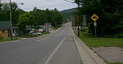
New York State Route 10 is a north–south highway in Caroga. It leads north to Piseco Lake in the town of Arietta and south to Canajoharie on the Mohawk River. New York State Route 29A is an east–west highway intersecting NY-10 near Pine Lake and then running southward as a conjoined highway to Caroga Lake. NY 29A leads southeast to Gloversville and west to Salisbury. New York State Route 10A branches off NY-10 to the southeast near Bradtville, providing a route to Johnstown, the Fulton County seat.
Census | Pop. | Note | %± |
---|---|---|---|
1850 | 589 | — | |
1860 | 629 | 6.8% | |
1870 | 828 | 31.6% | |
1880 | 855 | 3.3% | |
1890 | 624 | −27.0% | |
1900 | 470 | −24.7% | |
1910 | 441 | −6.2% | |
1920 | 332 | −24.7% | |
1930 | 306 | −7.8% | |
1940 | 408 | 33.3% | |
1950 | 462 | 13.2% | |
1960 | 568 | 22.9% | |
1970 | 822 | 44.7% | |
1980 | 1,177 | 43.2% | |
1990 | 1,337 | 13.6% | |
2000 | 1,407 | 5.2% | |
2010 | 1,205 | −14.4% | |
2016 (est.) | 1,162 | [2] | −3.6% |
U.S. Decennial Census [4] |
As of the census [5] of 2000, there were 1,407 people, 588 households, and 392 families residing in the town. The population density was 27.7 inhabitants per square mile (10.7/km2). There were 1,794 housing units at an average density of 35.3 per square mile (13.6/km2). The racial makeup of the town was 98.86% White, 0.07% Native American, 0.14% Asian, 0.07% Pacific Islander, and 0.85% from two or more races. Hispanic or Latino of any race were 0.21% of the population.
There were 588 households, out of which 27.9% had children under the age of 18 living with them, 53.7% were married couples living together, 7.7% had a female householder with no husband present, and 33.2% were non-families. 26.2% of all households were made up of individuals, and 11.9% had someone living alone who was 65 years of age or older. The average household size was 2.39 and the average family size was 2.87.
In the town, the population was spread out, with 22.9% under the age of 18, 5.0% from 18 to 24, 27.1% from 25 to 44, 28.4% from 45 to 64, and 16.6% who were 65 years of age or older. The median age was 42 years. For every 100 females, there were 105.4 males. For every 100 females age 18 and over, there were 107.9 males.
The median income for a household in the town was $34,911, and the median income for a family was $36,852. Males had a median income of $26,452 versus $22,067 for females. The per capita income for the town was $18,048. About 6.7% of families and 9.0% of the population were below the poverty line, including 12.1% of those under age 18 and 9.7% of those age 65 or over.
Fulton County is a county in the U.S. state of New York. It forms part of the state's Mohawk Valley region. Its county seat is Johnstown. At the 2020 U.S. census, the county had a population of 53,324. The county is named in honor of Robert Fulton, who is widely credited with developing the first commercially successful steamboat. Fulton County comprises the Gloversville micropolitan statistical area, which is included in the Capital District.
Bleecker is a town in Fulton County, New York, United States. The population was 533 at the 2010 census. The name is from Barent Bleecker, one of the original landowners of the region.
Ephratah is a town in Fulton County, New York, United States. The population was 1,682 at the 2010 census. It is named after Ephrath, a biblical town in what is now Israel.
Gloversville is a city in the Mohawk Valley region of Upstate New York, United States. The most populous city in Fulton County, Gloversville was once the hub of the United States' glovemaking industry, with over two hundred manufacturers in Gloversville and the adjacent city of Johnstown. In 2020, Gloversville had a population of 15,131.
Northampton is a town in Fulton County, New York, United States. The population was 2,670 at the 2010 census. The name comes from an original land patent. Northampton is in the northeastern corner of the county and is northeast of Gloversville. The town is known for the village of Northville, a major Adirondack community; and the Great Sacandaga Lake, which composes around 40% of the town.
Stratford is a town in Fulton County, New York, United States. The population was 610 at the 2010 census. The town is in the northwestern corner of the county, northeast of the village of Dolgeville. It was named after Stratford, Connecticut.
Arietta is a town in Hamilton County, New York, United States. The population was 304 at the 2010 census. The town was named after the mother of one of the first settlers, Rensselaer Van Rennslaer.
Indian Lake is a town in Hamilton County, New York, United States. The population was 1,352 at the 2010 census. The name is from a lake of the same name that is largely inside the town. There are no permanent stop lights in the town. Law enforcement is provided by New York State Troopers and Hamilton County Sheriff's Office.
Morehouse is a town in Hamilton County, New York, United States. The population was 86 at the 2010 census. The name is that of an early developer, Andrew K. Morehouse.
Wells is a town in Hamilton County, New York, United States. The population was 674 at the 2010 census. The town is named after Joshua Wells, a land agent, who built the first mills in the area. It is in the Adirondack Park and on the eastern border of the county. It is northwest of Schenectady.
Columbia is a town in Herkimer County, New York, United States. As of the 2010 census, the town population was 1,580. The town is at the southern border of the county and is southeast of Utica.
Ohio is a town in Herkimer County, New York, United States. The population was 1,002 at the 2010 census. The town is named after the state of Ohio. The town is in the northern part of the county and northeast of Utica. Part of Ohio is within the Adirondack Park.
Salisbury is a town in Herkimer County, New York, United States. The population was 1,958 at the 2010 census. The town is on the eastern edge of the county, north of the city of Little Falls. The northern part of the town is in the Adirondack Park.
Webb is the northernmost town in Herkimer County, New York, United States. As of the 2010 census it had a population of 1,807.
Broadalbin is a town in Fulton County, New York, on the eastern border of the county and northwest of Albany. The town was named after the Breadalbane Region in Scotland by an early settler. The town contains a village also called Broadalbin. The population was 5,260 at the 2010 census.
Johnstown is a town located in Fulton County, New York, United States. As of the 2010 census, the town had a population of 7,098. The name of the town is from landowner William Johnson. The town of Johnstown is located on the southern border of the county. It borders on three sides the city of Johnstown and the city of Gloversville.
Mayfield is a town in Fulton County, New York, United States, northeast of Gloversville and Johnstown. The town contains a village also named Mayfield. The population of the town was 6,495 at the 2010 census.
New York State Route 309 (NY 309) is a 6.56-mile-long (10.56 km) state highway located entirely in Fulton County, New York, in the United States. The southern terminus of the route is at an intersection with NY 29A in Gloversville. The northern terminus of the route is at a junction with Lily Lake Road in the hamlet of Bleecker, where the highway continues north and west as County Route 112 (CR 112) to London Bridge Road at West Caroga Lake in the town of Caroga. Part of NY 309 and all of CR 112 is located within Adirondack Park. NY 309 was assigned to its current alignment as part of the 1930 renumbering of state highways in New York.
New York State Route 29A (NY 29A) is a state highway in the western portion of the Capital District of New York in the United States. The western terminus of the route is at an intersection with NY 29 in the Herkimer County hamlet of Salisbury Center. Its eastern end is at another junction with NY 29 about 36 miles (58 km) to the east near the Fulton County hamlet of Vail Mills. NY 29A enters Gloversville via Rose Street and continues through downtown on Fulton Street.
Caroga Lake is an unincorporated community and census-designated place (CDP) in the town of Caroga, Fulton County, New York, United States. The population was 518 at the 2010 census. The hamlet is in the southern part of the town of Caroga and is northwest of Gloversville. Two lakes, West Caroga Lake and East Caroga Lake are located next to the hamlet.