Ashley County is a rural South Arkansas county with a culture, economy, and history based on timber and agriculture. Created as Arkansas's 52nd county on November 30, 1848, Ashley County has seven incorporated municipalities, including Hamburg, the county seat and Crossett, the most populous city. The county is also the site of numerous unincorporated communities and ghost towns. The county is named for Chester Ashley, a prominent lawyer in the Arkansas Territory and U.S. senator from the state from 1844 to 1848.

Grand Isle is a town in Jefferson Parish in the U.S. state of Louisiana, located on a barrier island of the same name in the Gulf of Mexico. The island is at the mouth of Barataria Bay where it meets the gulf. The town of Grand Isle is statistically part of the New Orleans−Metairie−Kenner metropolitan statistical area, though it is not connected to New Orleans' continuous urbanized area.
Taconic State Park is located in Columbia and Dutchess County, New York abutting Massachusetts and Connecticut within the Taconic Mountains. The state park is located off New York State Route 344 south of Interstate 90 and 110 miles (180 km) north of New York City. It features camping, hiking, bicycling, hunting, cross county skiing and other recreational opportunities.
The Emiquon National Wildlife Refuge is a 11,122-acre (45.01 km2) wetland wildlife refuge located in Waterford Township in Fulton County, Illinois across the Illinois River from the town of Havana. Only 3,000 acres (12 km2) are currently managed by the U.S. Fish and Wildlife Service as part of the Illinois River National Wildlife and Fish Refuges Complex. It is in the Central forest-grasslands transition ecoregion.
Beechwood Farms Nature Reserve is a 134-acre (0.5 km2) protected area for flora, fauna, and wildlife in Fox Chapel, Pennsylvania, a Pittsburgh suburb. The site has served as the headquarters of the Audubon Society of Western Pennsylvania (ASWP) since 1977.

The geography of Arkansas varies widely. The state is covered by mountains, river valleys, forests, lakes, and bayous in addition to the cities of Arkansas. Hot Springs National Park features bubbling springs of hot water, formerly sought across the country for their healing properties. Crowley's Ridge is a geological anomaly rising above the surrounding lowlands of the Mississippi embayment.

Beury Mountain Wildlife Management Area is located on 9,232 acres (3,736 ha) near Babcock State Park and New River Gorge National River in Fayette County, West Virginia. Beury Mountain's sloping terrain is covered with mixed hardwoods and oak-hickory second growth woodlands overlooking New River Gorge. Camping is not allowed at Beury Mountain WMA, but is available at nearby Babcock State Park.
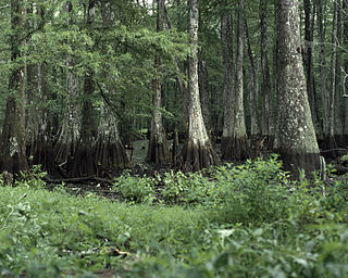
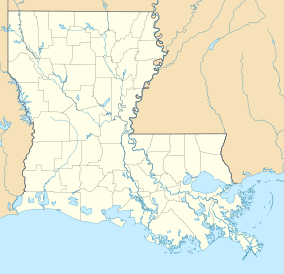
Bayou Cocodrie National Wildlife Refuge was established in 1992 to preserve waterfowl habitat and hardwood forest of the lower Mississippi river. The 13,200-acre (53 km2) refuge is located in Concordia Parish, Louisiana, 10 miles (16 km) southwest of Vidalia, Louisiana. It is named for the state-designated scenic river of Bayou Cocodrie.
Conserving Carolina is a non-profit conservation organization working to preserve water and land resources in Western North Carolina. Conserving Carolina was created in July 2017, from a merger of two previously-separate organizations, Carolina Mountain Land Conservancy and Pacolet Area Conservancy. The combined organization maintains a primary office in Hendersonville, NC and a regional office in Columbus, NC.

Fontainebleau State Park is located in St. Tammany Parish, Louisiana, on the north shore of Lake Pontchartrain. The park is 2,800 acres (1,100 ha) in size and was once the site of a sugar cane plantation and brickyard operated by Bernard de Marigny and later by his son Armand Marigny. The park has a multitude of habitats for birds.

Lake Claiborne State Park is a recreation site located in Claiborne Parish, northwestern Louisiana, USA. It was opened in 1974 and is 643 acres (2.60 km2) in size. The park provides access to scenic Lake Claiborne, a 6,400-acre (26 km2) man-made water body formed by damming Bayou D'Arbonne. Guests may stay at 10 cabins and 89 campsites on the Park grounds. Boats and canoes are available to rent. There is a large swimming beach, boat launch, Nature Center and numerous interpretive programs. The entrance to Lake Claiborne State Park is located 7 miles (11 km) southeast of Homer on Louisiana Highway 146.

South Toledo Bend State Park is one of two Louisiana State Parks located on the shores of Toledo Bend Reservoir. The land for the park was acquired in 1979, but it was not opened to the public with facilities until November 20, 2004. The park, located at 120 Bald Eagle Road, in Anacoco, LA, quickly became popular due to its recreation potential.
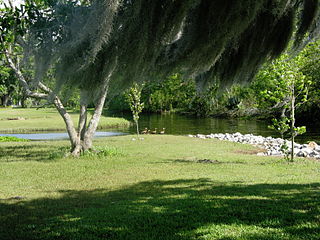
Fairview-Riverside State Park is a tourist attraction 2 miles (3.2 km) east of Madisonville, Louisiana, United States. Its 99 acres (400,000 m2) is set along the banks of the Tchefuncte River. Within the park is the Otis House Museum, built in 1885, which was placed on the National Register of Historic Places in 1999. Visitors go to Fairview-Riverside to camp, and for water sports and fishing. The park has 100 campsites, a short nature trail, and a boardwalk which reveals forested wetlands along the Tchefuncte River.
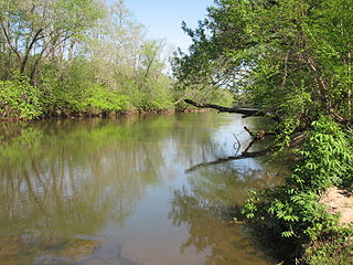
Mayo River State Park is a North Carolina state park in Rockingham County, North Carolina in the United States. It covers 2,778-acre (11.24 km2) along the Mayo River, and it adjoins a Virginia State Park of the same name. North Carolina's park is near Mayodan, North Carolina. The park is one of the newest in the North Carolina system, having been authorized by the General Assembly in May 2003.
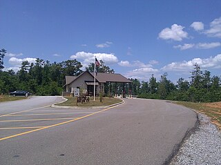
Bogue Chitto State Park is a recent addition to the Louisiana State Park system. It opened to the public on August 28, 2010, after a delay of approximately three months.
The Sherburne Complex is a joint land management venture of the U.S. Fish and Wildlife Service, the Louisiana Department of Wildlife and Fisheries (LDWF), and the U.S. Army Corps of Engineers that began in 1983. The area consists of 44,000 acres (180 km2), and is managed by the Louisiana Department of Wildlife and Fisheries. The complex is located in the Morganza Flood way system of the Atchafalaya Basin about 30 miles (48 km) west of Baton Rouge, Louisiana and actually extends a little south of the I-10 Atchafalaya Basin Bridge at Whiskey Bay, Louisiana. The bridge crosses the Whiskey Bay Pilot Channel. Located on the graveled LA 975, the west boundary is on the east side of the Atchafalaya River with the east boundary being the East Protection Levee. The complex stretches just north of old highway 190, and a short distance to the south of I-10. The nearest town is Krotz Springs to the north off US 190.

Palmetto Island State Park is a recent addition to the Louisiana State Park system. The new state park is located south of Abbeville, Louisiana in Vermilion Parish. The state of Louisiana acquired the property for the park in 1981 but did not begin construction on it with the intent of public use until 2002. State budget constraints and other concerns delayed the park's opening until October 28, 2010.
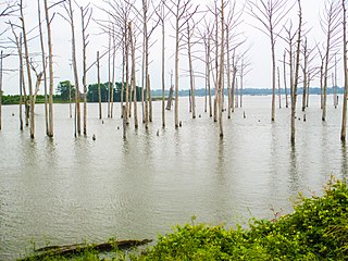
Poverty Point Reservoir State Park is a state park in Richland Parish in northeastern Louisiana located along a 2,700 acres (4.2 sq mi) man-made reservoir offering camping and watersport activities, swimming, hiking, and fishing. The reservoir is named after nearby Poverty Point, an archeological site settled between 1,400 and 700 BC consisting of Native-American earthworks and other artifacts. The park has eight deluxe cabins, four standard cabins, and fifty-four campsites.
Ben Lilly Conservation Area is a 247-acre tract of protected area located in Morehouse Parish, Louisiana, USA. The Louisiana Department of Wildlife and Fisheries (LDWF) became the new owner in 2013.

