Jefferson Parish is a parish in the U.S. state of Louisiana. As of the 2020 census, the population was 440,781. Its parish seat is Gretna, its largest community is Metairie, and its largest incorporated city is Kenner. Jefferson Parish is included in the Greater New Orleans area.

Grand Isle is a town in Jefferson Parish in the U.S. state of Louisiana, located on a barrier island of the same name in the Gulf of Mexico. The island is at the mouth of Barataria Bay where it meets the gulf. The town of Grand Isle is statistically part of the New Orleans−Metairie−Kenner metropolitan statistical area, though it is not connected to New Orleans' continuous urbanized area.
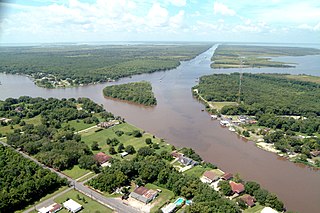
Jean Lafitte is a town on Bayou Barataria in the U.S. state of Louisiana. Located in Jefferson Parish, it is named after the privateer Jean Lafitte. The population was 1,809 at the 2020 census. It is part of the New Orleans–Metairie–Kenner metropolitan statistical area.

Chalmette is a census-designated place (CDP) in, and the parish seat of, St. Bernard Parish in southeastern Louisiana, United States. The 2010 census reported that Chalmette had 16,751 people; 2011 population was listed as 17,119; however, the pre-Katrina population was 32,069 at the 2000 census. At the 2020 U.S. census, its population rebounded to 21,562. Chalmette is part of the New Orleans–Metairie–Kenner metropolitan statistical area. Chalmette is located east of downtown New Orleans and south of Arabi, towards Lake Borgne.

Biloxi is a city in Harrison County, Mississippi, United States. It lies on the Gulf Coast in southern Mississippi, bordering the city of Gulfport to its west. The adjacent cities are both designated as seats of Harrison County. The population of Biloxi was 49,449 at the 2020 census, making it the state's 4th most populous city. It is a principal city of the Gulfport–Biloxi metropolitan area, home to 416,259 residents in 2020. The area's first European settlers were French colonists.
Port Fourchon is Louisiana’s southernmost port, located on the southern tip of Lafourche Parish, on the Gulf of Mexico. It is a seaport, with significant petroleum industry traffic from offshore Gulf oil platforms and drilling rigs as well as the Louisiana Offshore Oil Port pipeline. Fourchon's primary service markets are domestic deepwater oil and gas exploration, drilling, and production in the Gulf. Port Fourchon currently services over 90% of the Gulf of Mexico's deepwater oil production. There are over 600 oil platforms within a 40-mile radius of Port Fourchon. This area furnishes 16 to 18 percent of the US oil supply.

The Florida panhandle is the northwestern part of the U.S. state of Florida. It is a salient roughly 200 miles (320 km) long, bordered by Alabama on the north and the west, Georgia on the north, and the Gulf of Mexico to the south. Its eastern boundary is arbitrarily defined. It is defined by its southern culture and rural geography relative to the rest of Florida, as well as closer cultural links to French-influenced Louisiana, Mississippi, and Alabama. Its major communities include Pensacola, Navarre, Destin, Panama City Beach, and Tallahassee.
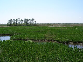
Jean Lafitte National Historical Park and Preserve protects the natural and cultural resources of Louisiana's Mississippi River Delta region. It is named after French pirate Jean Lafitte and consists of six separate sites and a park headquarters.
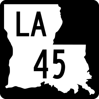
Louisiana Highway 45 (LA 45) is a state highway located in Jefferson Parish, Louisiana. It runs 22.08 miles (35.53 km) in a north–south direction from a dead end at Bayou Barataria in Lafitte to a junction with LA 18 in Marrero.

Barataria Bay, also Barrataria Bay, is a bay of the Gulf of Mexico, about 15 miles (24 km) long and 12 miles (19 km) wide, in southeastern Louisiana, in Jefferson Parish and Plaquemines Parish, United States. It is separated from the gulf by two barrier islands, Grand Isle and Grand Terre.

Fort Livingston was a 19th-century coastal defense fort located on Grand Terre Island in Jefferson Parish, Louisiana. The fort was named after Edward Livingston who had held positions as Mayor of New York City, U.S. Senator from Louisiana, and U.S. Secretary of State under President Andrew Jackson. The structure was listed on the National Register of Historic Places on August 30, 1974. Original plans for the fort were prepared by Lieutenant H. G. Wright. These plans called for the fortress to be a trapeziform stronghold surrounded by a wet ditch and by outworks on the land side. The walls were constructed of cemented shell, faced with brick, and trimmed with granite.

Breton National Wildlife Refuge is located in southeastern Louisiana in the offshore Breton Islands and Chandeleur Islands. It is located in the Gulf of Mexico and is accessible only by boat. The refuge was established in 1904 through executive order of President Theodore Roosevelt and is the second-oldest refuge in the National Wildlife Refuge System.

Cocodrie is an unincorporated fishing, shrimping and crabbing village in Terrebonne Parish, Louisiana, United States, 10 miles south of Chauvin and due south of the city of Houma. It is part of the Houma–Bayou Cane–Thibodaux Metropolitan Statistical Area. The settlement is known for being very near the landfall location for Tropical Storm Matthew on October 10, 2004, Hurricane Gustav on September 1, 2008, and Hurricane Zeta on October 28, 2020.

Texas Gulf Coast is an intertidal zone which borders the coastal region of South Texas, Southeast Texas, and the Texas Coastal Bend. The Texas coastal geography boundaries the Gulf of Mexico encompassing a geographical distance relative bearing at 367 miles (591 km) of coastline according to CRS and 3,359 miles (5,406 km) of shoreline according to NOAA.

Louisiana Highway 3134 is a state highway in Louisiana that serves Jefferson Parish. It spans 7.2 miles (11.6 km) in a north-south direction along Leo Kerner/Lafitte Parkway between Jean Lafitte and Estelle and acts as a four-lane bypass to the older Barataria Boulevard.
Salvador Wildlife Management Area is a protected area in St. Charles Parish Louisiana covering a combined total of over 36,000 acres (15,000 ha). The WMA is located 11 miles (18 km) south of New Orleans, Louisiana, and provides habitat for many species of animal and plant life with hunting, fishing, and boating as the predominant activities. Commercial fishing or harvesting is not allowed.
Queen Bess Island Wildlife Refuge is located on Queen Bess Island in the southern portion of Barataria Bay, Jefferson Parish, Louisiana, USA. The entire island was designatedas a refuge in 2019 and a restoration project completed in February 2020.
Terrebonne Basin is an abandoned delta complex, in Terrebonne Parish, Louisiana. The area is identified by thick sections of unconsolidated sediments that are undergoing dewatering and compaction which contributes to high subsidence. There is a network of old distributary ridges, associated with past distributaries of the Mississippi River, extending south from Houma, Louisiana into the Gulf of Mexico.