The Atchafalaya Basin, or Atchafalaya Swamp, is the largest wetland and swamp in the United States. Located in south central Louisiana, it is a combination of wetlands and river delta area where the Atchafalaya River and the Gulf of Mexico converge. The river stretches from near Simmesport in the north through parts of eight parishes to the Morgan City southern area.

The Louisiana Department of Wildlife & Fisheries – Enforcement Division (LDWF) is the fish & game regulatory agency of Louisiana. It has jurisdiction anywhere in the state, and in state territorial waters. The agency enforces both state and federal laws dealing with hunting, fishing, and boating safety. The agency also enforces criminal laws in rural areas including DWI enforcement both on highways and waterways. Most of the Department's Wildlife Agents also carry Federal law enforcement commissions issued from the United States Department of the Interior - U.S. Fish and Wildlife Service, and United States Department of Commerce - U.S. National Marine Fisheries Service (NMFS). These federal commissions allow these state officers to enforce federal migratory waterfowl laws and federal marine fisheries laws in state and federal waters off the coast of Louisiana. Besides their traditional role as a "game warden", Louisiana Wildlife Enforcement Agents also have a number of other responsibilities, including conducting board of health inspections on some portions of the state's commercial fishing industry. Agents are trained in and conduct numerous search and rescue operations, both in remote land areas and on the state's waterways. Agents ensure that hunters, anglers, boaters, dealers, breeders, farmers, and transporters are in compliance with regulations governing equipment, quotas, licenses, and registrations. Agents also assist other State departments and law enforcement agencies in the coordination of educational and professional endeavors, as well as national and state emergency alerts by the Federal Office of Emergency Preparedness. In addition, agents perform search and rescue missions alone or in conjunction with other local, state, and federal agencies.
Loggy Bayou is a 17.3-mile-long (27.8 km) stream in northwestern Louisiana which connects Lake Bistineau with the Red River. Bistineau is the reservoir of Dorcheat Bayou, which flows 115 miles (185 km) southward from Nevada County, Arkansas, into Webster Parish. Loggy Bayou flows through south Bossier Parish, west of Ringgold, in a southerly direction through Bienville Parish, and into Red River Parish, where north of Coushatta it joins the Red River, a tributary of the Mississippi. At East Point, LA, the river has a mean annual discharge of 1,960 cubic feet per second.
The Sherburne Complex is a joint land management venture of the U.S. Fish and Wildlife Service, the Louisiana Department of Wildlife and Fisheries (LDWF), and the U.S. Army Corps of Engineers that began in 1983. The area consists of 43,637 acres (17,659 ha), and is managed by the Louisiana Department of Wildlife and Fisheries. The complex is located in the Morganza Flood way system of the Atchafalaya Basin about 30 miles (48 km) west of Baton Rouge, Louisiana and actually extends a little south of the I-10 Atchafalaya Basin Bridge at Whiskey Bay, Louisiana. The bridge crosses the Whiskey Bay Pilot Channel. Located on the graveled LA 975, the west boundary is on the east side of the Atchafalaya River with the east boundary being the East Protection Levee. The complex stretches just north of old highway 190, and a short distance to the south of I-10. The nearest town is Krotz Springs to the north off US 190.
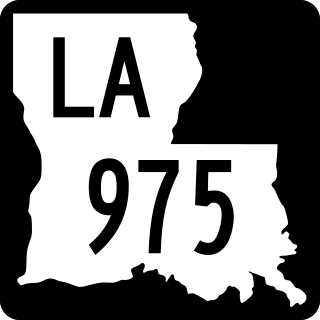
Louisiana Highway 975 (LA 975) is a gravel state highway in central Louisiana. It runs north–south for 18.4 miles (29.6 km). The southern terminus is at Whiskey Bay in Iberville Parish, and the northern terminus is east of Krotz Springs at a junction with U.S. Route 190 (US 190) and the north, south LA 973, in Pointe Coupee Parish. The entire route traverses the Sherburne Complex WMA, which is a combined Sherburne WMA, Atchafalaya National Wildlife Refuge, and Bayou Des Ourse, managed by the Louisiana Department of Wildlife and Fisheries. The road runs between the Atchafalaya River and Whiskey Bay Pilot Channel on the west and the East Protection Levee on the east.
Elm Hall Wildlife Management Area is a 2,839-acre (1,149 ha) protected area in Assumption Parish, Louisiana. The WMA is located five miles west of Napoleonville, with Lake Verret on the western border, farmland to the east, and is managed by the Louisiana Department of Wildlife and Fisheries (LDWF).
Clear Creek Wildlife Management Area is a 52,559-acre (21,270 ha) tract of protected area located in Vernon Parish, Louisiana. The Louisiana Department of Wildlife and Fisheries (LDWF) leases the land from Hancock Timber.
Dewey W. Wills Wildlife Management Area, also just called Dewey Wills Wildlife Management Area and formally known as the Saline Wildlife Management area, is a 63,984-acre (25,893 ha) tract of protected area located in LaSalle Parish, Catahoula Parish, and Rapides Parish, in Central Louisiana. The Louisiana Department of Wildlife and Fisheries (LDWF) owns 63,901 acres, the LaSalle Parish School Board owns 1530 acres, and the U.S. Army Corps of Engineers (USCOE) owns 265 acres, managed by the LDWF.
The Richard K. Yancey Wildlife Management Area, formerly the Red River/Three Rivers Wildlife Management Area, is a 70,872-acre (28,681 ha) tract of protected area in lower Concordia Parish, Louisiana. The area is owned by the Louisiana Department of Wildlife and Fisheries and the U.S. Army Corps of Engineers (USACOE). The WMA is located off LA 15 approximately 35 miles (56 km) south of Ferriday between the Red River and the Mississippi River.
Maurepas Swamp Wildlife Management Area is a 112,615-acre (45,574 ha) tract of protected area located in parts of Ascension, Livingston, St. John the Baptist, St. James and Tangipahoa Parishes, Louisiana, encircling three sides of Lake Maurepas.
Biloxi Wildlife Management Area also referred to as Biloxi WMA, is a 35,644-acre (14,425 ha) privately owned tract of protected marsh land located in St. Bernard Parish, Louisiana, managed by the Louisiana Department of Wildlife and Fisheries (LDWF). The land is owned by Biloxi Marsh Lands Corporation, owning approximately 90,000 acres (36,000 ha) of land in St. Bernard Parish, that started leasing land to the LDWF as early as 1957. Access is limited to boats as there are no roads in the WMA. The nearest road access is LA 46 to Shell Beach or LA 624 to Hopedale.
Pearl River Wildlife Management Area, also known as Pearl River WMA, is a 35,619 acres (14,414 ha) tract of protected area near Slidell in St. Tammany Parish, Louisiana, in the United States. The WMA is managed by the Louisiana Department of Wildlife and Fisheries (LDWF)
Salvador Wildlife Management Area is a protected area in St. Charles Parish Louisiana covering a combined total of over 36,000 acres (15,000 ha). The WMA is located 11 miles (18 km) south of New Orleans, Louisiana, and provides habitat for many species of animal and plant life with hunting, fishing, and boating as the predominant activities. Commercial fishing or harvesting is not allowed.
Lake Palourde, or Palourde Lake is an 11,520-acre (4,660 ha) lake in St. Mary Parish, Louisiana, adjacent to Morgan City, Louisiana.
Grassy Lake is 1,024 acres (414 ha), a natural lake, and is located in St. Martin and Assumption, Parishes, Louisiana. The 246,000 acres (1,000 km2) of watershed includes Lake Verret, Lake Palourde, all draining into the Atchafalaya River, and finally the Gulf of Mexico. Grassy Lake is almost entirely in St. Martin Parish but Assumption Parish runs along the east side, just west of the shoreline.
Joyce Wildlife Management Area is a 42,292 acres (17,115 ha) protected area in Tangipahoa Parish, Louisiana, owned by the Louisiana Department of Wildlife and Fisheries. It is located 10 miles (16 km) south of Hammond and features a boardwalk leading into the swamps on the northwest corner.
Pointe-aux-Chenes Wildlife Management Area, also referred to as the Pointe-aux-Chenes WMA, is a 33,488 acres (13,552 ha) protected area located in Terrebonne and Lafourche Parish, Louisiana, that is owned and managed by the Louisiana Department of Wildlife and Fisheries (LDWF).
Grassy Lake Wildlife Management Area, also referred to as Grassy Lake WMA, is a 12,983 acres (5,254 ha) protected area located in northern Avoyelles Parish, Louisiana, with limited land access and water access from the Red River.
J. C. "Sonny" Gilbert Wildlife Management Area is a 7,524-acre (3,045 ha) wildlife management area in Catahoula, Parish, Louisiana, owned by the Louisiana Department of Wildlife and Fisheries. It is located 6 miles (9.7 km) miles west of Sicily Island. The area contains the 17 ft (5.2 m) high Rock Falls, one of the tallest waterfalls in the state.