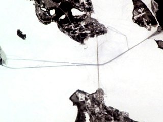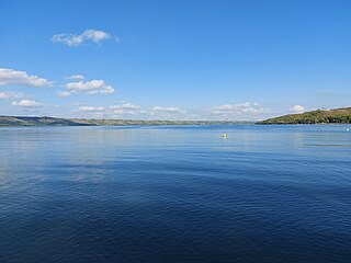
Lady Bird Lake is a river-like reservoir on the Colorado River in Austin, Texas, United States. The City of Austin created the reservoir in 1960 as a cooling pond for a new city power plant. The lake, which has a surface area of 416 acres (168 ha), is now used primarily for recreation and flood control. The reservoir is named in honor of former First Lady of the United States Lady Bird Johnson.

Crappies are two species of North American freshwater fish of the genus Pomoxis in the family Centrarchidae (sunfishes). Both species of crappies are popular game fish among recreational anglers.

The Verde River is a major tributary of the Salt River in the U.S. state of Arizona. It is about 170 miles (270 km) long and carries a mean flow of 602 cubic feet per second (17.0 m3/s) at its mouth. It is one of the largest perennial streams in Arizona.

Grand Lake St. Marys State Park is a public recreation area located on 13,500-acre (5,500 ha) Grand Lake in Mercer and Auglaize counties, Ohio. Grand Lake is the largest inland lake in Ohio in terms of area, but is shallow, with an average depth of only 5–7 feet (1.5–2.1 m). The state park is open for year-round recreation, including boating, fishing, swimming and hunting. The park consists of the lake and park facilities scattered all around the shore intermingled with private property and a facility operated by Wright State University. It is west of St. Marys, and southeast of Celina, 23 miles (37 km) southwest of Lima in the northwestern part of the state.

Deep Creek Lake is a man-made reservoir in the U.S. state of Maryland. It has an area of 3,900 acres (16 km2), a shoreline length of 69 miles (111 km), and a volume of 106,000 acre⋅ft (0.131 km3). The lake is home to a wide variety of aquatic life, such as freshwater fish and aquatic birds. Along with the nearby Wisp Ski Resort, the lake is a popular regional vacation and tourism destination.

Lake Oroville is a reservoir formed by the Oroville Dam impounding the Feather River, located in Butte County, northern California. The lake is situated 5 miles (8 km) northeast of the city of Oroville, within the Lake Oroville State Recreation Area, in the western foothills of the Sierra Nevada. Known as the second-largest reservoir in California, Lake Oroville is treated as a keystone facility within the California State Water Project by storing water, providing flood control, recreation, freshwater releases to assist in controlling the salinity intrusion into the Sacramento-San Joaquin Delta and protecting fish and wildlife.

Lake Jocassee is a 7,500-acre (30 km2), 300-foot (91 m) deep reservoir in northwest South Carolina. It was created in 1973 by the state in partnership with Duke Power. The lake is known for the clean and cold Appalachian mountain rivers that flow into it, keeping its waters cool and clear year-round. The Jocassee Dam, which forms the lake, is 385 feet (117 m) high and 1,750 feet (530 m) long. The lake is within Devils Fork State Park.

Skiatook Lake is a federally-owned and operated reservoir located in Osage County, Oklahoma, 4 miles (6.4 km) west of the town of Skiatook, 11 miles (18 km) east of Hominy, Oklahoma and about 18 miles (29 km) from Tulsa. The Skiatook Dam is located on Hominy Creek, 14 miles (23 km) upstream of the confluence of Hominy and Bird Creeks. The project purposes include flood control, water quality, water supply, recreation, and fish and wildlife management. The cities of Skiatook, Sand Springs, Sapulpa, and Tulsa use Skiatook Lake as a municipal water supply. Gentle rolling hills of Blackjack and Post Oak interspersed with Tallgrass prairie surround the lake. The lake is under the management of the U.S. Army Corps of Engineers, Tulsa District.

Papago Park is a municipal park of the cities of Phoenix and Tempe, Arizona, United States. It has been designated as a Phoenix Point of Pride. It includes Hunt's Tomb, which is listed on the National Register of Historic Places.

Inks Lake State Park is a state park located in Burnet County, Texas, United States, next to Inks Lake on the Colorado River. It contains facilities for swimming, camping, hiking, boating, fishing and general enjoyment of the natural beauty. The landscape is hilly with a mix of forest and cleared land with ground that's rocky, mainly consisting of gneiss rock. Containing plants such as cedar, live oak, prickly pear cacti, and yuccas. Devil's Waterhole is a small extension of Inks Lake, which is almost completely surrounded by rock.

St. Helena Island is an uninhabited 240 acres (97 ha) island in the Lake Michigan approach to the Straits of Mackinac. The island is located offshore from Gros Cap, Michigan, 10 miles (16 km) west of Mackinac Island in Mackinac County in the U.S. state of Michigan.

Lake Perris is an artificial lake completed in 1973. It is the southern terminus of the California State Water Project, situated in a mountain-rimmed valley between Moreno Valley and Perris, in what is now the Lake Perris State Recreation Area. The park offers a variety of recreational activities. Because of this and the lake's proximity to major population centers, it is very crowded during the summer months.

Lake Natoma is a small lake in the Western United States, along the lower American River, between Folsom and Nimbus Dams in Sacramento County, California. The lake is located within the Folsom Lake State Recreation Area which maintains the facilities and bike trails surrounding the lake. Lake Natoma is located 15 miles (24 km) east of Sacramento, and has 500 surface acres of water. The total length of lake Natoma is 4 miles (6.4 km).

Alamo Lake State Park is a state park of Arizona, United States, centered on Alamo Lake, a flood control and recreational reservoir. The park is located in western Arizona about 38 miles (61 km) north of Wenden. It is accessed via a paved two-lane road off either U.S. Route 60 to the south or U.S. Route 93 to the east. Owing to its remoteness, the park is often considered one of the "best kept secrets" of the state park system.

Chicot State Park is located near Ville Platte, Louisiana. This wildlife reserve of South Central Louisiana features 6,400 acres (26 km2) of rolling hills surrounding a 2,000-acre (8 km2) man-made lake stocked with bass, crappie (sac-au-lait), bluegill, and red-ear sunfish. Chicot Park offers fishing boat rentals, pavilions, barbecue pits, picnic areas, restrooms, primitive hike-to campsites, lodges, and furnished cabins. The park is home to a number of wild animal species, including whitetail deer, raccoons, coyotes, and bobcats.

Spring Lake State Fish and Wildlife Area is an Illinois state park on 2,032 acres (822 ha) in Tazewell County, Illinois, United States.

Fish stocking is the practice of releasing fish that are artificially raised in a hatchery into a natural body of water, to supplement existing wild populations or to create a new population where previously none exists. Stocking may be done for the benefit of commercial, recreational or tribal heritage fishing, but may also be done for ecological conservation to restore or increase the population of threatened/endangered fish species that is pressured by prior overfishing, habitat destruction ,and/or competition from invasive species.

Hardy Lake, originally named Quick Creek Reservoir, is an Indiana state reservoir in Scott and Jefferson counties, Indiana. It is located four miles (6 km) east of Austin, Indiana and 35 miles (56 km) north of Louisville, Kentucky. It is the smallest reservoir maintained by the state of Indiana, measuring 2,448 acres (9.9 km2) of total property, and 741 acres (3.0 km2) of surface area for the lake. The lake is approximately 38 feet (12 m) deep.
Piney Run Park is a nature park in Sykesville, located in Carroll County, Maryland. It is Carroll County's oldest developed park and hosts thousands of visitors annually. The park encompasses 550 acres of fields, forest and open spaces, features over 15 miles of hiking trails, a 300-acre lake and many sports and recreational facilities. Prior to being a park, this land was a private farm.

Echo Lake is a lake along the course of the Qu'Appelle River in the Canadian province of Saskatchewan. Echo Lake is so named because of the echo heard by the First Nations while paddling on the lake. It is one of four lakes that make up the Fishing Lakes. Pasqua Lake is upstream and Mission Lake is downstream. The lake can be accessed by Highway 56 and Highway 210. In 1942, a 4-metre (13 ft) high dam was built on the Qu'Appelle River at Echo Lake's outflow to control the lake's water levels. In the summer of 2024, Saskatchewan's Water Security Agency begun "interim repairs" on Echo Lake Dam to "improve safety and extend the dam's life until a replacement can be completed".


