This is a list of properties and districts listed on the National Register of Historic Places in Rhode Island. As of May 29, 2015, there are more than 750 listed sites in Rhode Island. All 5 of the counties in Rhode Island have listings on the National Register.

The Hazard Farmstead is a historic archaeological site in Jamestown, Rhode Island. It is the location of a major American Indian settlement whose artifacts have been dated from 2,500 BC to 1,000 AD. It appeared to be occupied seasonally from late summer to fall, and was intensively used during those times.
Old Friends Archeological Site is an archaeological historical site in Jamestown, Rhode Island.
Pine Hill Archeological Site, RI-655 is a prehistoric archaeological site on Prudence Island in Portsmouth, Rhode Island. The site's principal feature is a coastal shell midden dating to the Late Woodland period. Finds at the site include projectile points, stone tools, bones, and ceramics.
The Breezy Hill Site (RI-957) is a prehistoric archaeological site in Foster, Rhode Island. Finds at the site have been dated to 500-1000 AD, and included dentate stamped pottery fragments.

The Furnace Hill Brook Historic and Archeological District in a historic district in Cranston, Rhode Island.

The Sassafras Site, designated RI-55, is a prehistoric archaeological site in Albion, a village of Lincoln, Rhode Island. The site was discovered by archaeologists while surveying an area for a potential replacement for the Albion Street bridge, which spans the Blackstone River between Lincoln and Cumberland. The site encompasses a regionally significant quartz stone tool workshop.

The Woonasquatucket River Site (RI-163) is a prehistoric archaeological site in Smithfield, Rhode Island. The site contains Late Archaic artifacts, primarily stone flakes indicative of stone toolmaking activity. It is located in the George Washington Grove Wildlife Management Area, near where the Farnum Pike crosses the Woonasquatucket River.
The YWCA Site is an archaeological site in North Kingstown, Rhode Island.

The Jireh Bull Blockhouse is an historic archaeological site on Middlebridge Road in South Kingstown, Rhode Island. In 1657 a blockhouse was built on the site by Jireh Bull, son of Rhode Island Governor Henry Bull. The stone garrison house was burned by the Native Americans in King Philip's War on December 15, 1675, and fifteen of its defenders were massacred. The site was acquired by the Rhode Island Historical Society in 1925.

Devil's Foot Cemetery Archeological Site, RI-694 is an archaeological site in North Kingstown, Rhode Island.

Hillsdale Historic and Archeological District is a historic district in Richmond, Rhode Island. The district was added to the National Register of Historic Places in 1980. It represents the site of the former textile mill village of Hillsdale.
The Lambda Chi Site, designated RI-704, is an historic archaeological site in South Kingstown, Rhode Island. It encompasses the site of an 18th-to-19th century homestead near Kingston village.
The Silas Mumford Site, also known as the Tappan Site and RI-705, is an historic archaeological site in South Kingstown, Rhode Island. Located in the northwestern part of the town, it includes a 19th-century homestead with an extensive household midden.
The Nursery Site, RI-273 is a prehistoric archaeological site in Westerly, Rhode Island. Located near the Westerly Airport, this site has yielded evidence of Woodland Period stone tool work.
The Potter Pond Archeological District is a large complex of archaeological sites in coastal South Kingstown, Rhode Island. The area is roughly bounded by United States Route 1, Point Judith Pond, Matunuck Beach Road, and the south coast, and includes 22 archaeologically significant sites dating from the Late Archaic through the Late Woodland periods.
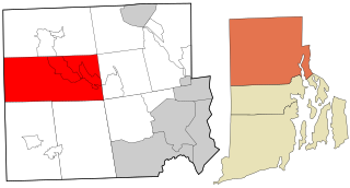
The Carbuncle Hill Archaeological District encompasses a collection of archaeological sites in rural western Coventry, Rhode Island. Designated by the state as sites RI-1072 through RI-1079, this discontiguous cluster of sites has the potential to increase knowledge of prehistoric patterns of stone tool procurement, development, and use. The district was added to the National Register of Historic Places in 1985, primarily for its potential to yield further information.
The Moosup River Site (RI-1153) is an archaeological site in Coventry, Rhode Island. The site is located on a bluff overlooking the Moosup River in western Coventry, not far from the Connecticut state line. The site was identified and excavated in 1985, yielding a quartzite Neville point, and radiocarbon dates to 3050 BCE.
Trafalgar Site, RI-639 is a prehistoric archaeological site in Warwick, Rhode Island. The site's primary component is a shell midden. Finds at the site include stone tools, bone, and tools for working bone.
The Thomas Carr Farmstead Site is a historic archaeological site in Jamestown, Rhode Island. Located in the vicinity of Tashtassuc Road and Eldred Avenue, the site was the farmstead for the locally prominent Carr family from the late 18th century into the 19th century.