Chicago, officially the City of Chicago, is the most populous city in Illinois and the third most populous city in the United States. With an estimated population of 2,716,450 (2017), it is the most populous city in the Midwestern United States. Chicago is the county seat of Cook County, the second most populous county in the United States, and the principal city of the Chicago metropolitan area, which is often referred to as "Chicagoland." The Chicago metropolitan area, at nearly 10 million people, is the third-largest in the United States; the fourth largest in North America ; and the third largest metropolitan area in the world by land area.

The Atchison, Topeka and Santa Fe Railway, often referred to as the Santa Fe or AT&SF, was one of the larger railroads in the United States. Chartered in February 1859, the railroad reached the Kansas-Colorado border in 1873 and Pueblo, Colorado, in 1876. To create a demand for its services, the railroad set up real estate offices and sold farm land from the land grants that it was awarded by Congress. Despite the name, its main line never served Santa Fe, New Mexico, as the terrain was too difficult; the town ultimately was reached by a branch line from Lamy.

Dearborn Station was the oldest of the six intercity train stations serving downtown Chicago, Illinois. It currently serves as office retail and entertainment space. Located at Dearborn and Polk Streets, adjacent to Printers Row, the station was owned by the Chicago & Western Indiana Railroad, which itself was owned by the companies operating over its line. The station now houses a shopping mall.

East Garfield Park is a community area on the West Side of Chicago, Illinois, west of the Loop.

South Lawndale, one of Chicago's 77 well-defined community areas, is on the West Side of the city of Chicago, Illinois. It is notable for having two well-known neighborhoods, Little Village and Marshall Square.
The Chicago Gaylords, also known as the Almighty Gaylords, is a Chicago street gang which was most active during the mid and late 20th century. It originated in the neighborhood of Grand and Noble. The original president of the Gaylords selected the name after reading about the Gaylords in the public library. They were a part of the People Nation alliance.
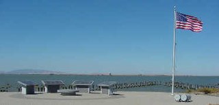
The Port Chicago Naval Magazine National Memorial is a memorial dedicated in 1994 recognizing the dead of the Port Chicago disaster, and the critical role played by Port Chicago, California during World War II, in serving as the main facility for the Pacific Theater of Operations. The memorial is located at the Concord Naval Weapons Station near Concord, California, in the United States.

Roosevelt Road is a major east-west street in the city of Chicago, Illinois, and its western suburbs. It is 1200 South in the city's street numbering system, but only 1 mile (1.6 km) south of Madison Street. It runs under this name from Columbus Drive to the western city limits, then continues through the western suburbs including Lombard, Wheaton and, West Chicago until it reaches Geneva, where it is known as State Street. 12th Street was renamed to Roosevelt Road on May 25, 1919, in recognition of President Theodore Roosevelt, who had died the previous January. In 1928 the new U.S. Route 330 (US 330), a different alignment of US 30, went down Roosevelt Road to Geneva, in 1942 it was redesignated as US 30 Alternate. In 1972, after the route had been discontinued, Roosevelt Road outside Chicago became Illinois Route 38.

This is a list of the National Register of Historic Places listings in San Bernardino County, California.

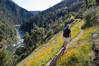
Chicago Park is a high-end residential and unincorporated historic agricultural and wine-growing community in Nevada County, California. It is located along Highway 174, with its center at the intersection of Mt. Olive Road. The neighborhood gets its name from its founding residents, who came from Chicago to California in the late 1800s to grow wine, which was often shipped back to Illinois for consumption. As one of California's first wine-growing regions, Chicago park is about 9 miles southeast of Grass Valley and about 3 miles north of Colfax.
Peardale is an unincorporated community in Nevada County, California, United States, along State Route 174, southeast of Cedar Ridge, California and northwest of Chicago Park, California. Its elevation is 2,710 feet (830 m) above sea level.

This is a list of the National Register of Historic Places listings in Kern County, California.
This is a list of the National Register of Historic Places listings in Lake County, California.
Buena Vista is a former settlement in Nevada County, California, 3 mi (4.8 km) north of Chicago Park. Its elevation is 2,631 ft (802 m) above sea level.

Little York is a former settlement in Nevada County, California, located near Chicago Park, between Bear River and Greenhorn Creek.
Bear River Pines is a former settlement in Nevada County, California, located 1.5 miles (2.4 km) north of Chicago Park. It was listed on an official map as of 1949.
Coleman is an unincorporated community in Nevada County, California. It lies at an elevation of 2549 feet. Coleman is located on the Nevada County Narrow Gauge Railroad, 2 miles (3.2 km) north of Chicago Park.
Pinecrest is an unincorporated community in Nevada County, California. It lies at an elevation of 2438 feet. Pinecrest is located on the Nevada County Narrow Gauge Railroad, 1 mile (1.6 km) north of Chicago Park.
Smiths is a former settlement in Placer County, California. Smiths is located 0.5 miles (0.8 km) north of Chicago Park. It still appeared on maps as of 1934.