
Theodore Dehone Judah was an American railroad and civil engineer who was a central figure in the original promotion, establishment, and design of the First Transcontinental Railroad. He found investors for what became the Central Pacific Railroad (CPRR). As chief engineer, he performed much of the land survey work to determine the best route for the railroad over the Sierra Nevada mountains.

Donner Pass is a mountain pass in the northern Sierra Nevada, above Donner Lake about 9 miles (14 km) west of Truckee, California. Like the Sierra Nevada mountains themselves, the pass has a steep approach from the east and a gradual approach from the west.
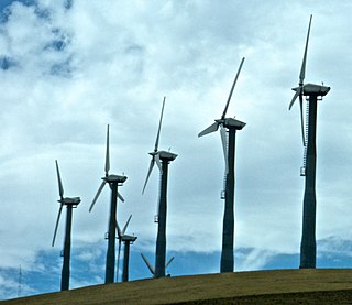
Altamont Pass, formerly Livermore Pass, is a low mountain pass in the Diablo Range of Northern California between Livermore in the Livermore Valley and Tracy in the San Joaquin Valley. The name is actually applied to two distinct but nearby crossings of the range. The lower of the two, at an elevation of 741 ft (226 m), carries two railroad rights-of-way (ROWs) and Altamont Pass Road, part of the old Lincoln Highway and the original alignment of US 50 before it was bypassed c. 1937. The bypass route travels over the higher summit, at 1,009 ft (308 m), and now carries Interstate 580, a major regional highway heavily congested by Central Valley suburbanization.

Cajon Pass is a mountain pass between the San Bernardino Mountains and the San Gabriel Mountains in Southern California. It was created by the movements of the San Andreas Fault. Located in the Mojave Desert, the pass is an important link from the Greater San Bernardino Area to the Victor Valley, and northeast to Las Vegas.

Drawbridge is a ghost town with an abandoned railroad station located at the southern end of the San Francisco Bay on Station Island, now a part of the city of Fremont, California, United States. It is located on the Union Pacific Railroad 6 miles (10 km) south of downtown Fremont, at an elevation of 7 feet. Formerly used as a hunting village, it has been a ghost town since 1979 and is slowly sinking into the marshlands. It is now part of the Don Edwards San Francisco Bay Wildlife Refuge and is illegal to visit.

Norden is a small unincorporated community in Nevada County, California, United States, about 9 miles (14 km) west of Truckee. The community is located on a former portion of U.S. Route 40 near Interstate 80 and lies along the historical First Transcontinental Railroad, 1.5 miles (2.4 km) west of Donner Pass.
Fluhr is a former settlement in Kern County, California. It was located on the Atchison, Topeka and Santa Fe Railroad 2 miles (3.2 km) north-northwest of Edwards, at an elevation of 2372 feet. Fluhr still appeared on maps as of 1942.

Summit is an unincorporated community in Kern County, California.
Walong is an unincorporated community in Kern County, California. It is located on the railroad 2.25 miles (3.6 km) southeast of Keene, at an elevation of 3,058 feet (932 m).
Plumas is an unincorporated community in Lassen County, California. It is located on the Western Pacific Railroad 2.25 miles (3.6 km) southeast of Beckwourth Pass, at an elevation of 4941 feet.
Reno Junction is an unincorporated community in Lassen County, California. It is located on the former Western Pacific Railroad, now Union Pacific Railroad 0.5 miles (0.8 km) east of Beckwourth Pass, at an elevation of 4997 feet.
Scotts is an unincorporated community in Lassen County, California. It is located on the Western Pacific Railroad 4 miles (6.4 km) north-northeast of Beckwourth Pass, at an elevation of 4810 feet.
Tehichipa is a former settlement in Kern County, California. It was located on the railroad near Oak Creek Pass and Old Town.
Yuba Pass is a former settlement in Nevada County, California. Yuba Pass was located on the former Southern Pacific Railroad, 1 mile (1.6 km) east-northeast of Yuba Gap. It lay at an elevation of 5636 feet.
Donner is a former settlement in Placer County, California. Donner was located on the Southern Pacific Railroad, 2 miles (3.2 km) east-southeast of Donner Pass. Its site lies at an elevation of 7021 feet.
Spruce is a former settlement in Placer County, California. Spruce is located on the Southern Pacific Railroad, 5.5 miles (8.9 km) west of Donner Pass. It lay at an elevation of 6558 feet.
Stanford is a former settlement in Placer County, California. Stanford is located on the Southern Pacific Railroad, 3.5 miles (5.6 km) east-south east of the Donner Pass. It lay at an elevation of 6240 feet.
Tamarack is a former settlement in Placer County, California. Tamarack is located on the Southern Pacific Railroad, 9 miles (14.5 km) west of Donner Pass. It lay at an elevation of 6224 feet.
The Cedars is an unincorporated community in Placer County, California. The Cedars is located on Cedar Creek, 4.5 miles (7.2 km) south-southwest of Donner Pass. It lies at an elevation of 5787 feet.
Troy is a former railroad town in Placer County, California. Troy was located on the Southern Pacific Railroad, 7.5 miles (12.1 km) west of Donner Pass. It lay at an elevation of 6345 feet.


