Four Acres | |
---|---|
Unincorporated community | |
Coordinates: 39°00′31″N120°47′19″W / 39.00861°N 120.78861°W Coordinates: 39°00′31″N120°47′19″W / 39.00861°N 120.78861°W | |
Country | |
State | |
County | Placer County |
Elevation [1] | 1,234 ft (376 m) |
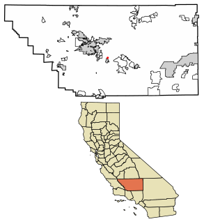
Four Acres is an unincorporated community in Placer County, California. [1] Four Acres is located 2 miles (3.2 km) east-southeast of Foresthill. [2] It lies at an elevation of 1234 feet (376 m). [1]
In law, an unincorporated area is a region of land that is not governed by a local municipal corporation; similarly an unincorporated community is a settlement that is not governed by its own local municipal corporation, but rather is administered as part of larger administrative divisions, such as a township, parish, borough, county, city, canton, state, province or country. Occasionally, municipalities dissolve or disincorporate, which may happen if they become fiscally insolvent, and services become the responsibility of a higher administration. Widespread unincorporated communities and areas are a distinguishing feature of the United States and Canada. In most other countries of the world, there are either no unincorporated areas at all, or these are very rare; typically remote, outlying, sparsely populated or uninhabited areas.
Placer County, officially the County of Placer, is a county in the U.S. state of California. As of the 2010 census, the population was 348,432. The county seat is Auburn.
California is a state in the Pacific Region of the United States. With 39.6 million residents, California is the most populous U.S. state and the third-largest by area. The state capital is Sacramento. The Greater Los Angeles Area and the San Francisco Bay Area are the nation's second and fifth most populous urban regions, with 18.7 million and 9.7 million residents respectively. Los Angeles is California's most populous city, and the country's second most populous, after New York City. California also has the nation's most populous county, Los Angeles County, and its largest county by area, San Bernardino County. The City and County of San Francisco is both the country's second-most densely populated major city after New York City and the fifth-most densely populated county, behind only four of the five New York City boroughs.
Portola Redwoods State Park is a California state park, located in San Mateo County. Peters Creek and Pescadero Creek meet in Portola, and are the park's primary watercourses, and feature numerous tributaries. Tip Toe Falls is a small waterfall along Fall Creek, a tributary of Pescadero Creek.
Portola Redwoods State Park contains approximately 18 miles of hiking trails in the 2,800-acre park, a small car-camping campground of about 50 campsites, four group campsites, and 6 trail sites at Slate Creek Trail Camp. Portola Redwoods State Park is also home to the site of Page shingle Mill, for which Page Mill Road is named.
The King Range is a mountain range of the Outer Northern California Coast Ranges System, located entirely within Humboldt County on the North Coast of California.
Carpinteria State Beach is a protected beach in the state park system of California, in Santa Barbara County, Southern California.
Lovdal is an unincorporated community in Yolo County, California. It lies at an elevation of 20 feet. The area is named after the Lovdal family that owned 2,800 acres (11 km2) of land in the area by 1903.
The Indian Pass Wilderness is 32,418-acre (13,119 ha) wilderness area under the administered by the Bureau of Land Management. The reserve is located in the very southeastern part of the Chocolate Mountains, in the southeastern part of California, just to the west of the Colorado River in the Lower Colorado River Valley. It adjoins the Picacho Peak Wilderness to the south, and the Imperial National Wildlife Refuge to the east.
Big Trees Village is an unincorporated community in Calaveras County, California. It lies at an elevation of 5164 feet.
Fly-In Acres is an unincorporated community in Calaveras County, California. It lies at an elevation of 3858 feet. Despite the name, there is no longer any airfield associated with or near the community.
Lynn Park Acres is an unincorporated community in Calaveras County, California. It lies at an elevation of 2723 feet.
Mother Lode Acres is an unincorporated community in Calaveras County, California. It lies at an elevation of 243 feet.
Mumbert Acres is an unincorporated community in Calaveras County, California. It lies at an elevation of 4649 feet.
Sherman Acres is an unincorporated community in Calaveras County, California. It lies at an elevation of 7008 feet.
Aerial Acres is a fly-in unincorporated community in Kern County, California. It is located 5.5 miles (9 km) east-southeast of Castle Butte, at an elevation of 2,428 feet (740 m). It was noted as "a desert town at Clay Mine Road and Sequoia in Peerless Valley, California.
Edmundson Acres is a census-designated place in Kern County, California. It is located 1.25 miles (2 km) north-northeast of Arvin, at an elevation of 486 feet (148 m). Edmundson Acres' ZIP code is 93203. The population was 279 at the 2010 census.
Fuller Acres is a census-designated place in Kern County, California. It is located 7.25 miles (12 km) southeast of downtown Bakersfield, at an elevation of 420 feet (128.02 m). The population was 991 at the 2010 census.
Bivalve is an unincorporated community in Marin County, California. It is located on the Northwestern Pacific Railroad 2 miles (3.2 km) northwest of Point Reyes Station, at an elevation of 43 feet.
Gabilan Acres is an unincorporated community in Monterey County, California. It is located on San Juan Grade Road northeast of Salinas and Bolsa Knolls and 6.5 miles (10 km) west of Fremont Peak, at an elevation of 203 feet.
Pacific Grove Acres is an unincorporated community in Monterey County, California. It is located northwest of Pacific Grove, at an elevation of 125 feet.
Shipyard Acres was an unincorporated community in Napa County, California. It lies at an elevation of 33 feet. Shipyard Acres is located 2.5 miles (4.0 km) south-southeast of Napa. This was a wartime neighborhood consisting of nearly 400 of plywood houses built to house worker families involved in the World War II effort building ships at Basalt Rock Company. It sprang up early in the war and was dismantled sometime in the mid-1950s. It was on the northwest corner of what is now Kaiser Road and Napa-Vallejo Highway. Some of the structures were moved a few miles west to the Cuttings Wharf area, resurrected, and are still in place near the marina.
Marsh Mill is an unincorporated community in Nevada County, California. It lies at an elevation of 5843 feet. Marsh Mill is located 2 miles (3.2 km) east of Graniteville.
This Placer County, California-related article is a stub. You can help Wikipedia by expanding it. |