Khunjerab Pass is a mountain pass in northern Pakistan that lies at an elevation of 4,693 meters above sea level. It is located in the Karakoram and holds a significant strategic position on the northern border of Pakistan, specifically in the Gilgit-Baltistan's Hunza and Nagar Districts. Additionally, it is positioned on the southwestern border of China, within the Xinjiang region.

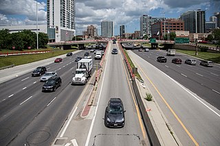
A highway is any public or private road or other public way on land. It includes not just major roads, but also other public roads and rights of way. In the United States, it is also used as an equivalent term to controlled-access highway, or a translation for motorway, Autobahn, autostrada, autoroute, etc.

Hualien County is a county on the east coast of Taiwan. It is Taiwan's largest county by area, yet due to its mountainous terrain, has one of the lowest populations in the country. The county seat and largest city is Hualien City. Hualien County is located in the eastern part of Taiwan—the Pacific Ocean lies to its east and the Central Mountain Range lies to its west. Narrow and long, Hualien is the largest county in Taiwan in terms of area.

The Karakoram Highway, also known as the KKH, National Highway 35, N-35, and the China–Pakistan Friendship Highway, is a 1,300 km (810 mi) national highway which extends from Hasan Abdal in the Punjab province of Pakistan to the Khunjerab Pass in Gilgit-Baltistan, where it crosses into China and becomes China National Highway 314. The highway connects the Pakistani provinces of Punjab and Khyber Pakhtunkhwa plus Gilgit-Baltistan with China's Xinjiang Uyghur Autonomous Region. The highway is a popular tourist attraction and is one of the highest paved roads in the world, passing through the Karakoram mountain range, at 36°51′00″N75°25′40″E at maximum elevation of 4,714 m (15,466 ft) near Khunjerab Pass. Due to its high elevation and the difficult conditions under which it was constructed, it is often referred to as the Eighth Wonder of the World. The highway is also a part of the Asian Highway AH4.

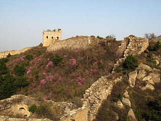
The China National Highways (CNH/Guodao) is a network of trunk roads across mainland China. Apart from the expressways of China that are planned and constructed later, most of the CNH are not controlled-access highways.
The China National Highways of Beijing article focuses on Beijing, as a national transport hub, is the starting point for eleven of the twelve series-100 China National Highways. These are major truck routes, primarily intended to connect Beijing with the rest of China.

China National Highway 101 is a major trunk route connecting Beijing to Shenyang, Liaoning. In Beijing it is known as Jingshun Road or Jingmi Road for connecting central Beijing to Shunyi District and Miyun District, although the actual road goes far beyond these two locations.

The expressway network of China, with the national-level expressway system officially known as the National Trunk Highway System, is an integrated system of national and provincial-level expressways in China.

China National Highway 312 (312国道), also referred to as Route 312, is a key east-west route beginning in Shanghai and ending at Khorgas, Xinjiang in the Ili River valley, on the border with Kazakhstan. In total it spans 5,000 km (3,100 mi), passing through Jiangsu, Anhui, Henan, Shaanxi, Gansu before ending in Xinjiang. Besides Shanghai, cities of note on the route include Suzhou, Wuxi, Nanjing, Hefei, Xinyang, Nanyang, Xi'an, Lanzhou, Jiayuguan and Ürümqi.

China National Highway 109 connects Beijing with Lhasa. It runs westwards from Beijing via Datong, Yinchuan and Xining to Golmud before turning southwest to Lhasa. The portion of the highway from Xining to Lhasa is known as the Qinghai-Tibet Highway. The total length of the route is 3,901 km.

Changzhi is a prefecture-level city in the southeast of Shanxi Province, China, bordering the provinces of Hebei and Henan to the northeast and east, respectively. Historically, the city was one of the 36 administrative areas extant under the reign of the first emperor of a unified China.

Laiyang city is a county-level city within Yantai bordering Qingdao, located in the middle of the Shandong Peninsula, in Shandong province, China. The majority (70%) of its population are farmers and it is famous for producing the Laiyang pear. As of 2010, it had a population of 923,000.

China National Highway 219 is a highway which runs along the entire western and southern border of the People's Republic of China, from Kom-Kanas Mongolian ethnic township in Xinjiang to Dongxing in Guangxi. At over 10,000 kilometres (6,214 mi) long, it is part of the China National Highway Network Planning (2013–2030), and once completed it will be the longest National Highway.
Motorways of Pakistan are a network of multiple-lane, high-speed, controlled-access highways in Pakistan which are owned, maintained, and operated federally by Pakistan's National Highway Authority. At present, 2567 km of motorways are operational, while an additional 1191 km are under construction. Motorways are a part of Pakistan's “National Trade Corridor Project” and “China-Pakistan Belt Road Initiative,” from Khunjerab Pass near the Chinese border to Gwadar in Balochistan. There are a total of 16 motorways, 11 of which are operational, while some are under construction and others are planned.

Laiyuan County is a county in western Hebei province, China, bordering Shanxi province to the west. It is under the jurisdiction of the prefecture-level city of Baoding, and, as of 2006, it had a population of 270,000 residing in an area of 2,430 km2 (940 sq mi).

China National Highway 318 (G318) runs from Shanghai to Zhangmu on the China-Nepal border. It is the longest China National Highway at 5,476 kilometres (3,403 mi) in length and runs west from Shanghai towards Zhejiang, Anhui, Hubei, Chongqing, Sichuan, and ends in Tibet Autonomous Region. From Lhasa to Zhangmu it is also called Friendship Highway. From Markam to Zogang it shares the highway with G214. At the Sino-Nepal Friendship Bridge, it connects with the 115 km long Araniko Highway to Kathmandu.

National Highway 228 was a hypothetical highway encircling the island of Taiwan as part of the National Highway System of the People's Republic of China. It never came into existence due to the political status of Taiwan. The People's Republic of China claims control over Taiwan while it is currently administered and controlled by the Republic of China. Taiwan has its own highway system and does not recognize the designation by the People's Republic of China.
Arunachal Frontier Highway (AFH), officially notified as the National Highway NH-913 and also called Bomdila-Vijaynagar Highway (BVH), connecting Bomdila Airstrip ALG & HQ in northwest to Vijaynagar Airstrip ALG & HQ in southeast via Nafra HQ-Sarli HQ-Huri Helipad ALG & HQ-Nacho HQ-Mechuka Airstrip ALG & HQ-Monigong HQ-Jido -Hunli HQ-Hayuliang Airstrip ALG HQ-Chenquenty-Hawai HQ-Miao HQ including 800 km greenfield section and network of new tunnels & bridges, is a 2-lane paved-shoulder under-construction national highway along the India-China LAC-McMahon Line border in the Indian state of Arunachal Pradesh. The 1,748 km-long (1,086 mi) highway itself will cost ₹27,000 crore and total cost including 6 additional inter-corridors is ₹40,000 crore. In some places, this highway will run as close as 20 km from the LAC. To be constructed by MoRTH in 9 packages, all packages will be approved by the end of fy 2024-25 and construction will be completed in 2 years by 31 March 2027. Of the total route, 800km is greenfield, rest brownfield will be upgraded and tunnels will be built. This highway in the north & east Arunachal along the China border, would complement the Trans-Arunachal Highway and the Arunachal East-West Corridor as major highways spanning the whole state, pursuing the Look East connectivity policy.

National Highway 13, part of the larger Trans-Arunachal Highway network, is a 1,559 km long two-lane national highway across Arunachal Pradesh in India running from Tawang in northwest to Wakro in southeast. Entire route became operational in 2018 when 6.2 km long Dibang River Bridge was completed across Dibang River. Sela Tunnel, a shorter alternative route with target completion by Jan/Feb 2022, will provide all-weather connectivity. Before the renumbering of highways, it was known as NH 229 and NH52. This strategically important highway enhances Indian military's capabilities in combating the threat of China's Western Theater Command opposite India's eastern sector of Line of Actual Control.

National Highway 310, commonly referred to as NH 310 is a national highway in India. It is a spur road of National Highway 10. NH-310 traverses the state of Sikkim in India.


