
A highway is any public or private road or other public way on land. It is used for major roads, but also includes other public roads and public tracks. In some areas of the United States, it is used as an equivalent term to controlled-access highway, or a translation for autobahn, autoroute, etc.

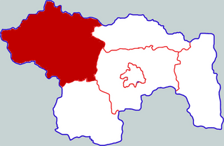
Zhanjiang, historically spelled Tsamkong, is a prefecture-level city at the southwestern end of Guangdong province, People's Republic of China, facing Haikou city to the south.

The China National Highways (CNH/Guodao) is a network of trunk roads across mainland China. Apart from the expressways of China that are planned and constructed later, most of the CNH are not controlled-access highways.

The expressway network of China, with the national-level expressway system officially known as the National Trunk Highway System, is an integrated system of national and provincial-level expressways in China.

Pingzhen District is a district in the central part of Taoyuan City, Taiwan, home to 227,047 people.

State Route 325 (SR 325) is an arc-shaped 11.1-mile-long (17.9 km) state highway completely within the Chattahoochee-Oconee National Forest in Union County in the extreme northern part of the U.S. state of Georgia. It hugs the western and northern shores of Lake Nottely, and is known as Nottely Dam Road for its entire length.
Yuzhou is a county-level city in the central part of Henan, People's Republic of China. It occupies the northwest corner of the prefecture-level city of Xuchang. The city is named for Yu the Great, the founder of the Xia Dynasty, which the city's government claims was founded in present-day Yuzhou, and that the dynasty's capital was located in present-day Yuzhou. There is a statue of Yu the Great in Yuzhou, and he serves as a symbol of the city.
Lecong is a town in Shunde District, Foshan City, Guangdong province, Southern China.

Pennsylvania Route 325 is a 30-mile-long (48 km) state highway located in Dauphin and Schuylkill counties in Pennsylvania. The western terminus is at Riverview Road just past an interchange with U.S. Route 22 /US 322 in the community of Speeceville in Middle Paxton Township. The eastern terminus is at US 209 in Tower City. PA 325 runs through a narrow valley for its length, passing through forested areas with some farmland. The route forms a concurrency with PA 225 to the north of Dauphin. The road was paved in stages between 1930 and the 1940s. PA 325 was designated in the 1940s to run between US 22/US 322/PA 14 in Speeceville east to US 209 in Tower City. In 1999, an interchange with US 22/US 322 was constructed near the western terminus; the end of PA 325 remained at Riverview Road, the former alignment of US 22/US 322.
National Route 325 is a national highway of Japan connecting Kurume, Fukuoka, and Takachiho, Miyazaki, in Japan, with a total length of 138.5 km (86.06 mi).

Lianjiang is a county-level city in the municipal region of Zhanjiang, Guangdong. The city has an area of 2,543 square kilometers, and had a population of about 1,680,000 as of 2010.

Dali is a town in Nanhai District, located to the north of the downtown Foshan, Guangdong, People's Republic of China.

Arkansas Highway 325 is a north–south state highway in Mississippi County, Arkansas. The route of 5.00 miles (8.05 km) runs from US 61 in Osceola north through the city to terminate at Highway 158.

The Rural Municipality of Invermay No. 305 is a rural municipality (RM) in the Canadian province of Saskatchewan within Census Division No. 9 and SARM Division No. 4.

Panipat Elevated Corridor is an Indian elevated 6-lane expressway located in Panipat, Haryana. The entire stretch has been developed into an elevated 6 lane access controlled highway to by-pass the city of Panipat.
Arunachal Frontier Highway (AFH), officially notified as the National Highway NH-913 and also called Bomdila-Vijaynagar Highway (BVH), connecting Bomdila Airstrip ALG & HQ in northwest to Vijaynagar Airstrip ALG & HQ in southeast via Nafra HQ-Sarli HQ-Huri Helipad ALG & HQ-Nacho HQ-Mechuka Airstrip ALG & HQ-Monigong HQ-Jido -Hunli HQ-Hayuliang Airstrip ALG HQ-Chenquenty-Hawai HQ-Miao HQ including 800 km greenfield section and network of new tunnels & bridges, is a 2-lane paved-shoulder under-construction national highway along the India-China LAC-McMahon Line border in the Indian state of Arunachal Pradesh. The 1,748 km-long (1,086 mi) highway itself will cost ₹27,000 crore (US$3.4 billion) and total cost including 6 additional inter-corridors is ₹40,000 crore (US$5.0 billion). In some places, this highway will run as close as 20 km from the LAC. To be constructed by MoRTH in 9 packages, all packages will be approved by the end of fy 2024-25 and construction will be completed in 2 years by 31 March 2027. This highway in the north & east Arunachal along the China border, would complement the Trans-Arunachal Highway and the Arunachal East-West Corridor as major highways spanning the whole state, pursuing the Look East connectivity policy.

National Highway 2 is a national highway in India that runs from Dibrugarh in Assam to Tuipang in Mizoram. This national highway passes through the Indian states of Assam, Nagaland, Manipur and Mizoram. This national highway is 1,325.6 km (823.7 mi) long. Before renumbering of national highways, NH-2 was variously numbered as old national highways 37, 61, 39, 150 and 54.
National Highway 25 is a National Highway in India that connects Barmer and Beawar in the state of Rajasthan. It has recently been upgraded to four lanes by the National Highways Authority of India.
National Highway 325 (NH 325) is a National Highway in India that connects Balotra, Rajasthan, with Sanderao, Rajasthan. The total length of NH 325 is 135 kilometres (84 mi). This highway connects NH 25 in Balotra to NH 62 in Sanderao.

