Climate change in Algeria

Last updated

Topographic Map
Locator Map Algeria (centered orthographic projection).svg
Topographic Map Algeria Topography.png
Topographic Map
Locator Map

Climate change in Algeria has wide-reaching effects on the country. Algeria was not a significant contributor to climate change, [1] but, like other countries in the Middle East and North Africa (MENA) region, is expected to be among the most affected by climate change impacts. [2] Because a large part of the country is in already hot and arid geographies, including part of the Sahara, already strong heat and water resource access challenges are expected to get worse. [1] As early as 2014, scientists were attributing extreme heat waves to climate change in Algeria. [1] Algeria was ranked 46th of countries in the 2020 Climate Change Performance Index. [3]

Contents

Geography

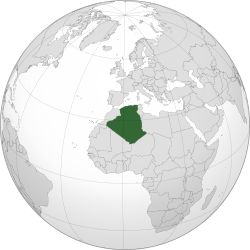
Algeria, the largest country in Africa, shares borders with Morocco, Tunisia, Libya, Mauritania, Mali, and Nigeria. These nations are situated in the Maghreb region, encompassing the desert areas of Northwest Africa along the Mediterranean Sea and Atlantic Ocean. Algeria has diverse landscapes, with the vast Sahara Desert dominating over four-fifths of its territory, particularly in the arid southern regions marked by expansive sand dunes and rocky plateaus. [4]

To the north, the Tell Atlas Mountain range, a subset of the broader Atlas Mountains, runs parallel to the Mediterranean coast. This mountainous terrain significantly influences the country's climate and topography. The Atlas Mountains create a rain shadow effect, blocking rainfall to the Saharan desert that would otherwise be brought by westerly winds from the Atlantic and winds from the Mediterranean. [5] Notably, about 90% of Algeria's population resides in the fertile coastal zones, which constitute around 12% of the total land area. [6]

South of the Atlas Mountains lies the high plateaus, a predominantly fertile region known for its saltwater lakes called "chotts”.  This region has unique wetlands that provide habitat and breeding grounds for migratory birds. [7] The Saharan Atlas Mountains lie to the south of the high plateaus, running parallel to the Tell Atlas Mountains. It receives significantly less water than the Tell Atlas and high plateau, due to the rain shadow effect.

Greenhouse gas emissions

Climate TRACE has estimated 2022 emissions at 350 million tonnes, [8] emissions per capita are about average.

Algeria greenhouse emission of gas from 1990-2016 Greenhouse-gas-emissions-by-gas (6).png
Algeria greenhouse emission of gas from 1990–2016

Algeria's economy relies significantly on its abundant reserves of oil and natural gas. The country possesses the world's tenth-largest proven reserves of natural gas and the sixteenth-largest reserves of proven oil. [9] During the period from 2016 to 2021, the hydrocarbon sector contributed 19% to the gross domestic product (GDP), accounting for 93% of product exports, and represented 38% of budget revenues. [10] Over half of emissions are thought to be from fossil fuel operations and power generation. [8]

Algeria aims to develop more sustainable development practices through four main strategies: institutional strengthening, adaptation to climate change, mitigation, and capacity building. [11] Algeria is working towards diversifying its economy by investing in renewable technologies. As of 2023 roughly 3% of Algeria's electricity comes from renewable resources. [12]

Impacts on the natural environment

Temperature and weather

Atlas Mountains, Tell Atlas range Atlas-Mountains-Labeled-2.jpg
Atlas Mountains, Tell Atlas range

An examination of climate data from 1931 to 1990 in northern Algeria suggests an anticipated temperature increase of 2 °C by the year 2050. Accompanying changes include a decrease in water resources, declining agricultural yields, and Increased desertification. [13]

Algeria has two distinct climates depending on the regions. In the Northern region, Algeria experiences a Mediterranean climate while in the South, it experiences a desert climate. The North, surrounded by the Tell Atlas Mountains experiences more humid winters and more exaggerated warm and dry summers. Most of Algeria is considered the Sahara Desert, which covers majority of the country, where average winters are as low as -20 °C and summers are as high as 45 °C. [14] As climate change has progressed in Algeria, there have been large dry seasons, which has caused wildfires in the Mediterranean Region of Algeria. In July 2023, terrible heat waves have exacerbated the effects of fires, and this forest fire in particular had crossed the border between Algeria and Tunisia. This caused power outages and home displacement to Algerians, and decimated forests. [15]

Algeria is projected to have less frequent rainfall, but an increase in precipitation intensity in the near future. Algeria's temperature expected to increase by -10°C from the date of 2013-2050. In correlation with these changes, Sea levels are also expected to rise 5–10 cm. Alergia is expected to have many issues with water quality, scarcity, agricultural issues, desertification, and changes to energy consumption and air conditioning functionality. [11]

Sea level rise

Algerian coasts Taazibt 2019 Algeria 1.jpg
Algerian coasts

Algeria's coastline spans 1,600 kilometers along the Mediterranean, and with a significant portion of the population residing along these coastal areas. [16] Algeria's coastal region faces mounting pressures from natural factors like seismic risks and erosion, tsunamagenic events. [17] These impacts are compounded by human-induced issues such as pollution and habitat loss. [18]

Coastal vulnerability to sea level rise requires assessment of both physical coastal vulnerability (e.g., coastal slope, tidal range, wave height, erosion rate), and socio-economic vulnerability (e.g., population density, cultural significance, infrastructure, land usage, and conservation status). A recent study assessing Zemmouri, northwest of Algiers, found that 24.58 kilometers (52%) of Algeria's coastline exhibited very high vulnerability to rising sea levels based on physical coastal vulnerability. Socioeconomic vulnerability indicators further identified 30 kilometers (36%) of the coastline as the most vulnerable areas. [19] Another study assessing Bou Ismail Bay showed that 80% of coastal area in the Bay exhibits moderate vulnerability and 45% is highly exposed to coastal hazards. The risk mapping identifies 40% of the Bay at a high-risk level, signaling to policy makers the need for interventions to reduce sensitivity and bolster resilience. [20]

Water resources

Algeria is categorized as water-scarce, along with 17 other African countries, falling below the theoretical scarcity threshold established by the World Bank of 1000 m3 (cubic meters) per capita per year. As of 2020, the theoretical availability of water per capita per year is 430 m3. [21] Algeria has also been experiencing major drought events, which has greatly affected the water cycle in the region, as well as dam functionality by 25%. [22]

Ecosystem

Fetzara lake Lac of fedzara 2.jpg
Fetzara lake

The decline in precipitation levels, coupled with rising temperatures and increased evaporation rates, has contributed to the desiccation of two significant wetlands, Fetzara and Halloula Lake. Eight species of birds once nested here, but have not been seen in the area, as the wetland habitat has undergone through major anthropocenic transformation in the recent two decades. [21] [23] The ecosystems in Algeria consist of temperate coniferous forests, woodlands, and scrubs, but almost all other terrestrial land consists of desert and desert associated ecosystems. [24] Algerian forests cover approximately 4.1 million hectares and are composed mainly of Aleppo pine (68%) and cork oak (21%). [25] Algerian forests faces several challenges including forest fires, overgrazing, agricultural expansion, and climate change that contribute to deforestation and degradation over time. Indeed, fires consume an average of 20,000 hectares of forest land in Algeria each year. [25] Rising temperatures, unpredictable rain patterns, and longer droughts are likely to alter the cover and distribution of forests and trees over the next years. Studies already show that there has been a decline of Atlas cedar trees in Algeria. [26]

The Northern Sahara lies in a steppe/woodland ecosystem, with rainy winter seasons and salty soil providing habitat for birds and reptiles. South Saharan steppe and xeric woodlands have rainy summer months as opposed to the North Sahara. Many grasses and herbs grow in this region, and summer rain helps sustain these species. [27]

Precipitation

2014 rain patterns in Tarihant, Boudjima, Algeria Precipitations Tarihant.jpg
2014 rain patterns in Tarihant, Boudjima, Algeria

Algeria faces notable impacts, due to changes in precipitation patterns, particularly in Northwestern regions. Over the last century, this area has witnessed a consistent reduction in annual rainfall, coupled with a significant temperature rise. Recent IPCC reports suggest that rainfall events will become less frequent but more intense, with prolonged and common droughts. These shifts in the spatial and temporal distribution of precipitation will directly impact agriculture and water resources. [28]

Northwestern Algeria, is highly susceptible to the impacts of climate change. A recent study about Tafna Basin in Algeria (7245 km2) analyzed rainfall and runoff data, and revealed a significant decline in annual rainfall since the 1980s. This change led to a decrease in rainfall ranging from 8.21% to 38.85% across stations, averaging 17.85%. [29] Another study in the same basin found that the average water volumes mobilized by aquifers dropped significantly, ranging from 11.38 to 3.62 hm^3 before and after 1987, with an average decrease of -69.06%. These findings suggest a substantial decline in groundwater resources post-1987, emphasizing the impact of climate change on water availability in certain regions of Algeria. [30]

In Northeast Algeria, another study scrutinized temporal trends across 22 rainfall stations from 1978 to 2010. The study revealed a seasonal delay that could potentially harm cereal crops and steppe rangelands in the plateaus, impacting vegetation. Furthermore, the study identified a discernible pattern of decreasing precipitation from North to South and from East to West. [31]

Agriculture

A study investigating climate change's impact on durum wheat in Algeria anticipates varying declines in crop yields, from in some cases as high as 40%, depending on the sowing date and the specific location within the central northern region. For Algiers, in northern Algeria, the forecast suggests reduced rainfall especially during spring and summer. [32] Conversely, Bordj Bou Arreridj, also situated in northern Algeria but farther east, is expected to see a notable increase in precipitation. There are also impacts about the timing of rainfall. Both regions are projected to experience higher rainfall in autumn. Yields in Algiers are expected to continue declining, while those in Bordj Bou Arreridj are likely to remain stable, mainly due to an earlier sowing schedule adapted to the changing climate. [32]

Mitigation and adaptation

Algeria ratified the Paris Agreement. [33] In 2015, Algeria presented its first Nationally Determined Contribution (NDC), intending to reduce its greenhouse gas emissions by 7% to 22% by 2030 through  energy transition and economic diversification. [34] The 7% will be financed through national resources and the remaining 15% through the international financial channel. Algeria's NDCs aim to achieve a 9% reduction in electric energy consumption and strive to raise the share of renewable energy in electricity production to 22,000 MW, accounting for 27% of the total electrical generation by 2030. [35] However, Algeria has yet to submit an updated NDC, long-term low carbon and climate resilient development strategies (LTS) and National Adaptation Plan (NAP). [36]

To enhance its renewable energy portfolio, Algeria plans to invest in solar energy, leveraging its significant solar irradiance levels. The country has the potential to generate between 1,850 to 2,100 kilowatts per hour, operating for up to 35,000 hours annually. [37] By 2035, Algeria aims to generate 15,000 MW of solar energy. [37]

Algeria has tried to expand renewable energy investments by making agreements with Germany, China, and the U.S for foreign renewable supplies. A plan to build at least 5 solar power sites across Algeria has been made, each within the capacity of 50-300 megawatts. Some international business from Germany, China, Italy, Egypt, Spain, and the UK have started investing in land for renewable energy in Algeria. [6]

The 2020 Climate Change Performance Index (CCPI) characterized Algeria's policy approach as insufficient to meet the 2 °C goal. Algeria was ranked 48th in the CCPI, receiving a medium rating in the GHG emissions and Energy Use Categories, with very low ratings in Renewable Energy and Climate Policy. [38]

Impacts on people

In Algeria, 50% of non-irrigated agricultural lands are dedicated to cereal cultivation, particularly durum wheat. [39] A decline in national meat and milk production has impacted their prices, leading to heightened demand for cereal products. Wheat serves as a primary protein source in the Algerian diet. With diminishing yields annually, Algeria's reliance on wheat imports has increased, resulting in an average yearly expenditure of $1 billion. These imports are funded by revenue generated from oil. [39] As a result, food security in Algeria is significantly influenced by precipitation levels and oil prices. Anemia prevails significantly due to poorly diversified diets, affecting over half of children under 5. The impact of the food crisis is particularly acute among Sahrawi refugees, who were displaced from Western Sahara in 1975 following Morocco's territorial claim, leading to an armed conflict. Among Sahrawi refugees, 30% face food insecurity, with 58% at risk of experiencing food insecurity. [40]

Related Research Articles

<span class="mw-page-title-main">Geography of Libya</span> Geographical features of Libya

Libya is the fourth largest country in Africa and the sixteenth largest country in the world. It is on the Mediterranean with Egypt to the east, Tunisia to the northwest, Algeria to the west, Niger and Chad to the south, and Sudan to the southeast. Although the oil discoveries of the 1960s have brought immense wealth, at the time of its independence it was an extremely poor desert state whose only important physical asset appeared to be its strategic location at the midpoint of Africa's northern rim.

<span class="mw-page-title-main">Geography of Morocco</span> Overview of the geography of Morocco

Morocco is the northwesternmost country which spans from the Mediterranean Sea and Atlantic Ocean on the north and the west respectively, into large mountainous areas in the interior, to the Sahara desert in the far south. Morocco is a Northern African country, located in the extreme northwest of Africa on the edge of continental Europe. The Strait of Gibraltar separates Spain from Morocco with a 13 kilometres (8.1 mi) span of water. Morocco borders the North Atlantic Ocean to the west, and the western Mediterranean Sea to the north, and has borders with Algeria and disputed Western Sahara.

<span class="mw-page-title-main">Geography of Algeria</span>

Algeria comprises 2,381,740 square kilometres (919,590 sq mi) of land, more than 80% of which is desert, in North Africa, between Morocco and Tunisia. It is the largest country in Africa. Its Arabic name, Al Jazair, is believed to derive from the rocky islands along the coastline of the Mediterranean Sea. The northern portion, an area of mountains, valleys, and plateaus between the Mediterranean and the Sahara Desert, forms an integral part of the section of North Africa known as the Maghreb. This area includes Morocco, Tunisia, and the northwestern portion of Libya known historically as Tripolitania.

<span class="mw-page-title-main">Sahara</span> Desert on the African continent

The Sahara is a desert spanning across North Africa. With an area of 9,200,000 square kilometres (3,600,000 sq mi), it is the largest hot desert in the world and the third-largest desert overall, smaller only than the deserts of Antarctica and the northern Arctic.

<span class="mw-page-title-main">Middle East and North Africa</span> Geographic region

The Middle East and North Africa (MENA), also referred to as West Asia and North Africa (WANA) or South West Asia and North Africa (SWANA), is a geographic region. While still referring to most of the Middle East and North Africa together, it is widely considered to be a more defined and apolitical alternative to the grouping of countries that is known as the Greater Middle East, which comprises the bulk of the Muslim world.

Climate change is an urgent and significant issue affecting Japan. In recent years, the country has observed notable changes in its climate patterns, with rising temperatures serving as a prominent indicator of this phenomenon. As an archipelago situated in northeastern Asia, Japan is particularly vulnerable to the impacts of climate change due to its diverse geography and exposure to various weather systems. The nation experiences a broad range of climates, spanning from the frigid winters of Hokkaido to the subtropical climates of Okinawa. Changes in temperature patterns have the potential to disrupt ecosystems, impact agricultural productivity, modify water resources, and pose significant challenges to infrastructure and human settlements.

<span class="mw-page-title-main">Desert greening</span> Process of man-made reclamation of deserts

Desert greening is the process of afforestation or revegetation of deserts for ecological restoration (biodiversity), sustainable farming and forestry, but also for reclamation of natural water systems and other ecological systems that support life. The term "desert greening" is intended to apply to both cold and hot arid and semi-arid deserts. It does not apply to ice capped or permafrost regions. It pertains to roughly 32 million square kilometres of land. Deserts span all seven continents of the Earth and make up nearly a fifth of the Earth's landmass, areas that recently have been increasing in size. As some of the deserts expand and global temperatures increase, the different methods of desert greening may provide a potential solution. Planting suitable flora in deserts has a range of environmental benefits from carbon sequestration to providing habitat for native desert fauna to generating employment opportunities to creation of habitable areas for local communities. The prevention of land desertification is one of 17 sustainable development objectives outlined by the United Nations, desert greening is a process that aims to not only combat desertification but to foster an environment where plants can create a sustainable environment for all forms of life while preserving its integrity.

<span class="mw-page-title-main">Climate of Africa</span> Climate of the continent

The climate of Africa is a range of climates such as the equatorial climate, the tropical wet and dry climate, the tropical monsoon climate, the semi-arid climate, the desert climate, the humid subtropical climate, and the subtropical highland climate. Temperate climates are rare across the continent except at very high elevations and along the fringes. In fact, the climate of Africa is more variable by rainfall amount than by temperatures, which are consistently high. African deserts are the sunniest and the driest parts of the continent, owing to the prevailing presence of the subtropical ridge with subsiding, hot, dry air masses. Africa holds many heat-related records: the continent has the hottest extended region year-round, the areas with the hottest summer climate, the highest sunshine duration, and more.

<span class="mw-page-title-main">Climate of Spain</span> Overview of the climate of Spain

The climate of Spain is highly diverse and varies considerably across the country's various regions. Spain is the most climatically diverse country in Europe with 13 different Köppen climates.

<span class="mw-page-title-main">Climate change in Puerto Rico</span> Climate change in the US territory of Puerto Rico

Climate change has had large impacts on the ecosystems and landscapes of the US territory Puerto Rico. According to a 2019 report by Germanwatch, Puerto Rico is the most affected by climate change. The territory's energy consumption is mainly derived from imported fossil fuels.

<span class="mw-page-title-main">Climate change in the Caribbean</span> Emissions, impacts and responses of the Caribbean region related to climate change

Climate changein the Caribbean poses major risks to the islands in the Caribbean. The main environmental changes expected to affect the Caribbean are a rise in sea level, stronger hurricanes, longer dry seasons and shorter wet seasons. As a result, climate change is expected to lead to changes in the economy, environment and population of the Caribbean. Temperature rise of 2 °C above preindustrial levels can increase the likelihood of extreme hurricane rainfall by four to five times in the Bahamas and three times in Cuba and Dominican Republic. Rise in sea level could impact coastal communities of the Caribbean if they are less than 3 metres (10 ft) above the sea. In Latin America and the Caribbean, it is expected that 29–32 million people may be affected by the sea level rise because they live below this threshold. The Bahamas is expected to be the most affected because at least 80% of the total land is below 10 meters elevation.

<span class="mw-page-title-main">Climate change in Malaysia</span> Impact of global warming on the south-east Asian country and mitigating and adaptating to it

Climate change is having a considerable impact in Malaysia. Increasing temperatures are likely to greatly increase the number of heatwaves occurring annually. Variations in precipitation may increase the frequency of droughts and floods in various local areas. Sea level rise may inundate some coastal areas. These impacts are expected to have numerous environmental and socioeconomic effects, exacerbating existing environmental issues and reinforcing inequality.

<span class="mw-page-title-main">Climate change in Egypt</span>

Climate change is causing Egypt’s already hot and arid climate to experience environmental stresses including extreme temperatures, droughts, floods, and sea level rise. These extreme conditions will have significant impacts on the lives of Egyptians resulting in food insecurity, water scarcity, and economic destabilization.

<span class="mw-page-title-main">Climate change in Senegal</span> Emissions, impacts and responses of Senegal related to climate change

Climate change in Senegal will have wide reaching impacts on many aspects of life in Senegal. Climate change will cause an increase in average temperatures over west Africa by between 1.5 and 4 °C by mid-century, relative to 1986–2005. Projections of rainfall indicate an overall decrease in rainfall and an increase in intense mega-storm events over the Sahel. The sea level is expected to rise faster in West Africa than the global average. Although Senegal is currently not a major contributor to global greenhouse gas emissions, it is one of the countries most vulnerable to climate change.

<span class="mw-page-title-main">Climate change in Morocco</span> Emissions, impacts and responses of Morocco related to climate change

Climate change is expected to significantly impact Morocco on multiple dimensions, similar to other countries in the Middle East and North Africa region. As a coastal country with hot and arid climates, environmental impacts from climate change are likely to be wide and varied. Analysis of these environmental changes on the economy of Morocco are expected to create challenges at all levels of the economy. The main effects will be felt in the agricultural systems and fisheries which employ half of the population, and account for 14% of GDP. In addition, because 60% of the population and most of the industrial activity are on the coast, sea level rise is a major threat to key economic forces. Morocco’s average temperatures have increased by 0.2 °C per decade since the 1960s. Morocco is particularly susceptible to heat waves, droughts and floods.

<span class="mw-page-title-main">Climate change in Italy</span> Impact of climate change in Italy

In Italy, widespread impacts of climate change are currently being felt. With an increase in extreme events such as heatwaves, droughts and more frequent flooding, Italy faces many challenges adapting to climate change.

<span class="mw-page-title-main">Climate change in Iran</span> Emissions, impacts and responses in Iran related to climate change

Iran is among the most vulnerable countries to climate change in the Middle East and North Africa (MENA). Iran contributes to about 1.8% of global greenhouse gas emissions (GHG), and is ranked 8th in greenhouse gas emissions (GHG) world wide and is ranked first in the MENA region due to its reliance on oil and natural gas. Climate change has led to reduced precipitation as well as increased temperatures, with Iran holding the hottest temperature recorded in Asia.

<span class="mw-page-title-main">Climate change in the Middle East and North Africa</span> Emissions, impacts and responses of the MENA region related to climate change

Climate change in the Middle East and North Africa (MENA) refers to changes in the climate of the MENA region and the subsequent response, adaption and mitigation strategies of countries in the region. In 2018, the MENA region emitted 3.2 billion tonnes of carbon dioxide and produced 8.7% of global greenhouse gas emissions (GHG) despite making up only 6% of the global population. These emissions are mostly from the energy sector, an integral component of many Middle Eastern and North African economies due to the extensive oil and natural gas reserves that are found within the region. The region of Middle East is one of the most vulnerable to climate change. The impacts include increase in drought conditions, aridity, heatwaves and sea level rise.

<span class="mw-page-title-main">Climate change in Israel</span>

Israel, like many other countries in the Middle East and North Africa, experience adverse effects from climate change. Annual and mean temperatures are increasing in Israel, with mean temperature expected to increase between 1.6 and 1.8 °C by 2100. There is a reduction in annual precipitation and delayed winter rains. Israel is already experiencing droughts and water shortages. Heatwaves are other natural hazards expected to increase with climate change.

<span class="mw-page-title-main">Climate of Tunisia</span>

The climate of Tunisia is Mediterranean in the north, with mild rainy winters and hot, dry summers. The south of the country is desert. The terrain in the north is mountainous, which, moving south, gives way to a hot, dry central plain. The south is semiarid, and merges into the Sahara. A series of salt lakes, known as chotts or shatts, lie in an east–west line at the northern edge of the Sahara, extending from the Gulf of Gabes into Algeria. The lowest point of the Tunisian landscape is located at Chott el Djerid, which stands at 17 metres (56 ft) below sea level and the highest point is Jebel ech Chambi, at 1,544 metres (5,066 ft) above sea level.

References

  1. 1 2 3 Benzerga, Mohamed (24 August 2015). "Heatwaves are on the rise in Algeria due to climate change, says specialist". the Guardian. Archived from the original on 6 September 2015. Retrieved 17 May 2020.
  2. Sahnoune, F.; Belhamel, M.; Zelmat, M.; Kerbachi, R. (1 January 2013). "Climate Change in Algeria: Vulnerability and Strategy of Mitigation and Adaptation". Energy Procedia. TerraGreen 13 International Conference 2013 – Advancements in Renewable Energy and Clean Environment. 36: 1286–1294. doi: 10.1016/j.egypro.2013.07.145 . ISSN   1876-6102.
  3. "Algeria". Climate Change Performance Index. 28 November 2019. Archived from the original on 10 June 2020. Retrieved 17 May 2020.
  4. "Algeria country profile". BBC News. 12 July 2011. Retrieved 29 November 2023.
  5. "Wet and Dry Morocco". earthobservatory.nasa.gov. 17 March 2019. Retrieved 11 November 2023.
  6. 1 2 Bounoua, Lahouari; Bachir, Nora; Souidi, Hanane; Bahi, Hicham; Lagmiri, Souad; Khebiza, Mohamed Yacoubi; Nigro, Joseph; Thome, Kurt (March 2023). "Sustainable Development in Algeria's Urban Areas: Population Growth and Land Consumption". Urban Science. 7 (1): 29. doi: 10.3390/urbansci7010029 . ISSN   2413-8851.
  7. Demnati, Fatma; Samraoui, Boujéma; Allache, Farid; Sandoz, Alain; Ernoul, Lisa (4 February 2017). "A literature review of Algerian salt lakes: values, threats and implications". Environmental Earth Sciences. 76 (3): 127. Bibcode:2017EES....76..127D. doi:10.1007/s12665-017-6443-x. ISSN   1866-6299. S2CID   132566283.
  8. 1 2 "Country Inventory - Climate TRACE". climatetrace.org. Retrieved 4 December 2023.
  9. "Algeria - Oil and Gas - Hydrocarbons". www.trade.gov. Retrieved 28 November 2023.
  10. "Overview". World Bank. Retrieved 11 November 2023.
  11. 1 2 "ScienceDirect.com | Science, health and medical journals, full text articles and books". www.sciencedirect.com. Retrieved 20 October 2023.
  12. "Algeria - Renewable Energy". www.trade.gov. Retrieved 15 November 2023.
  13. Sahnoune, F.; Belhamel, M.; Zelmat, M.; Kerbachi, R. (1 January 2013). "Climate Change in Algeria: Vulnerability and Strategy of Mitigation and Adaptation". Energy Procedia. TerraGreen 13 International Conference 2013 - Advancements in Renewable Energy and Clean Environment. 36: 1286–1294. doi: 10.1016/j.egypro.2013.07.145 . ISSN   1876-6102.
  14. "World Bank Climate Change Knowledge Portal". climateknowledgeportal.worldbank.org. Retrieved 13 November 2023.
  15. Sekkai, Rachid (25 July 2023). "34 Killed in Algerian Wildfires as Heat Waves Parch Mediterranean Region". The New York Times. Retrieved 19 November 2023.
  16. "Algeria", The World Factbook, Central Intelligence Agency, 13 December 2023, retrieved 18 December 2023
  17. Theilen-Willige, Barbara; Mansouri, Rachid (2022), Al Saud, Mashael M. (ed.), "Flooding Hazard Assessment Considering Climate Change in the Coastal Areas of Algeria Based on a Remote Sensing and GIS Data Base", Applications of Space Techniques on the Natural Hazards in the MENA Region, Cham: Springer International Publishing, pp. 225–253, doi:10.1007/978-3-030-88874-9_10, ISBN   978-3-030-88874-9 , retrieved 18 December 2023
  18. Bencheikh, Z., Refes, W., Brito, P. M., Prodocimo, M. M., Gusso-Choueri, P. K., Choueri, R. B., & de Oliveira Ribeiro, C. A. (2022). Chemical pollution impairs the health of fish species and fishery activities along the Algeria coastline, Mediterranean Sea. Environmental Monitoring and Assessment, 194(7), 497.
  19. Sallaye, Miloud; Mezouar, Khoudir; Dahmani, Abdelalim; Cherif, Youssra Salem (31 December 2022). "Coastal vulnerability assessment and identification of adaptation measures to climate change". Geo-Eco-Marina. 28: 181–193. doi:10.5281/7493268 (inactive 31 January 2024). ISSN   1224-6808.{{cite journal}}: CS1 maint: DOI inactive as of January 2024 (link)
  20. Chaib, Walid; Guerfi, Mokhtar; Hemdane, Yacine (31 May 2020). "Evaluation of coastal vulnerability and exposure to erosion and submersion risks in Bou Ismail Bay (Algeria) using the coastal risk index (CRI)". Arabian Journal of Geosciences. 13 (11): 420. Bibcode:2020ArJG...13..420C. doi:10.1007/s12517-020-05407-6. ISSN   1866-7538. S2CID   219103451.
  21. 1 2 Touitou, Mohammed; Abul Quasem (March 2018). "Climate change and water resources in Algeria: vulnerability, impact and adaptation strategy". Economic and Environmental Studies. 18 (45): 411–329. doi: 10.25167/ees.2018.45.23 . hdl: 10419/193092 .
  22. "Climate Change in Algeria and its Impacts | Leila Ben Smaine". السفير العربي. 5 November 2022. Retrieved 13 November 2023.
  23. Toubal, O., Boussehaba, A., Toubal, A., & Samraoui, B. (2014). Mediterranean biodiversity and global change: the case of the Guerbès-Senhadja wetland complex (Algeria). Physio-Géo, 8, 273-295.
  24. "Ecological Regions Of Algeria". WorldAtlas. 12 June 2019. Retrieved 18 December 2023.
  25. 1 2 Banque mondiale, Direction générale des forêts, Délégation nationale aux risques majeurs. 2023. Note sur les forêts algériennes : Gestion durable des forêts pour lutter contre les feux de forêt. World Bank, Washington, DC.
  26. UNEP (4 December 2018). "Mediterranean forest area on the rise but increasingly in jeopardy - Climate change, wildfires and water scarcity drive forest degradation".
  27. "Ecological Regions Of Algeria". WorldAtlas. 12 June 2019. Retrieved 19 November 2023.
  28. Boudiaf, B., Dabanli, I., Boutaghane, H., & Şen, Z. (2020). Temperature and precipitation risk assessment under climate change effect in northeast Algeria. Earth Systems and Environment, 4, 1-14.
  29. Bougara, H., Hamed, K. B., Borgemeister, C., Tischbein, B., & Kumar, N. (2020). Analyzing trend and variability of rainfall in the Tafna basin (Northwestern Algeria). Atmosphere, 11(4), 347.
  30. Berhail, Sabri (2019). "The impact of climate change on groundwater resources in northwestern Algeria". Arabian Journal of Geosciences. 12 (24): 770. Bibcode:2019ArJG...12..770B. doi:10.1007/s12517-019-4776-3. ISSN   1866-7538. S2CID   208869303.
  31. Merniz; Tahar; Benmehaia (2019). "Statistical assessment of rainfall variability and trends in northeastern Algeria" (PDF).
  32. 1 2 Chourghal, Nacira (2016). "Climate change in Algeria and its impact on durum wheat". Regional Environmental Change. 16 (6): 1623. Bibcode:2016REnvC..16.1623C. doi:10.1007/s10113-015-0889-8. S2CID   155225051.
  33. UNFCCC. "Paris Agreement Parties".
  34. "Intended Nationally Determined Contribution" (PDF). unfccc.int. Retrieved 11 November 2023.
  35. Bouznit, Mohammed; Pablo-Romero, María del P.; Sánchez-Braza, Antonio (January 2020). "Measures to Promote Renewable Energy for Electricity Generation in Algeria". Sustainability. 12 (4): 1468. doi: 10.3390/su12041468 . ISSN   2071-1050.
  36. "About Africa NDC Hub". africandchub.org. Retrieved 11 November 2023.
  37. 1 2 "Algeria's renewable energy potential: Solar power is the way to go". euronews. 3 October 2022. Retrieved 28 November 2023.
  38. "Algeria – Climate Performance Ranking 2023 | Climate Change Performance Index". 14 November 2022. Retrieved 15 November 2023.
  39. 1 2 Kourat, Tassadit; Smadhi, Dalila; Madani, Azzeddine (April 2022). "Modeling the Impact of Future Climate Change Impacts on Rainfed Durum Wheat Production in Algeria". Climate. 10 (4): 50. Bibcode:2022Clim...10...50K. doi: 10.3390/cli10040050 . ISSN   2225-1154.
  40. "Algeria: Hunger & Food Security". World Food Program USA. Retrieved 26 November 2023.