College Township, Pennsylvania

Last updated

College Township,
Centre County,
Pennsylvania
Township
Mount Nittany2.JPG
Mount Nittany and College Township seen from the Bryce Jordan Center at Penn State
Seal of College Township, Pennsylvania.png
Logo of College Township, Pennsylvania.png
Motto: 
"Gateway to the Centre Region" [1]
Map of College Township, Centre County, Pennsylvania Highlighted.png
Location of College Township in Centre County, Pennsylvania
Map of Pennsylvania highlighting Centre County.svg
Location of Centre County in Pennsylvania
Country United States
State Pennsylvania
County Centre
Settled1800
Incorporated1875
Government
  TypeTownship Council
  Council ChairL. Eric Bernier
  Vice-ChairSusan Trainor
  Council MemberD. Richard (Rich) Francke
  Council MemberTracey Mariner
  Council MemberDustin Best
Area
[2]
  Total
18.55 sq mi (48.05 km2)
  Land18.55 sq mi (48.05 km2)
  Water0.00 sq mi (0.00 km2)
Population
 (2020) [3]
  Total
10,762
  Estimate 
(2021) [4]
10,695
  Density554.63/sq mi (214.15/km2)
Time zone UTC-5 (EST)
  Summer (DST) UTC-4 (EDT)
FIPS code 42-027-15136
Website www.collegetownship.org

College Township is a township in Centre County, Pennsylvania. It is part of the State College, Pennsylvania metropolitan statistical area. The population was 10,762 at the 2020 census, which was a 13% increase from the 2010 census. [5] College Township was formed on November 25, 1875, [6] from Harris Township. The most notable feature of the township is Mount Nittany, the southwestern (and iconic) portion of which is located within the township's northeastern section near the village of Lemont.

Contents

History

Two major Native American archaeological sites are located in College Township. Known as the Tudek and Houserville sites, they were used during the Archaic period for the quarrying and reduction of stone tools made of jasper. Both sites are listed on the National Register of Historic Places. [7] [8]

Historic Districts

Geography

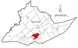
According to the U.S. Census Bureau, the township has a total area of 18.6 square miles (48.1 km2), all land. [9] Mount Nittany is a prominent and well-known feature in the township.

College Township is bordered by Ferguson Township to the west, Patton Township to the northwest, Benner Township to the north, Harris Township to the south, and east, and the borough of State College to the south and west.

Neighborhoods

Demographics

Historical population
CensusPop.Note
2000 8,489
2010 9,52112.2%
2020 10,76213.0%
2021 (est.)10,695 [4] −0.6%
[3]

As of a 2015 census estimate, the township was 89.9% Non-Hispanic White, 4.3% Black or African American, 1.2% Native American Alaska Native, 4.8% Asian, 0.3% Some other race, and 2.1% were Two or More Races. Hispanics and Latinos (of any race) were 1.1% of the population. [ dead link ]

Government

College Township is part of Pennsylvania's 12th congressional district, represented by Republican Fred Keller, elected in 2019.

College Township contracts police service from the State College Police Department, while Penn State University Police provides coverage to University Park campus. [10] [11]

College Township is served by the Alpha Fire Company for fire protection, which maintains one of its two substations in the College Township Municipal Building. Centre Lifelink EMS is based in College Township, as is Mount Nittany Medical Center which also provides emergency medical services. [12] [13]

A portion of State Correctional Institution – Rockview, a prison of the Pennsylvania Department of Corrections, is in College Township. [14]

Education

College Township is served by the State College Area School District for K-12 education. [15]

Pennsylvania State University is partially in College Township. [14]

Transportation

The Centre Area Transportation Authority provides local bus service with fixed routes between College Township and the borough of State College as well as Patton, and Ferguson Township. [16]

Roads

Highways include:

References

  1. "College Township, Centre County, Pennsylvania". College Township, Centre County, Pennsylvania. Archived from the original on July 31, 2012. Retrieved August 10, 2012.
  2. "2016 U.S. Gazetteer Files". United States Census Bureau. Retrieved August 13, 2017.
  3. 1 2 "2020 Census Data". United StatesCensus Bureau. Retrieved July 22, 2023.
  4. 1 2 "City and Town Population Totals: 2020—2021". Census.gov. US Census Bureau. Retrieved August 11, 2022.
  5. Census 2010: Pennsylvania. Usatoday.Com. Retrieved on July 23, 2013.
  6. "Archive & Historical Records". College Township.
  7. Stevenson, Christopher M., and Conran Hay. National Register of Historic Places Inventory/Nomination: Houserville Site (36CE65). National Park Service, October 15, 1980.
  8. Stevenson, Christopher M., and Conran Hay. National Register of Historic Places Inventory/Nomination: Tudek Site. National Park Service, October 10, 1980.
  9. "Geographic Identifiers: 2010 Census Summary File 1 (G001): College township, Centre County, Pennsylvania". U.S. Census Bureau, American Factfinder. Archived from the original on April 9, 2015. Retrieved April 9, 2015.
  10. "FAQs". College Township, PA. Retrieved August 5, 2023.
  11. "Police". Penn State. Retrieved November 4, 2023.
  12. "Contact". Centre Life Link EMS. Retrieved August 5, 2023.
  13. "Mount Nittany Medical Center's emergency medical services team providing excellent pre-hospital care". Mount Nittany Health. August 18, 2020. Retrieved November 4, 2023.
  14. 1 2 "2020 CENSUS - CENSUS BLOCK MAP: College township, PA" (PDF). U.S. Census Bureau. pp. 1-2 (PDF pp. 2-3/4). Retrieved September 1, 2022. Pennsylvania State Univ[...]State Correctional Institution Rockview
  15. "2020 CENSUS - SCHOOL DISTRICT REFERENCE MAP: Centre County, PA" (PDF). U.S. Census Bureau . Retrieved July 18, 2024. - Text list
  16. "Route Map". Centre Area Transportation Authority.

40°49′00″N77°52′34″W / 40.81667°N 77.87611°W / 40.81667; -77.87611