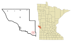
Correll | |
---|---|
Coordinates: 45°13′55″N96°09′43″W / 45.23194°N 96.16194°W | |
Country | United States |
State | Minnesota |
County | Big Stone |
Area | |
• Total | 0.38 sq mi (0.99 km2) |
• Land | 0.38 sq mi (0.99 km2) |
• Water | 0.00 sq mi (0.00 km2) |
Elevation | 981 ft (299 m) |
Population (2020) | |
• Total | 26 |
• Density | 68.06/sq mi (26.29/km2) |
Time zone | UTC-6 (Central (CST)) |
• Summer (DST) | UTC-5 (CDT) |
ZIP code | 56227 |
Area code | 320 |
FIPS code | 27-13384 [3] |
GNIS feature ID | 2393639 [2] |
Correll is a city in Big Stone County, Minnesota, United States. The population was 34 at the 2010 census. [4] Correll was named for David N Correll, a railroad official who founded the city in 1881. [5]
According to the United States Census Bureau, the city has a total area of 0.36 square miles (0.93 km2), all land. [6]
Minnesota State Highway 7 and County Highway 25 are two of the main routes in the community.
Census | Pop. | Note | %± |
---|---|---|---|
1910 | 102 | — | |
1920 | 176 | 72.5% | |
1930 | 143 | −18.7% | |
1940 | 151 | 5.6% | |
1950 | 130 | −13.9% | |
1960 | 101 | −22.3% | |
1970 | 95 | −5.9% | |
1980 | 83 | −12.6% | |
1990 | 60 | −27.7% | |
2000 | 47 | −21.7% | |
2010 | 34 | −27.7% | |
2020 | 26 | −23.5% | |
U.S. Decennial Census [7] |
As of the census [8] of 2010, there were 34 people, 18 households, and 10 families living in the city. The population density was 94.4 inhabitants per square mile (36.4/km2). There were 27 housing units at an average density of 75.0 per square mile (29.0/km2). The racial makeup of the city was 94.1% White, 2.9% African American, and 2.9% Native American. Hispanic or Latino of any race were 2.9% of the population.
There were 18 households, of which 16.7% had children under the age of 18 living with them, 33.3% were married couples living together, 16.7% had a female householder with no husband present, 5.6% had a male householder with no wife present, and 44.4% were non-families. 27.8% of all households were made up of individuals, and 11.1% had someone living alone who was 65 years of age or older. The average household size was 1.89 and the average family size was 2.10.
The median age in the city was 48.5 years. 8.8% of residents were under the age of 18; 5.8% were between the ages of 18 and 24; 26.3% were from 25 to 44; 32.4% were from 45 to 64; and 26.5% were 65 years of age or older. The gender makeup of the city was 52.9% male and 47.1% female.
As of the census [3] of 2000, there were 47 people, 23 households, and 14 families living in the city. The population density was 128.2 inhabitants per square mile (49.5/km2). There were 30 housing units at an average density of 81.8 per square mile (31.6/km2). The racial makeup of the city was 100.00% White.
There were 23 households, out of which 21.7% had children under the age of 18 living with them, 56.5% were married couples living together, 8.7% had a female householder with no husband present, and 34.8% were non-families. 30.4% of all households were made up of individuals, and 8.7% had someone living alone who was 65 years of age or older. The average household size was 2.04 and the average family size was 2.47.
In the city, the population was spread out, with 17.0% under the age of 18, 4.3% from 18 to 24, 31.9% from 25 to 44, 27.7% from 45 to 64, and 19.1% who were 65 years of age or older. The median age was 43 years. For every 100 females, there were 147.4 males. For every 100 females age 18 and over, there were 116.7 males.
The median income for a household in the city was $19,375, and the median income for a family was $23,250. Males had a median income of $27,500 versus $11,250 for females. The per capita income for the city was $12,920. There were 15.8% of families and 15.7% of the population living below the poverty line, including no under eighteens and 50.0% of those over 64.
Felton is a city in Clay County, Minnesota, United States. The population was 177 at the 2020 census.
Emily is a city in Crow Wing County, Minnesota, United States. The population was 813 at the 2010 census. It is part of the Brainerd Micropolitan Statistical Area.
Kenyon is a city in southwestern Goodhue County, Minnesota, United States, located along the North Fork of the Zumbro River. It was founded in 1856 and named in honor of Kenyon College. It is known for the Boulevard of roses on main street, which is the namesake of the town festival "Rosefest" held every August. The population was 1,815 at the 2010 census.
Coleraine is a city in Itasca County, Minnesota, United States. The population was 1,970 at the 2010 census. The community was named after Thomas F. Cole, President of the Oliver Iron Mining Company.
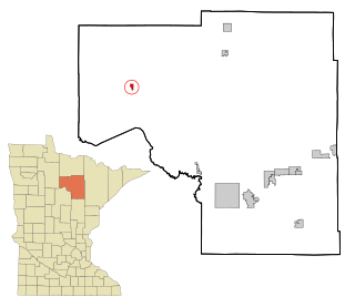
Squaw Lake is a city in Itasca County, Minnesota, United States. The population was 107 at the 2010 census.
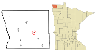
Lake Bronson is a city in Kittson County, Minnesota, United States. The population was 178 at the 2020 census. Lake Bronson State Park is nearby.
Stephen is a city in Marshall County, Minnesota, United States. The population was 592 at the 2020 census.
Parkers Prairie is a city in Otter Tail County, Minnesota, United States. The population was 1,020 at the 2020 census.
Long Beach is a city in Pope County, Minnesota, United States. The population was 338 at the 2020 census.
Sedan is a city in Pope County, Minnesota, United States. The population was 43 at the 2020 census.
Maplewood is a city in Ramsey County, Minnesota, United States. The population was 42,088 at the 2020 census. Maplewood is ten minutes' drive from downtown Saint Paul. It stretches along the northern and eastern borders of Saint Paul.
Hoyt Lakes is a city in Saint Louis County, Minnesota. The population was 2,017 at the time of the 2010 census.
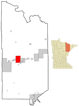
Mountain Iron is a city in Saint Louis County, Minnesota, United States, in the heart of the Mesabi Range. The population was 2,878 at the 2020 census.
Greenwald is a city in Stearns County, Minnesota, United States. The population was 222 at the 2010 census. It is part of the St. Cloud Metropolitan Statistical Area.
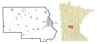
Saint Rosa is a city in Stearns County, Minnesota, United States. The population was 68 at the 2010 census. It is part of the St. Cloud Metropolitan Statistical Area.
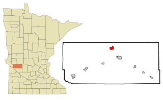
Clontarf is a city in Swift County, Minnesota, United States. The population was 164 at the 2010 census.
De Graff is a city in Swift County, Minnesota, United States. The population was 115 at the 2010 census.
Fifty Lakes is a city in Crow Wing County, Minnesota, United States. The population was 387 at the 2010 census. It is part of the Brainerd Micropolitan Statistical Area.
Bellechester is a city in Goodhue and Wabasha counties in the U.S. state of Minnesota. The population was 175 at the 2010 census. Most of Bellchester is in Goodhue County, with only a small part extending into Wabasha County.
Brooten is a city in Stearns and Pope counties in the U.S. state of Minnesota, United States. The population was 626 as of the 2020 census. Almost the entire city is within Stearns County, with a small portion in Pope County.