Williams Lake Indian Reserve, also called the Williams Lake Band Reservation and commonly referred to locally as the Sugarcane Reserve, aka Sugarcane or The Cane or SCB, is an Indian Reserve in British Columbia, Canada, located at the east end of Williams Lake and 12 km east of the city of the same name, on the right bank of the San Jose River. and is home to the Williams Lake Indian Band. The band is part of the Northern Shuswap Tribal Council, also known as the Cariboo Tribal Council, which is one of two tribal councils of the Secwepemc peoples.

Cowpar Airport, (TC LID: CFM3), was located near Cowper Lake Indian Reserve 194a, Alberta, Canada.
The Chipewyan Prairie First Nation is a First Nations band government located in northeast Alberta south of Fort McMurray.
The Williams Lake Indian Band is a First Nations government of the Secwepemc (Shuswap) Nation, located in the Cariboo region of the Central Interior region of the Canadian province of British Columbia, at the city of Williams Lake. It was created when the government of the then-Colony of British Columbia established an Indian Reserve system in the 1860s. It is a member government of the Northern Shuswap Tribal Council. Its main Indian Reserve is Williams Lake Indian Reserve No. 1, a.k.a. "Sugarcane" or "The Cane" or "SCB".
The Alkali Lake Indian Band, also known as the Esketemc First Nation, is a First Nations government of the Secwepemc (Shuswap) people, located at Alkali Lake in the Cariboo region of the Central Interior of the Canadian province of British Columbia. It was created when the government of the then-Colony of British Columbia established an Indian Reserve system in the 1860s. It is one of three Secwepemc bands that is not a member of either the Shuswap Nation Tribal Council or the Northern Shuswap Tribal Council.
The Kluskus First Nation is the band government of the Lhoosk’uz, a Dakelh people whose main reserve located on the Chilcotin Plateau 130 km west of the city of Quesnel, British Columbia, Canada. The First Nation is a member of the Carrier-Chilcotin Tribal Council, which includes both Tsilhqot'in and Carrier (Dakelh) communities.
The Stone First Nation or Yunesit'in First Nation is a band government of the Yunesit'in subgroup of the Tsilhqot'in people, whose territory is the Chilcotin District in the western Central Interior region of the Canadian province of British Columbia. It is a member of the Tsilhqot'in Tribal Council. The people of the Stone First Nation are known as the Yunesit'in in the Chilcotin language.
Buffalo Point First Nation is an Ojibwa or Saulteaux band government located in southeastern corner of Manitoba, along the shores of Lake of the Woods. It is bordered largely by the unorganized portion of Division No. 1, Manitoba. It also has smaller borders with the Rural Municipality of Piney, as well as the northeast corner of Roseau County, Minnesota. The main settlement of Buffalo Point is located at 49°00′40″N 95°14′20″W.

Marcelin is a village in Saskatchewan, Canada within the rural municipality of Blaine Lake No. 434. It was named after the first postmaster Antoine Marcelin in 1904.

Gitanyow is an Indian reserve community of the Gitxsan people, located on the Kitwanga River 8 km south of Kitwancool Lake, at the confluence of Kitwancool Creek. The community is located on Gitanyow Indian Reserve No. 1.
Takla Landing, also known as McLaing Landing is an unincorporated locality and former steamboat landing on the east side of Takla Lake in the Omineca Country of the Central Interior of British Columbia, Canada. In the days of the Omineca Gold Rush, Takla Landing was a port for steamboats connecting trails from Hazelton, British Columbia via Babine Lake to trails leading from Takla Landing eastwards to the area of the gold strikes in the lower Omineca River.
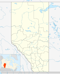
Charles Lake 225 is an Indian reserve in Alberta.
Chipewyan 201 is an Indian reserve in Alberta. It is located on the south shore of Lake Athabasca. It is the primary reserve of the Athabasca Chipewyan First Nation, though much of the registered population lives elsewhere.
Cold Lake 149 is an Indian reserve in northern Alberta, Canada. The reserve is located 4 km (2.5 mi) south of the City of Cold Lake and is surrounded by the Municipal District of Bonnyville No. 87. It is one of five reserves of the Cold Lake First Nations.
Collin Lake 223 is an Indian reserve in northeast Alberta, Canada.
Cornwall Lake 224 is an Indian reserve in Alberta.
Janvier 194 is a First Nations reserve in Alberta, Canada. It is located 98 kilometres (61 mi) southeast of Fort McMurray. It is at an elevation of 447 metres (1,467 ft).
Puskiakiwenin 122 is an Indian reserve in Alberta. It is located 59 kilometres (37 mi) southwest of Cold Lake. It is at an elevation of 612 metres (2,008 ft). It belongs to the Frog Lake First Nation, a Cree nation.
Sturgeon Lake 154 is an Indian reserve in northern Alberta, Canada. It is located on Highway 43, 3.5 km (2.2 mi) west of the Town of Valleyview and approximately 85 km (53 mi) east of the City of Grande Prairie. It and the adjacent Sturgeon Lake 154B Indian Reserve are surrounded by the Municipal District of Greenview No. 16. It is under the administration of the Sturgeon Lake Cree Nation.
Birch Narrows Dene Nation is a Dene First Nation band government in the boreal forest region of northern Saskatchewan, Canada.