First Nations in Alberta are Indigenous peoples who live in the Canadian province of Alberta. The First Nations are peoples recognized as Aboriginal peoples in Canada excluding the Inuit and the Métis. According to the 2011 Census, a population of 116,670 Albertans self-identified as First Nations. Specifically there were 96,730 First Nations people with registered Indian Status and 19,945 First Nations people without registered Indian Status. Alberta has the third largest First Nations population among the provinces and territories. From this total population, 47.3% of the population lives on an Indian reserve and the other 52.7% live in urban centres. According to the 2011 Census, the First Nations population in Edmonton totalled at 31,780, which is the second highest for any city in Canada. The First Nations population in Calgary, in reference to the 2011 Census, totalled at 17,040. There are 48 First Nations or "bands" in Alberta, belonging to nine different ethnic groups or "tribes" based on their ancestral languages.

Stony Plain 135 is an Indian reserve in central Alberta, Canada in Division No. 11. It is located adjacent to Parkland County and the City of Edmonton, Alberta. It is home to the Enoch Cree Nation. The postal address of the reserve is Enoch, Alberta.
The Sunchild First Nation is a Cree First Nation in Alberta, Canada part of Treaty 6, signed on May 25, 1944 under the leadership of Chief Louis Sunchild. The First Nation has one reserve, Sunchild 202. The reserve, 52.18 km2 (20.15 sq mi) in size, is located approximately 60 km (37 mi) northwest of Rocky Mountain House. It shares the western border of the O'Chiese First Nation.

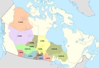
Division No. 8 is a census division in Alberta, Canada. It is located in the south-central portion of central Alberta and surrounds the City of Red Deer. The division forms the central segment of the Calgary–Edmonton Corridor. Division No. 8 is the smallest census division in Alberta according to area.
Division No. 17 is a census division in Alberta, Canada. It spans the central and northwest portions of northern Alberta and its largest urban community is the Town of Slave Lake. Division No. 17 is the largest census division in Alberta according to area and also has the lowest population density.

Kinuso is a hamlet in northern Alberta, Canada within Big Lakes County, and surrounded by the Swan River First Nation reserve. It is located approximately 48 kilometres (30 mi) west of Slave Lake and 71 km east of High Prairie along Highway 2, south of the southern shore of Lesser Slave Lake.
Wabasca, also known as Wabasca-Desmarais, is a hamlet in northern Alberta, Canada, within the Municipal District of Opportunity No. 17. It is located between and along the South and North Wabasca Lakes, at the intersection of Highway 813 and Highway 754. It is approximately 123 kilometres (76 mi) northeast of Slave Lake.
Cadotte Lake is an unincorporated community in northern Alberta, Canada within Northern Sunrise County. It is located on the northern shore of the homonymous lake, along Highway 986, 79 km (49 mi) east of Peace River and 68 km (42 mi) west of the Bicentennial Highway.
Calling Lake is a hamlet in northern Alberta, Canada within the Municipal District of Opportunity No. 17. It is located on Highway 813 along the eastern shore of Calling Lake, immediately north of Calling Lake Provincial Park. It is approximately 59 km (37 mi) north of Athabasca and 113 km (70 mi) south of Wabasca and has an elevation of 595 m (1,952 ft).
Blood 148 is a First Nations reserve in Alberta, Canada. It is inhabited by the Blood (Kainai) First Nations and was established under the provisions of the Treaty 7. This reserve is located in Stand Off along Highway 2 and the Belly River.
Kapasiwin is a summer village in Alberta, Canada. It is located in the eastern shore of Wabamun Lake, south of Wabamun Lake Provincial Park and the Yellowhead Highway. The name derives from kapesiwin (ᑲᐯᓯᐃᐧᐣ), the Cree word for "campground". It was known as the Village of Wabamun Beach from 1913 to 1918.
Ermineskin Cree Nation also known as the Ermineskin Tribe, is a band government in Alberta, Canada, a western branch of the large Cree Nation, and a Treaty 6 nation.
Little Buffalo is a hamlet in northern Alberta, Canada within Northern Sunrise County. It is located on Highway 986, approximately 100 kilometres (62 mi) northeast of the Town of Peace River and 47 kilometres (29 mi) west of Highway 88. Little Buffalo Lake is to the south of the community.
Lousana is a hamlet in central Alberta, Canada within Red Deer County. It is located 4 kilometres (2.5 mi) east of the junction of Highway 21 and Highway 42, approximately 45 kilometres (28 mi) southeast of Red Deer.
Montana 139 is an Indian reserve in Alberta. It is located 26 kilometres (16 mi) south of Wetaskiwin. It is at an elevation of 796 metres (2,612 ft). Located near Maskwacis, it is one of two reserves under the governance of the Montana First Nation. The other is Pigeon Lake 138A, which is shared with three other First Nations, the Ermineskin Tribe, the Louis Bull First Nation and the Samson Indian Reserve No. 137.
Pigeon Lake 138A is an Indian reserve in Alberta. It is located 39 kilometres (24 mi) west of Wetaskiwin along Pigeon Lake. It is at an elevation of 860 metres (2,820 ft). It is shared between the Samson Cree Nation, the Montana Cree Nation, the Louis Bull Tribe, and the Ermineskin Cree Nation.

Maskwacis Cultural College (MCC) is a private post-secondary institution within the Four Nations of Maskwacis, Alberta, Canada. MCC offers programs from basic adult literacy, two-year college diplomas, to university transfer programs.
Duncan's First Nation is a First Nation in northwestern Alberta, Canada. It operates as an Indian band under the Indian Act representing a community of Aboriginal Canadians, in this case from the Woods Cree ethnic group. The band became a party to Treaty 8 with the Canadian Crown on July 1, 1899. Indian reserves were surveyed for the band in 1905, but the reserves were not confirmed by Order-in-Council until 1907 and 1925. All but one reserves (#151A) were later surrendered to the Canadian government in 1928. One of them, #151K, was later returned to the band in 1965. The two remaining reserves are #151A, located 52 kilometres (32 mi) west of Peace River, Alberta and #151K, located in the McLennon/Reno area, southeast of Peace River. The two reserves comprise a total area of 2,426.1 hectares, and the majority of the population lives on #151A. In 2012, the band had a registered population of 269, of whom 142 members living the band's reserves.