Stoney Indian Reserves Nos. 142, 143, and 144

Last updated
Canada Alberta location map 2.svg
Red pog.svg
Stoney
Location of Stoney Reserve in Alberta

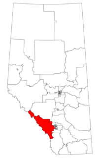
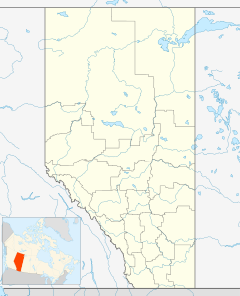
Stoney 142, 143, 144 make up an Indian reserve in southwest Alberta, Canada in Division No. 15. It is home to the Bearspaw, Chiniki and Wesley first nations of the Nakoda.

In Canada, an Indian reserve is specified by the Indian Act as a "tract of land, the legal title to which is vested in Her Majesty, that has been set apart by Her Majesty for the use and benefit of a band."

Alberta Province of Canada

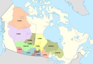
Alberta is a western province of Canada. With an estimated population of 4,067,175 as of 2016 census, it is Canada's fourth most populous province and the most populous of Canada's three prairie provinces. Its area is about 660,000 square kilometres (250,000 sq mi). Alberta and its neighbour Saskatchewan were districts of the Northwest Territories until they were established as provinces on September 1, 1905. The premier has been Rachel Notley since May 2015.

Canada Country in North America

Canada is a country in the northern part of North America. Its ten provinces and three territories extend from the Atlantic to the Pacific and northward into the Arctic Ocean, covering 9.98 million square kilometres, making it the world's second-largest country by total area. Canada's southern border with the United States is the world's longest bi-national land border. Its capital is Ottawa, and its three largest metropolitan areas are Toronto, Montreal, and Vancouver. As a whole, Canada is sparsely populated, the majority of its land area being dominated by forest and tundra. Consequently, its population is highly urbanized, with over 80 percent of its inhabitants concentrated in large and medium-sized cities, many near the southern border. Canada's climate varies widely across its vast area, ranging from arctic weather in the north, to hot summers in the southern regions, with four distinct seasons.

Contents

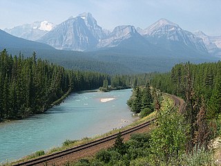
The community is spread along both sides of the Trans-Canada Highway, east of Banff National Park and north of Kananaskis Improvement District. In addition to Kananaskis, it is also bordered by Bighorn No. 8, Rocky View County, and the town of Cochrane. By land area, it is the third-largest Indian reserve in Canada (after Blood 148 and Siksika 146, both also in Alberta).

Trans-Canada Highway highway system in Canada

The Trans-Canada Highway is a transcontinental federal-provincial highway system that travels through all ten provinces of Canada from the Pacific Ocean on the west to the Atlantic on the east. The main route spans 7,821 km (4,860 mi) across the country, one of the longest routes of its type in the world. The highway system is recognizable by its distinctive white-on-green maple leaf route markers, although there are small variations in the markers in some provinces.

Banff National Park national park in Alberta, Canada

Banff National Park is Canada's oldest national park and was established in 1885. Located in the Rocky Mountains, 110–180 kilometres (68–112 mi) west of Calgary in the province of Alberta, Banff encompasses 6,641 square kilometres (2,564 sq mi) of mountainous terrain, with numerous glaciers and ice fields, dense coniferous forest, and alpine landscapes. The Icefields Parkway extends from Lake Louise, connecting to Jasper National Park in the north. Provincial forests and Yoho National Park are neighbours to the west, while Kootenay National Park is located to the south and Kananaskis Country to the southeast. The main commercial centre of the park is the town of Banff, in the Bow River valley.

Kananaskis Improvement District Improvement district in Alberta, Canada

Kananaskis Improvement District is an improvement district in Alberta, Canada. It is located within Alberta's Rockies, sharing much of its boundaries with Kananaskis Country.

According to the Canada 2011 Census:

History

Most of the film Buffalo Bill and the Indians, or Sitting Bull's History Lesson was shot on location on the reserve. [1] Frank "Sitting Wind" Kaquitts, who played Sitting Bull in the film, had been elected the first ever chief of Alberta's Nakoda (Stoney) First Nation, after three bands had amalgamated the year before. [2] [3] Kevin Costner's Open Range was also filmed on the reserve. The film Little Big Man starring Dustin Hoffman and Chief Dan George was shot here also, and the first screening was held in Calgary so the tribe could attend.

<i>Buffalo Bill and the Indians, or Sitting Bulls History Lesson</i> 1976 film by Robert Altman

Buffalo Bill and the Indians, or Sitting Bull's History Lesson is a 1976 revisionist Western film directed by Robert Altman and based on the play Indians by Arthur Kopit. It stars Paul Newman as William F. Cody, alias Buffalo Bill, along with Geraldine Chaplin, Will Sampson, Joel Grey, Harvey Keitel and Burt Lancaster as Bill's biographer, Ned Buntline. It was filmed in Panavision by cinematographer Paul Lohmann.

Sitting Bull Hunkpapa Lakota medicine man and holy man

Sitting Bull was a Hunkpapa Lakota leader who led his people during years of resistance to United States government policies. He was killed by Indian agency police on the Standing Rock Indian Reservation during an attempt to arrest him, at a time when authorities feared that he would join the Ghost Dance movement.

Kevin Costner American actor, singer, musician, producer, director, and businessman

Kevin Michael Costner is an American actor, director, producer, and musician. His accolades include two Academy Awards, three Golden Globe Awards, one Primetime Emmy Award, and two Screen Actors Guild Awards.

The Stoney Reserve was badly damaged by a massive flood in June 2013 and hundreds of residents were evacuated from their homes. [4]

2013 Alberta floods floods in Southern Alberta in 2013

In the days leading up to June 19, 2013, Alberta, Canada, experienced heavy rainfall that triggered catastrophic flooding described by the provincial government as the worst in Alberta's history. Areas along the Bow, Elbow, Highwood, Red Deer, Sheep, Little Bow, and South Saskatchewan rivers and their tributaries were particularly affected. A total of 32 states of local emergency were declared and 28 emergency operations centres were activated as water levels rose and numerous communities were placed under evacuation orders.

See also

Related Research Articles

Bragg Creek Hamlet in Alberta, Canada

Bragg Creek is a hamlet in southern Alberta under the jurisdiction of Rocky View County in Division No. 6. It is also recognized as a designated place by Statistics Canada.

Kananaskis Country park system in Alberta Rockies, Canada

Kananaskis Country is a park system situated to the west of Calgary, Alberta, Canada in the foothills and front ranges of the Canadian Rockies. Kananaskis Country can be accessed by three highways that run into or through the area: Highway 40, a 66 km (41 mi) segment of the Bighorn Highway and also known as Kananaskis Trail; Highway 66, a 28 km (17 mi) highway originating near Bragg Creek known as Elbow Falls Trail; and Highway 68, a 42 km (26 mi) gravel highway originating from the Trans-Canada Highway known as Sibbald Creek Trail.

Bow River river in Alberta, Canada

The Bow River is a river in the Canadian province of Alberta. It begins in the Rocky Mountains and winds through the Alberta foothills onto the prairies, where it meets the Oldman River, the two then forming the South Saskatchewan River. These waters ultimately flow through the Nelson River into Hudson Bay. The Bow River runs through the city of Calgary, taking in the Elbow River at the historic site of Fort Calgary near downtown. The Bow River pathway, developed along the river's banks, is considered a part of Calgary's self-image.

The Siksika Nation is a First Nation in southern Alberta, Canada. The name Siksiká comes from the Blackfoot words sik (black) and iká (foot), with a connector s between the two words. The plural form of Siksiká is Siksikáwa. The Siksikáwa are the northernmost of the Niitsítapi, all of whom speak dialects of Blackfoot, an Algonquian language.

Mount John Laurie mountain in Canada

Mount John Laurie is a mountain in the Canadian Rockies, located in the province of Alberta, Canada.

Assiniboine ethnic group

The Assiniboine or Assiniboin people, also known as the Hohe and known by the endonym Nakota, are a First Nations/Native American people originally from the Northern Great Plains of North America.

Treaty 7

Treaty 7 is an agreement between Canadian Crown and several, mainly Blackfoot, First Nation band governments in what is today the southern portion of Alberta. The idea of developing treaties for Blackfoot lands was brought to a Blackfoot chief named Crowfoot by John McDougall in 1875. It was concluded on September 22, 1877. The agreement was signed at the Blackfoot Crossing of the Bow River, at the present-day Siksika Nation reserve, approximately 100 km (62 mi) east of Calgary, Alberta. Chief Crowfoot was one of the signatories to Treaty 7. Another signing on this treaty occurred on December 4, 1877 to accommodate some Blackfoot leaders who were not present at the primary September 1877 signing.

First Nations in Alberta are Indigenous peoples who live in the Canadian province of Alberta. The First Nations are peoples recognized as Aboriginal peoples in Canada excluding the Inuit and the Métis. According to the 2011 Census, a population of 116,670 Albertans self-identified as First Nations. Specifically there were 96,730 First Nations people with registered Indian Status and 19,945 First Nations people without registered Indian Status. Alberta has the third largest First Nations population among the provinces and territories. From this total population, 47.3% of the population lives on an Indian reserve and the other 52.7% live in urban centres. According to the 2011 Census, the First Nations population in Edmonton totalled at 31,780, which is the second highest for any city in Canada. The First Nations population in Calgary, in reference to the 2011 Census, totalled at 17,040. There are 48 First Nations or "bands" in Alberta, belonging to nine different ethnic groups or "tribes" based on their ancestral languages.

Division No. 15, Alberta Census division in Alberta in Canada

Division No. 15 is a census division in Alberta, Canada. The majority of the division is located in Alberta's Rockies, while the southernmost portion of the division is located within southern Alberta. The division's largest urban community is the Town of Canmore.

Nakoda (Stoney) Native American people in Western Canada

The Nakoda are an indigenous people in Western Canada and, originally, the United States.

Seebe, Alberta

Seebe is a former hamlet in Alberta, Canada, within the Municipal District of Bighorn No. 8. It is a former Calgary Power Company Ltd. employee townsite that was closed on August 31, 2004.

The Alexis Nakota Sioux Nation no. 437 is a Nakoda First Nation which reserves near Edmonton, Hinton, and Whitecourt, in the Canadian province of Alberta, and headquartered at 54° N and 114°, about 85 kilometres (53 mi) west of Edmonton. The Alexis Nakota Sioux Nation is a member of Treaty 6.

Morley, Alberta Settlement in Alberta, Canada

Morley is a First Nations settlement within the Stoney 142/143/144 Indian reserve in southern Alberta, Canada. It is located along the Canadian Pacific Railway between the Trans-Canada Highway and the Bow River, upstream from Ghost Lake. It has an elevation of 1,240 metres (4,070 ft). The settlement is located in census division No. 15 and in the federal riding of Wild Rose. The settlement and the Indian reserve are part of the Stoney Nation.

Big Horn 144A

Big Horn 144A is a First Nations Indian reserve in Alberta, formed in 1948. The 5000-acre reserve is roughly 100 miles north of the settlement of Morley. It is composed of members of the Wesley band of Nakoda (Stoney) Indians.

Eden Valley 216

www.edenvalleyreserve.caEden Valley 216 is an Indian reserve located near Longview, Alberta. It is shared by the Bearspaw, Chiniki, and Wesley bands of the Nakoda (Stoney) nation.

John Reilly is a former judge and best selling author. He served for 33 years as a judge of the Provincial Court of Alberta, largely in the area around Canmore and Cochrane, Alberta, until retiring in 2008.

Stoney language Siouan language of Canada

Stoney—also called Nakota, Nakoda, Isga, and formerly Alberta Assiniboine—is a member of the Dakota subgroup of the Mississippi Valley grouping of the Siouan languages. The Dakotan languages constitute a dialect continuum consisting of Santee-Sisseton (Dakota), Yankton-Yanktonai (Dakota), Teton (Lakota), Assiniboine, and Stoney.

Chief Sitting Eagle

Sitting Eagle, also known as John Hunter, was the chief of the Stoney Nakoda First Nation of Alberta, located in the town of Morley which is home to the Chiniki, Bearspaw, and Wesley bands of Nakoda. Chief Sitting Eagle was born in 1874 and became heavily involved in the Calgary Stampede, over the years coming to be considered a symbol of the event himself. He died in 1970. In 1988, an 11-foot statue of Chief Sitting Eagle was unveiled in downtown Calgary, where it stands to this day.

Banff-Kananaskis

Banff-Kananaskis is a future provincial electoral district in Alberta, Canada. The district will be one of 87 districts mandated to return a single member (MLA) to the Legislative Assembly of Alberta using the first past the post method of voting. It will be contested for the first time in the 2019 Alberta election.

References

Coordinates: 51°09′N114°56′W / 51.150°N 114.933°W / 51.150; -114.933

Geographic coordinate system Coordinate system

A geographic coordinate system is a coordinate system that enables every location on Earth to be specified by a set of numbers, letters or symbols. The coordinates are often chosen such that one of the numbers represents a vertical position and two or three of the numbers represent a horizontal position; alternatively, a geographic position may be expressed in a combined three-dimensional Cartesian vector. A common choice of coordinates is latitude, longitude and elevation. To specify a location on a plane requires a map projection.