Dakota, Wisconsin

Last updated

Dakota, Wisconsin
WIMap-doton-Dakota.png
Location of Dakota, Wisconsin
Coordinates: 44°1′54″N89°17′59″W / 44.03167°N 89.29972°W / 44.03167; -89.29972
Country Flag of the United States.svg  United States
State Flag of Wisconsin.svg  Wisconsin
County Waushara
Area
  Total33.8 sq mi (87.4 km2)
  Land33.2 sq mi (85.9 km2)
  Water0.6 sq mi (1.5 km2)
Elevation
[1]
850 ft (259 m)
Population
 (2000)
  Total1,259
  Density38.0/sq mi (14.7/km2)
Time zone UTC-6 (Central (CST))
  Summer (DST) UTC-5 (CDT)
FIPS code 55-18475 [2]
GNIS feature ID1583043 [1]
Website http://townofdakota.org

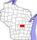
Dakota is a town, as well as an unincorporated community in Waushara County, Wisconsin, United States. The town took its name from the community of the same name, which was platted for the community's first postmaster, Chapin M. Seeley, in 1853. It was likely named for the Dakota Territory which was in the news at the time. [3] The unincorporated community of Bannerman is also located in the town. Bannerman was originally named Bannerman Junction in 1901 as a stop on the Chicago & Northwestern Railroad. It was named for William and John Bannerman, two Scottish men who owned the area's granite company. [4]

Contents

Geography

According to the United States Census Bureau, the town has a total area of 33.8 square miles (87.4 km2). 33.2 square miles (85.9 km2) of it is land and 0.6 square miles (1.5 km2) of it (1.75%) is water.

Demographics

As of the census [2] of 2000, there were 1,259 people, 493 households, and 356 families residing in the town. The population density was 38.0 inhabitants per square mile (14.7/km2). There were 693 housing units at an average density of 20.9 per square mile (8.1/km2). The racial makeup of the town was 93.33% White, 0.16% Native American, 0.40% Asian, 0.08% Pacific Islander, 5.40% from other races, and 0.64% from two or more races. Hispanic or Latino of any race were 8.66% of the population.

There were 493 households, out of which 31.8% had children under the age of 18 living with them, 64.3% were married couples living together, 4.9% had a female householder with no husband present, and 27.6% were non-families. 22.5% of all households were made up of individuals, and 10.3% had someone living alone who was 65 years of age or older. The average household size was 2.55 and the average family size was 2.97.

In the town, the population was spread out, with 26.6% under the age of 18, 6.4% from 18 to 24, 25.4% from 25 to 44, 24.9% from 45 to 64, and 16.6% who were 65 years of age or older. The median age was 40 years. For every 100 females, there were 107.4 males. For every 100 females age 18 and over, there were 100.9 males.

The median income for a household in the town was $34,931, and the median income for a family was $37,000. Males had a median income of $30,208 versus $19,438 for females. The per capita income for the town was $18,401. About 7.6% of families and 12.4% of the population were below the poverty line, including 22.3% of those under age 18 and 3.6% of those age 65 or over.

Related Research Articles

<span class="mw-page-title-main">Colburn, Adams County, Wisconsin</span> Town in Wisconsin, United States

Colburn is a town in Adams County in the U.S. state of Wisconsin. The population was 223 at the 2010 census. The town was most likely named for Sherman Colburn, who immigrated to Wisconsin from Vermont in 1855 and became a farmer in the area.

<span class="mw-page-title-main">Eileen, Wisconsin</span> Town in Wisconsin, United States

Eileen is a town in Bayfield County, Wisconsin, United States. The population was 681 at the 2010 census. The unincorporated community of Ashland Junction is located in the town.

<span class="mw-page-title-main">La Follette, Wisconsin</span> Town in Wisconsin, United States

La Follette is a town in Burnett County in the U.S. state of Wisconsin. The population was 536 at the 2010 census. The unincorporated communities of Coomer and Hertel are located in the town.

<span class="mw-page-title-main">Hendren, Wisconsin</span> Town in Wisconsin, United States

Hendren is a town in Clark County in the U.S. state of Wisconsin. The population was 499 at the 2010 census. The unincorporated communities of Tioga and Willard are located in the town.

<span class="mw-page-title-main">Haney, Wisconsin</span> Town in Wisconsin, United States

Haney is a town in Crawford County, Wisconsin, United States. The population was 309 at the 2010 census. The unincorporated communities of Barnum and Petersburg are located within the town.

<span class="mw-page-title-main">Dunkirk, Wisconsin</span> Town in Wisconsin, United States

The Town of Dunkirk is located in Dane County, Wisconsin, United States. The population was 2,053 at the 2000 census. The unincorporated community of Hanerville, which was named for James Haner, who had moved from Easton, New York in 1844, is located in the town.

<span class="mw-page-title-main">Hubbard, Dodge County, Wisconsin</span> Town in Wisconsin, United States

Hubbard is a town in Dodge County, Wisconsin, United States. The population was 1,643 at the 2000 census. The unincorporated community of Neda is located in the town. The town is named for Henry Hubbard, the governor of New Hampshire from 1842 to 1844.

<span class="mw-page-title-main">Clifton, Grant County, Wisconsin</span> Town in Wisconsin, United States

Clifton is a town in Grant County, Wisconsin, United States. The population was 304 at the 2000 census. The unincorporated community of Annaton is located in the town. The town was probably named for Bosman Clifton, a community and religious benefactor who came from Delaware.

<span class="mw-page-title-main">Clyde, Wisconsin</span> Town in Wisconsin, United States

Clyde is a town in Iowa County, Wisconsin, United States. The population was 322 at the 2000 census. The unincorporated community of Clyde is located in the town. The town was named by Seth Champion, a director of the Kewaunee, Green Bay & Western railroad in the 1890s, for his son Clyde.

<span class="mw-page-title-main">Koshkonong, Wisconsin</span> Town in Wisconsin, United States

Koshkonong is a town in Jefferson County, Wisconsin, United States. The population was 3,763 at the 2020 census. The town entirely surrounds the city of Fort Atkinson. The unincorporated communities of Koshkonong Mounds and Vinnie Ha Ha are located in the town. The unincorporated communities of Blackhawk Island and Koshkonong, as well as The Census-designated place of Lake Koshkonong are also located partially in the town.

<span class="mw-page-title-main">Burns, Wisconsin</span> Town in Wisconsin, United States

Burns is a town in La Crosse County, Wisconsin, United States. The population was 949 at the 2010 census. It is part of the La Crosse, Wisconsin Metropolitan Statistical Area. The unincorporated communities of Burns and Burns Corners are located in the town.

<span class="mw-page-title-main">Franzen, Wisconsin</span> Town in Wisconsin, United States

Franzen is a town in Marathon County, Wisconsin, United States. It is part of the Wausau, Wisconsin Metropolitan Statistical Area. The population was 578 at the 2010 census. The unincorporated communities of Galloway and Holt are located in the town.

<span class="mw-page-title-main">Harris, Wisconsin</span> Town in Wisconsin, United States

Harris is a town located in Marquette County, Wisconsin. According to the 2000 census, the town had a total population of 729. The unincorporated community of Harrisville is located in the town. Both the community and the town were named for James Harris, who became the first postmaster when the community's post office opened in March 1851. The village of Westfield is adjacent to the town.

<span class="mw-page-title-main">Wells, Wisconsin</span> Town in Wisconsin, United States

Wells is a town in Monroe County, Wisconsin. The population was 529 at the time of the 2000 census. The unincorporated community of Farmers Valley is located partially in the town. The town was named for James Wells, a prominent early settler and the first town chair.

<span class="mw-page-title-main">How, Wisconsin</span> Town in Wisconsin, United States

How is a town in Oconto County, Wisconsin, United States. The population was 563 at the 2000 census. The unincorporated community of Hayes is located in the town. The town is named for Calvin F. How, Jr., an insurance and banking executive.

<span class="mw-page-title-main">Maple Valley, Wisconsin</span> Town in Wisconsin, United States

Maple Valley is a town in Oconto County, Wisconsin, United States. The population was 670 at the 2000 census.

<span class="mw-page-title-main">Hackett, Wisconsin</span> Town in Wisconsin, United States

Hackett is a town in Price County, Wisconsin, United States. The population was 202 at the 2000 census. The unincorporated community of Worcester is located in the town. The town was named for Ephraim L. Hackett who owned lumber interests in the area.

<span class="mw-page-title-main">Cady, Wisconsin</span> Town in Wisconsin, United States

Cady is a town in St. Croix County, Wisconsin, United States. The population was 880 at the 2020 census, up from 821 in the 2010 census and 710 at the 2000 census. The unincorporated community of Hatchville is located partially in the town.

<span class="mw-page-title-main">La Grange, Walworth County, Wisconsin</span> Town in Wisconsin, United States

La Grange is a town in Walworth County, Wisconsin, United States. The population was 2,472 at the 2020 census. The unincorporated communities of Heart Prairie, La Grange, Lauderdale, Lauderdale Lakes, and Lauderdale Shores are located in the town.

<span class="mw-page-title-main">Larrabee, Wisconsin</span> Town in Wisconsin, United States

Larrabee is a town in Waupaca County, Wisconsin, United States. The population was 1,301 at the 2000 census. The unincorporated community of Buckbee is located in the town.

References

  1. 1 2 U.S. Geological Survey Geographic Names Information System: Dakota, Wisconsin
  2. 1 2 "U.S. Census website". United States Census Bureau . Retrieved January 31, 2008.
  3. Callary, Edward (2016). Place Names of Wisconsin (1st ed.). Madison, Wisconsin: University of Wisconsin Press. p. 69. ISBN   978-0-299-30964-0.
  4. Callary, Edward (2016). Place Names of Wisconsin (1st ed.). Madison, Wisconsin: University of Wisconsin Press. p. 20. ISBN   978-0-299-30964-0.

43°59′25″N89°21′23″W / 43.99028°N 89.35639°W / 43.99028; -89.35639