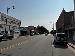
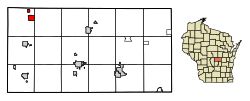
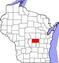
Plainfield, Wisconsin | |
---|---|
![]() Downtown Plainfield in July 2024 | |
![]() Location of Plainfield in Waushara County, Wisconsin. | |
Coordinates: 44°11′57″N89°32′16″W / 44.19917°N 89.53778°W | |
Country | ![]() |
State | ![]() |
County | Waushara |
Area | |
• Total | 1.56 sq mi (4.03 km2) |
• Land | 1.56 sq mi (4.03 km2) |
• Water | 0.00 sq mi (0.00 km2) |
Elevation | 1,109 ft (338 m) |
Population | |
• Total | 862 |
• Estimate (2019) [4] | 836 |
• Density | 536.59/sq mi (207.20/km2) |
Time zone | UTC-6 (Central (CST)) |
• Summer (DST) | UTC-5 (CDT) |
Area code | 715 & 534 |
FIPS code | 55-63175 [5] |
GNIS feature ID | 1571576 [2] |
Plainfield is a village in Waushara County, Wisconsin, United States. The village is located almost entirely within the Town of Plainfield. A tiny portion extends into adjacent Town of Oasis. The population was 897 at the 2010 census.
When first settled in 1848, the area was called Norwich. Elijah C. Waterman laid out the village in 1849, building mills and attracting new settlers by offering free lots. Waterman later became the village's first postmaster and changed the name to honor his hometown of Plainfield, Vermont. [6]
Plainfield is located at 44°12′42″N89°29′34″W / 44.21167°N 89.49278°W (44.211943, -89.492803). [7] According to the United States Census Bureau, the village has a total area of 1.61 square miles (4.17 km2), all of it land. [8]
Census | Pop. | Note | %± |
---|---|---|---|
1880 | 348 | — | |
1890 | 459 | 31.9% | |
1900 | 728 | 58.6% | |
1910 | 723 | −0.7% | |
1920 | 580 | −19.8% | |
1930 | 537 | −7.4% | |
1940 | 571 | 6.3% | |
1950 | 680 | 19.1% | |
1960 | 660 | −2.9% | |
1970 | 642 | −2.7% | |
1980 | 813 | 26.6% | |
1990 | 839 | 3.2% | |
2000 | 899 | 7.2% | |
2010 | 862 | −4.1% | |
2019 (est.) | 836 | [4] | −3.0% |
U.S. Decennial Census [9] |
At the 2010 census, there were 862 people, 315 households, and 223 families living in the village. The population density was 535.4 inhabitants per square mile (206.7/km2). There were 371 housing units at an average density of 230.4 per square mile (89.0/km2). The racial makeup of the village was 90.5% White, 0.3% African American, 0.1% Native American, 0.5% Asian, 7.3% from other races, and 1.3% from two or more races. Hispanic or Latino of any race were 18.0%. [3]
Of the 315 households 39.7% had children under the age of 18 living with them, 55.2% were married couples living together, 9.5% had a female householder with no husband present, 6.0% had a male householder with no wife present, and 29.2% were non-families. 26.7% of households were one person and 12.1% were one person aged 65 or older. The average household size was 2.74 and the average family size was 3.35.
The median age in the village was 34.4 years. 29.4% of residents were under the age of 18; 9.2% were between the ages of 18 and 24; 25.2% were from 25 to 44; 24.2% were from 45 to 64; and 12.1% were 65 or older. The gender makeup of the village was 49.0% male and 51.0% female.
At the 2000 census, there were 899 people, 342 households, and 230 families living in the village. The population density was 692.9 people per square mile (267.0/km2). There were 373 housing units at an average density of 287.5 per square mile (110.8/km2). The racial makup of the village was 92.21% White, 0.11% Black or African American, 1.11% Asian, 6.23% from other races, and 0.33% from two or more races. Some 17.91% of the population were Hispanic or Latino of any race. [5] Of the 342 households 34.8% had children under the age of 18 living with them, 50.3% were married couples living together, 12.0% had a female householder with no husband present, and 32.5% were non-families. About 28.7% of households were one person and 14.6% were one person aged 65 or older. The average household size was 2.60 and the average family size was 3.19.
The age distribution was 28.9% under the age of 18, 9.0% from 18 to 24, 28.4% from 25 to 44, 18.7% from 45 to 64, and 15.0% 65 or older. The median age was 34 years. For every 100 females, there were 97.1 males. For every 100 females age 18 and over, there were 93.6 males.
The median household income was $36,328 and the median family income was $43,977. Males had a median income of $29,688 versus $19,750 for females. The per capita income for the village was $15,563. About 8.0% of families and 11.4% of the population were below the poverty line, including 10.2% of those under age 18 and 14.0% of those age 65 or over.
Parts of the Werner Herzog film Stroszek were shot nearby.
Fall River is a village in Columbia County, Wisconsin, United States, along the North Fork of the Crawfish River. The population was 1,712 at the 2010 census. It is part of the Madison Metropolitan Statistical Area.
Mount Sterling is a village in Crawford County, Wisconsin, United States. The population was 211 at the 2010 census.
Hollandale is a village in Iowa County, Wisconsin, United States. The population was 306 at the 2020 census. It is part of the Madison Metropolitan Statistical Area.
Brokaw is a former village in Marathon County, Wisconsin, United States. It is part of the Wausau, Wisconsin Metropolitan Statistical Area. The population was 251 at the 2010 census. Brokaw merged with the village of Maine, Wisconsin on October 1, 2018.
Whiting is a village in Portage County, Wisconsin, United States and is a suburb of Stevens Point. It is included in the Stevens Point Micropolitan Statistical Area. The population was 1,601 at the 2020 census.
Big Falls is a village in Waupaca County, Wisconsin, United States. The population was 61 at the 2010 census.
Ogdensburg is a village in Waupaca County, Wisconsin, United States. The population was 185 at the 2010 census.
Redgranite is a village in Waushara County, Wisconsin, United States. The population was 2,149 at the 2010 census.
Wild Rose is a village in Waushara County, Wisconsin, United States. The population was 725 at the 2010 census.
Biron is a village in Wood County, Wisconsin, United States. The population was 839 at the 2010 census. It is the site of ND Paper's Biron Mill.
Birnamwood is a village in Marathon and Shawano counties in the U.S. state of Wisconsin. It is part of the Wausau, Wisconsin Metropolitan Statistical Area. The population was 818 at the 2010 census. Of this, 802 were in Shawano County, and 16 were in Marathon County. The village is located mostly within the town of Birnamwood in Shawano County; only a small portion extends into the town of Norrie in adjacent Marathon County.
Cross Plains is a village in Dane County, Wisconsin, United States. The population was 4,104 at the 2020 census. The village is located partially within the Town of Cross Plains. It is part of the Madison Metropolitan Statistical Area.
Marquette is a village in Green Lake County, Wisconsin, United States. The population was 150 at the 2010 census. The village is located within the Town of Marquette. Marquette uses the postal code 53947.
Elderon is a village in Marathon County, Wisconsin, United States. It is part of the Wausau, Wisconsin Metropolitan Statistical Area. The population was 179 at the 2010 census.
Almond is a village in Portage County, Wisconsin, United States. The population was 448 at the 2010 census.
Aniwa is a village in Shawano County, Wisconsin, United States. The population was 260 at the 2010 census. The village is located within the Town of Aniwa. U.S. Route 45 runs north–south through the village.
Scandinavia is a village in the Town of Scandinavia in Waupaca County, Wisconsin, United States. The population was 328 at the 2010 census.
Hancock is a village in Waushara County, Wisconsin, United States. The population was 417 at the 2010 census. The village is located within the Town of Hancock.
Plainfield is a town in Waushara County, Wisconsin, United States. The population was 533 at the 2000 census. The village of Plainfield is surrounded by the town. The ghost town of West Plainfield is located in the town.
Lohrville is a village in Waushara County, Wisconsin, United States. The population was 402 at the 2010 census.