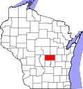
Warren, Wisconsin | |
---|---|
Coordinates: 44°2′2″N89°4′42″W / 44.03389°N 89.07833°W | |
Country | United States |
State | Wisconsin |
County | Waushara |
Area | |
• Total | 32.6 sq mi (84.5 km2) |
• Land | 32.5 sq mi (84.3 km2) |
• Water | 0.1 sq mi (0.2 km2) |
Elevation | 778 ft (237 m) |
Population (2000) | |
• Total | 675 |
• Density | 20.7/sq mi (8.0/km2) |
Time zone | UTC-6 (Central (CST)) |
• Summer (DST) | UTC-5 (CDT) |
FIPS code | 55-83425 [2] |
GNIS feature ID | 1584346 [1] |
Warren is a town in Waushara County, Wisconsin, United States. The population was 675 at the 2000 census. The ghost town of Rodney was located partially in the town.
According to the United States Census Bureau, the town has a total area of 32.6 square miles (84.5 km2), of which, 32.5 square miles (84.3 km2) of it is land and 0.1 square miles (0.2 km2) of it (0.28%) is water.
As of the census [2] of 2000, there were 675 people, 261 households, and 192 families residing in the town. The population density was 20.7 people per square mile (8.0/km2). There were 334 housing units at an average density of 10.3 per square mile (4.0/km2). The racial makeup of the town was 98.37% White, 0.15% Native American, 0.15% Asian, 0.74% from other races, and 0.59% from two or more races. Hispanic or Latino of any race were 2.22% of the population.
There were 261 households, out of which 29.5% had children under the age of 18 living with them, 65.1% were married couples living together, 4.2% had a female householder with no husband present, and 26.1% were non-families. 20.3% of all households were made up of individuals, and 10.3% had someone living alone who was 65 years of age or older. The average household size was 2.59 and the average family size was 2.95.
In the town, the population was spread out, with 24.4% under the age of 18, 6.7% from 18 to 24, 26.1% from 25 to 44, 26.7% from 45 to 64, and 16.1% who were 65 years of age or older. The median age was 40 years. For every 100 females, there were 98.5 males. For every 100 females age 18 and over, there were 105.6 males.
The median income for a household in the town was $38,438, and the median income for a family was $43,833. Males had a median income of $28,750 versus $20,000 for females. The per capita income for the town was $15,672. About 3.2% of families and 7.6% of the population were below the poverty line, including 4.6% of those under age 18 and 14.6% of those age 65 or over.
Stoneham is a town in Oxford County, Maine, United States. The population was 261 at the 2020 census.
Coalport is a borough in Clearfield County, Pennsylvania, United States. The population was 425 at the 2020 census.
Aurora is a town in Waushara County, Wisconsin, United States. The population was 971 at the 2000 census. The unincorporated community of Auroraville is located in the town, and the city of Berlin is adjacent to the town.
Bloomfield is a town in Waushara County, Wisconsin, United States. The population was 1,018 at the 2000 census. The census-designated place of Tustin is located in the town. The unincorporated communities of Brushville and West Bloomfield are also located in the town. The unincorporated community of Metz is also located partially in the town.
Deerfield is a town in Waushara County, Wisconsin, United States. The population was 629 at the 2000 census.
Leon is a town in Waushara County, Wisconsin, United States. The population was 1,281 at the 2000 census. The census-designated place of Pine River is located in the town. The village of Redgranite is located adjacent to the town.
Marion is a town in Waushara County, Wisconsin, United States. The population was 2,065 at the 2000 census. The unincorporated communities of Silver Lake and Spring Lake are located in the town. The ghost town of Rodney was also located partially in the town.
Mount Morris is a town in central Waushara County, Wisconsin, United States. The population was 1,092 at the 2000 census. The unincorporated community of Mount Morris is located in the town.
Oasis is a town in Waushara County, Wisconsin, United States. The population was 405 at the 2000 census.
Poy Sippi is a town in Waushara County, Wisconsin, United States. The population was 972 at the 2000 census. The census-designated place of Poy Sippi is located in the town. The unincorporated communities of Borth and Fountain Valley are also located in the town.
Richford is a town in Waushara County, Wisconsin, United States. The population was 588 at the 2000 census.
Rose is a town in Waushara County, Wisconsin, United States. The population was 595 at the 2000 census. The unincorporated community of Heffron is located partially in the town.
Saxeville is a town in Waushara County, Wisconsin, United States. The population was 974 at the 2000 census. The unincorporated community of Saxeville is located in the town.
Springwater is a town in Waushara County, Wisconsin, United States. The population was 1,389 at the 2000 census.
Wild Rose is a village in Waushara County, Wisconsin, United States. The population was 725 at the 2010 census.
Coloma is a town in Waushara County, Wisconsin, United States. The population was 748 at the 2000 census. The coordinates shown are for the Village of Coloma, located within the town.
Hancock founded in 1850 is a town in Waushara County, Wisconsin, United States. The population was 531 at the 2000 census. The Village of Hancock is located within the town.
Plainfield is a town in Waushara County, Wisconsin, United States. The population was 533 at the 2000 census. The village of Plainfield is surrounded by the town. The ghost town of West Plainfield is located in the town.
Wautoma is a town in Waushara County, Wisconsin, United States. The population was 1,312 at the 2000 census.
Wautoma is a city and the county seat of Waushara County, Wisconsin, United States. The population was 2,218 at the 2010 census.