Oasis, Wisconsin

Last updated

Oasis, Wisconsin
WIMap-doton-Oasis.png
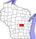
Location of Oasis, Wisconsin
Coordinates: 44°11′48″N89°25′15″W / 44.19667°N 89.42083°W / 44.19667; -89.42083
Country Flag of the United States.svg  United States
State Flag of Wisconsin.svg  Wisconsin
County Waushara
Area
  Total35.3 sq mi (91.4 km2)
  Land35.0 sq mi (90.7 km2)
  Water0.3 sq mi (0.7 km2)
Elevation
[1]
1,129 ft (344 m)
Population
 (2000)
  Total405
  Density11.6/sq mi (4.5/km2)
Time zone UTC-6 (Central (CST))
  Summer (DST) UTC-5 (CDT)
FIPS code 55-59225 [2]
GNIS feature ID1583846 [1]

Oasis is a town in Waushara County, Wisconsin, United States. The population was 405 at the 2000 census.

Contents

Geography

According to the United States Census Bureau, the town has a total area of 35.3 square miles (91.4 km2), of which, 35.0 square miles (90.7 km2) of it is land and 0.3 square miles (0.7 km2) of it (0.76%) is water.

Demographics

As of the census [2] of 2000, there were 405 people, 152 households, and 112 families residing in the town. The population density was 11.6 people per square mile (4.5/km2). There were 258 housing units at an average density of 7.4 per square mile (2.8/km2). The racial makeup of the town was 96.30% White, 0.25% African American, 0.49% Native American, 0.49% Asian, 1.48% from other races, and 0.99% from two or more races. Hispanic or Latino of any race were 2.72% of the population.

There were 152 households, out of which 33.6% had children under the age of 18 living with them, 66.4% were married couples living together, 4.6% had a female householder with no husband present, and 25.7% were non-families. 21.1% of all households were made up of individuals, and 11.8% had someone living alone who was 65 years of age or older. The average household size was 2.66 and the average family size was 3.09.

In the town, the population was spread out, with 27.2% under the age of 18, 6.9% from 18 to 24, 24.4% from 25 to 44, 25.9% from 45 to 64, and 15.6% who were 65 years of age or older. The median age was 39 years. For every 100 females, there were 99.5 males. For every 100 females age 18 and over, there were 100.7 males.

The median income for a household in the town was $38,472, and the median income for a family was $41,563. Males had a median income of $28,409 versus $20,417 for females. The per capita income for the town was $16,480. About 3.5% of families and 5.9% of the population were below the poverty line, including none of those under age 18 and 6.1% of those age 65 or over.

Related Research Articles

<span class="mw-page-title-main">New Allakaket, Alaska</span> CDP in Alaska, United States

New Allakaket was a census-designated place (CDP) in Yukon-Koyukuk Census Area, Alaska, United States. The population was 66 at the 2010 census, up from 36 in 2000. In March 2015, neighboring Allakaket annexed New Allakaket.

<span class="mw-page-title-main">Center Point, Indiana</span> Town in Indiana, United States

Center Point is a town in Sugar Ridge Township, Clay County, Indiana, United States. The population was 242 at the 2010 census. It is part of the Terre Haute Metropolitan Statistical Area.

<span class="mw-page-title-main">New Sharon, Maine</span> Town in the state of Maine, United States

New Sharon is a town in Franklin County, Maine, incorporated in 1794. The population was 1,458 at the 2020 census. The town is roughly bisected by the Sandy River, a tributary of the Kennebec River.

Stacyville is a town in Penobscot County, Maine, United States, in the foothills of Mount Katahdin. The population was 380 at the 2020 census.

<span class="mw-page-title-main">Belmont, Maine</span> Town in the state of Maine, United States

Belmont is a town in Waldo County, Maine, United States. The population was 976 at the 2020 census. It was originally known as Green Plantation. The squatters who lived there would, when alerted to the impending arrival of law officers, dress as Indians and then ignore the officers.

<span class="mw-page-title-main">Manhattan, Montana</span> Town in Montana, United States

Manhattan is a town in Gallatin County, Montana, United States. The population was 2,086 at the 2020 census. It is part of the 'Bozeman Micropolitan Statistical Area'.

<span class="mw-page-title-main">Fairview, Montana</span> Town in Montana, United States

Fairview is a town in Richland County, Montana, United States. The population was 896 at the 2020 census. The town is directly on the North Dakota border. Fairview incorporated in 1913.

<span class="mw-page-title-main">South Solon, Ohio</span> Village in Ohio, United States

South Solon is a village in Madison County, Ohio, United States. The population was 329 at the 2020 census. Despite their similar names, South Solon is not adjacent to the city of Solon, Ohio, a suburb of Cleveland in Cuyahoga County. The two towns are approximately 170 miles (270 km) apart.

<span class="mw-page-title-main">Oakvale, West Virginia</span> Town in West Virginia, United States

Oakvale is a town in Mercer County, West Virginia, United States, along the East River. The population was 137 at the 2020 census. It is part of the Bluefield, WV-VA micropolitan area which has a population of 107,578.

<span class="mw-page-title-main">Reedy, West Virginia</span> Town in West Virginia, United States

Reedy is a town in Roane County, West Virginia, United States. The population was 152 at the 2020 census.

<span class="mw-page-title-main">Pine Grove, West Virginia</span> Town in West Virginia, United States

Pine Grove is a town in Wetzel County, West Virginia, United States. The population was 363 at the 2020 census. The community was named for a grove of pine trees near the original town site.

Sherwood is a town in Clark County in the U.S. state of Wisconsin. The population was 252 at the 2000 census. The unincorporated community of Nevins is located in the town.

<span class="mw-page-title-main">Fairwater, Wisconsin</span> Village in Wisconsin, United States

Fairwater is a village in Fond du Lac County, Wisconsin, United States. The population was 371 at the 2010 census. The town of Metomen surrounds the village.

<span class="mw-page-title-main">Medary, Wisconsin</span> Town in Wisconsin, United States

Medary is a town in La Crosse County, Wisconsin, United States. The population was 1,461 at the 2010 census. It is part of the La Crosse, Wisconsin Metropolitan Statistical Area. The unincorporated community of Medary is located in the town.

<span class="mw-page-title-main">Bevent, Wisconsin</span> Town in Wisconsin, United States

Bevent is a town in Marathon County, Wisconsin, United States. It is part of the Wausau, Wisconsin Metropolitan Statistical Area. The population was 1,118 at the 2010 census. The unincorporated community of Shantytown is located in the town. The unincorporated community of Bevent is also located partially in the town.

<span class="mw-page-title-main">Ringle, Wisconsin</span> Town in Wisconsin, United States

Ringle is a town in Marathon County, Wisconsin, United States. It is part of the Wausau (WI) Metropolitan Statistical Area. The population was 1,711 at the 2010 census. The unincorporated community of Ringle is located in the town.

<span class="mw-page-title-main">Alden, Wisconsin</span> Town in Wisconsin, United States

Alden is a town in Polk County, Wisconsin, United States. The population was 2,615 at the 2000 Census. The unincorporated community of Little Falls is located in the town.

<span class="mw-page-title-main">Wilkinson, Wisconsin</span> Town in Wisconsin, United States

Wilkinson is a town in Rusk County, Wisconsin, United States. The population was 66 at the 2000 census.

<span class="mw-page-title-main">Barronett, Wisconsin</span> Town in Wisconsin, United States

Barronett is a town in Washburn County, Wisconsin, United States. The population was 405 at the 2000 census.

<span class="mw-page-title-main">Bass Lake, Washburn County, Wisconsin</span> Town in Wisconsin, United States

Bass Lake is a town in Washburn County, Wisconsin, United States. The population was 535 at the 2000 census.

References

  1. 1 2 U.S. Geological Survey Geographic Names Information System: Oasis, Wisconsin
  2. 1 2 "U.S. Census website". United States Census Bureau . Retrieved January 31, 2008.