Coloma, Wisconsin

Last updated

Coloma, Wisconsin
Coloma Wisconsin Downtown Looking West WIS21.jpg
Looking west in downtown Coloma
Waushara County Wisconsin Incorporated and Unincorporated areas Coloma Highlighted.svg
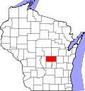
Location of Coloma in Waushara County, Wisconsin.
Coordinates: 44°1′26″N89°32′2″W / 44.02389°N 89.53389°W / 44.02389; -89.53389
Country Flag of the United States.svg  United States
State Flag of Wisconsin.svg  Wisconsin
County Waushara
Area
[1]
  Total1.49 sq mi (3.85 km2)
  Land1.49 sq mi (3.85 km2)
  Water0.00 sq mi (0.00 km2)
Elevation
[2]
1,106 ft (337 m)
Population
 (2010) [3]
  Total450
  Estimate 
(2019) [4]
448
  Density301.48/sq mi (116.37/km2)
Time zone UTC-6 (Central (CST))
  Summer (DST) UTC-5 (CDT)
zip code
Area code Area code 715
FIPS code 55-16400 [5]
GNIS feature ID1583003 [2]

Coloma is a village in Waushara County, Wisconsin, United States. The population was 450 at the 2010 census. The village is located within the Town of Coloma. Coloma is home of the annual Coloma Chicken Chew, held at the end of June.

Contents

History

The Coloma area was first settled in 1849 by John Drake and a man named Stowe. Stowe stole lumber Drake left in the area when Drake had to leave due to a family illness. Stowe built a tavern with the timber, leaving Drake to build his tavern out of rough hewn logs. [6]

By 1875, the area was known as Ross Corners, after the local postmaster. A railroad between Stevens Point and Portage was soon built, coming through four miles to the east at a spot called Coloma Station. The post office was moved from Ross Corners to Coloma Station, and Ross Corners soon became known as Coloma Corners. [6]

Geography

Coloma is located at 44°02′00″N89°31′16″W / 44.033421°N 89.521077°W / 44.033421; -89.521077 (44.033421, -89.521077). [7]

According to the United States Census Bureau, the village has a total area of 1.46 square miles (3.78 km2), all of it land. [8]

Glover Bluff crater, a meteor crater, is located about 4 miles south of Coloma.

Demographics

Historical population
CensusPop.Note
1880 74
1940 308
1950 3389.7%
1960 312−7.7%
1970 3367.7%
1980 3679.2%
1990 3834.4%
2000 46120.4%
2010 450−2.4%
2019 (est.)448 [4] −0.4%
U.S. Decennial Census [9]
Looking west at the sign for Coloma Coloma Wisconsin Sign Looking West WIS 21.jpg
Looking west at the sign for Coloma

2010 census

As of the census [3] of 2010, there were 450 people, 184 households, and 120 families residing in the village. The population density was 308.2 inhabitants per square mile (119.0/km2). There were 214 housing units at an average density of 146.6 per square mile (56.6/km2). The racial makeup of the village was 100.0% White. Hispanic or Latino of any race were 0.9% of the population.

There were 184 households, of which 33.7% had children under the age of 18 living with them, 46.7% were married couples living together, 10.3% had a female householder with no husband present, 8.2% had a male householder with no wife present, and 34.8% were non-families. 29.3% of all households were made up of individuals, and 20.1% had someone living alone who was 65 years of age or older. The average household size was 2.45 and the average family size was 2.94.

The median age in the village was 39.6 years. 26% of residents were under the age of 18; 6.8% were between the ages of 18 and 24; 22.9% were from 25 to 44; 25.1% were from 45 to 64; and 19.1% were 65 years of age or older. The gender makeup of the village was 50.2% male and 49.8% female.

2000 census

As of the census [5] of 2000, there were 461 people, 185 households, and 128 families residing in the village. The population density was 433.7 people per square mile (167.9/km2). There were 197 housing units at an average density of 185.3 per square mile (71.8/km2). The racial makeup of the village was 99.35% White, 0.22% Pacific Islander, 0.22% from other races, and 0.22% from two or more races. 3.04% of the population were Hispanic or Latino of any race.

There were 185 households, out of which 31.9% had children under the age of 18 living with them, 56.8% were married couples living together, 8.1% had a female householder with no husband present, and 30.8% were non-families. 27.6% of all households were made up of individuals, and 15.7% had someone living alone who was 65 years of age or older. The average household size was 2.42 and the average family size was 2.95.

In the village, the population was spread out, with 24.1% under the age of 18, 6.9% from 18 to 24, 27.1% from 25 to 44, 21.3% from 45 to 64, and 20.6% who were 65 years of age or older. The median age was 39 years. For every 100 females, there were 102.2 males. For every 100 females age 18 and over, there were 96.6 males.

The median income for a household in the village was $33,295, and the median income for a family was $38,542. Males had a median income of $30,350 versus $18,214 for females. The per capita income for the village was $14,766. About 11.9% of families and 16.7% of the population were below the poverty line, including 24.5% of those under age 18 and 18.2% of those age 65 or over.

Notable people

Images

Related Research Articles

<span class="mw-page-title-main">Doylestown, Wisconsin</span> Village in Wisconsin, United States

Doylestown is a village in Columbia County, Wisconsin, United States. The population was 297 at the 2010 census. It is part of the Madison Metropolitan Statistical Area.

<span class="mw-page-title-main">Taylor, Wisconsin</span> Village in Wisconsin, United States

Taylor is a village in Jackson County, Wisconsin, United States, along the Trempealeau River. The population was 484 at the 2020 census.

<span class="mw-page-title-main">Bowler, Wisconsin</span> Village in Wisconsin, United States

Bowler is a village in Shawano County, Wisconsin, United States. The population was 302 at the 2010 census.

<span class="mw-page-title-main">Eland, Wisconsin</span> Village in Wisconsin, United States

Eland is a village in Shawano County, Wisconsin, in the United States. The population was 202 at the 2010 census.

<span class="mw-page-title-main">Woodville, Wisconsin</span> Village in Wisconsin, United States

Woodville is a village in St. Croix County, Wisconsin, United States. The population was 1,344 at the 2010 census.

<span class="mw-page-title-main">Ogdensburg, Wisconsin</span> Village in Wisconsin, United States

Ogdensburg is a village in Waupaca County, Wisconsin, United States. The population was 185 at the 2010 census.

<span class="mw-page-title-main">Redgranite, Wisconsin</span> Village in Wisconsin, United States

Redgranite is a village in Waushara County, Wisconsin, United States. The population was 2,149 at the 2010 census.

<span class="mw-page-title-main">De Soto, Wisconsin</span> Village in Wisconsin, United States

De Soto is a village mostly in Vernon County but also in Crawford County in Wisconsin. The population was 287 at the 2010 census. Of this, 179 were in living in Vernon County, and 108 were living in Crawford County. The downtown and business area is located in Crawford County.

<span class="mw-page-title-main">Middle Village, Wisconsin</span> CDP in Wisconsin, United States

Middle Village is a census-designated place (CDP), in the towns of Menominee and Red Springs, in Menominee and Shawano counties in the U.S. state of Wisconsin. It does not have any legal status as an incorporated municipality. The population was 290 at the 2020 census.

<span class="mw-page-title-main">Viola, Wisconsin</span> Village in Wisconsin, United States

Viola is a village in Richland (mostly) and Vernon Counties in the U.S. state of Wisconsin, United States. The population was 699 at the 2010 census. Of this, 477 were in Richland County, and 222 were in Vernon County.

<span class="mw-page-title-main">Birnamwood, Wisconsin</span> Village in Wisconsin, United States

Birnamwood is a village in Marathon and Shawano counties in the U.S. state of Wisconsin. It is part of the Wausau, Wisconsin Metropolitan Statistical Area. The population was 818 at the 2010 census. Of this, 802 were in Shawano County, and 16 were in Marathon County. The village is located mostly within the town of Birnamwood in Shawano County; only a small portion extends into the town of Norrie in adjacent Marathon County. Until the 1990s, Birnamwood was home to the world's largest fiberglass badger. U.S. Route 45 runs through the village.

<span class="mw-page-title-main">Theresa, Wisconsin</span> Village in Wisconsin, United States

Theresa is a village in Dodge County, Wisconsin, United States. The population was 1,262 at the 2010 census. The village is within the Town of Theresa.

<span class="mw-page-title-main">Oakfield, Wisconsin</span> Village in Wisconsin, United States

Oakfield is a village in Fond du Lac County, Wisconsin, United States. The population was 1,052 at the 2020 census. The village is located within the Town of Oakfield.

<span class="mw-page-title-main">Mount Hope, Wisconsin</span> Village in Wisconsin, United States

Mount Hope is a village in Grant County, Wisconsin, United States. The population was 225 at the 2010 census. The village is located within the Town of Mount Hope.

<span class="mw-page-title-main">Linden, Wisconsin</span> Village in Wisconsin, United States

Linden is a village in Iowa County, Wisconsin, United States. The population was 549 at the 2010 census. The village is located within the Town of Linden.

<span class="mw-page-title-main">Gratiot, Wisconsin</span> Village in Wisconsin, United States

Gratiot is a village in Lafayette County, Wisconsin, United States. The population was 236 at the 2010 census. The village is surrounded by the Town of Gratiot.

<span class="mw-page-title-main">Elderon, Wisconsin</span> Village in Wisconsin, United States

Elderon is a village in Marathon County, Wisconsin, United States. It is part of the Wausau, Wisconsin Metropolitan Statistical Area. The population was 179 at the 2010 census.

<span class="mw-page-title-main">Pepin, Wisconsin</span> Village in Wisconsin, United States

Pepin is a village in Pepin County, Wisconsin, United States. The population was 837 at the 2010 census. The village is located within the Town of Pepin.

<span class="mw-page-title-main">Scandinavia, Wisconsin</span> Village in Wisconsin, United States

Scandinavia is a village in the Town of Scandinavia in Waupaca County, Wisconsin, United States. The population was 328 at the 2010 census.

<span class="mw-page-title-main">Coloma (town), Wisconsin</span> Town in Wisconsin, United States

Coloma is a town in Waushara County, Wisconsin, United States. The population was 748 at the 2000 census. The coordinates shown are for the Village of Coloma, located within the town.

References

  1. "2019 U.S. Gazetteer Files". United States Census Bureau. Retrieved August 7, 2020.
  2. 1 2 U.S. Geological Survey Geographic Names Information System: Coloma, Wisconsin
  3. 1 2 "U.S. Census website". United States Census Bureau . Retrieved November 18, 2012.
  4. 1 2 "Population and Housing Unit Estimates". United States Census Bureau. May 24, 2020. Retrieved May 27, 2020.
  5. 1 2 "U.S. Census website". United States Census Bureau . Retrieved January 31, 2008.
  6. 1 2 Floyd King & Sue Semrow, "Coloma History Archived 2011-07-25 at the Wayback Machine ", Coloma Historical Society.
  7. "US Gazetteer files: 2010, 2000, and 1990". United States Census Bureau. February 12, 2011. Retrieved April 23, 2011.
  8. "US Gazetteer files 2010". United States Census Bureau. Archived from the original on July 2, 2012. Retrieved November 18, 2012.
  9. "Census of Population and Housing". Census.gov. Retrieved June 4, 2015.
  10. 'Wisconsin Blue Book.' Biographical Sketch of Hellen M. Brooks, pg. 664
  11. 'Wisconsin Blue Book 1901,' Biographical Sketch of Thomas Fearne, pg. 731
  12. 'Wisconsin Blue Book 1921,' Biographical Sketch of Frank Poletz, pg. 493
  13. Hiram W. Roblier-death,' Stevens Point Daily Journal, October 30, 1897, pg. 7