Lohrville, Wisconsin

Last updated
Lohrville, Wisconsin
Waushara County Wisconsin Incorporated and Unincorporated areas Lohrville Highlighted.svg
Location of Lohrville in Waushara County, Wisconsin.
Coordinates: 44°2′19″N89°7′17″W / 44.03861°N 89.12139°W / 44.03861; -89.12139
Country Flag of the United States.svg  United States
State Flag of Wisconsin.svg  Wisconsin
County Waushara
Area
[1]
  Total1.22 sq mi (3.17 km2)
  Land1.21 sq mi (3.14 km2)
  Water0.01 sq mi (0.03 km2)
Elevation
[2]
804 ft (245 m)
Population
 (2010) [3]
  Total402
  Estimate 
(2019) [4]
389
  Density320.43/sq mi (123.69/km2)
Time zone UTC-6 (Central (CST))
  Summer (DST) UTC-5 (CDT)
FIPS code 55-45425 [5]
GNIS feature ID1568499 [2]

Lohrville is a village in Waushara County, Wisconsin, United States. The population was 402 at the 2010 census.

Contents

History

The American Granite Company started quarrying operations in what is now Lohrville in 1906. The village was named for the company's first president, Charles Lohr. Lohrville's population grew as workers moved to the area seeking employment in the quarries, and the Chicago and North Western Railway Company built a spur line to the quarries. The village incorporated in 1910. [6] [7]

By 1920, Lohrville had a population of 245, though by 1940 the population had declined to 191. [6] [8]

The railways has since been abandoned and converted to a rail trail called the Bannerman Trail. [7]

Geography

Lohrville is located at 44°2′19″N89°7′17″W / 44.03861°N 89.12139°W / 44.03861; -89.12139 (44.038700, -89.121266). [9]

According to the United States Census Bureau, the village has a total area of 1.24 square miles (3.21 km2), of which, 1.23 square miles (3.19 km2) of it is land and 0.01 square miles (0.03 km2) is water. [10]

Demographics

Historical population
CensusPop.Note
1920 245
1930 2626.9%
1940 191−27.1%
1950 2067.9%
1960 2259.2%
1970 213−5.3%
1980 33657.7%
1990 3689.5%
2000 40810.9%
2010 402−1.5%
2019 (est.)389 [4] −3.2%
U.S. Decennial Census [11]
Entering Lohrville Lohrville1.JPG
Entering Lohrville
Lohrville looking West Lohrville2.JPG
Lohrville looking West
Lohrville baseball field Lohrville3.JPG
Lohrville baseball field

2010 census

As of the census [3] of 2010, there were 402 people, 171 households, and 114 families living in the village. The population density was 326.8 inhabitants per square mile (126.2/km2). There were 198 housing units at an average density of 161.0 units per square mile (62.2 units/km2). The racial makeup of the village was 95.5% White, 0.5% African American, 1.7% Native American, 0.5% Asian, 1.0% from other races, and 0.7% from two or more races. Hispanic or Latino of any race were 4.0% of the population.

There were 171 households, of which 22.8% had children under the age of 18 living with them, 50.3% were married couples living together, 9.9% had a female householder with no husband present, 6.4% had a male householder with no wife present, and 33.3% were non-families. 26.9% of all households were made up of individuals, and 12.3% had someone living alone who was 65 years of age or older. The average household size was 2.35 and the average family size was 2.72.

The median age in the village was 45.4 years. 19.2% of residents were under the age of 18; 8.7% were between the ages of 18 and 24; 21.4% were from 25 to 44; 32.9% were from 45 to 64; and 17.9% were 65 years of age or older. The gender makeup of the village was 47.5% male and 52.5% female.

2000 census

As of the census [5] of 2000, there were 408 people, 168 households, and 122 families living in the village. The population density was 333.5 people per square mile (128.8 people/km2). There were 192 housing units at an average density of 156.9 units per square mile (60.6 units/km2). The racial makeup of the village was 96.81% White, 0.25% Native American, 1.23% from other races, and 1.72% from two or more races. Hispanic or Latino of any race were 2.21% of the population.

There were 168 households, out of which 26.2% had children under the age of 18 living with them, 59.5% were married couples living together, 7.7% had a female householder with no husband present, and 26.8% were non-families. 22.6% of all households were made up of individuals, and 8.9% had someone living alone who was 65 years of age or older. The average household size was 2.43 and the average family size was 2.80.

In the village, the population was spread out, with 23.5% under the age of 18, 5.6% from 18 to 24, 24.5% from 25 to 44, 26.2% from 45 to 64, and 20.1% who were 65 years of age or older. The median age was 42 years. For every 100 females, there were 102.0 males. For every 100 females age 18 and over, there were 105.3 males.

The median income for a household in the village was $34,479, and the median income for a family was $36,500. Males had a median income of $27,813 versus $22,000 for females. The per capita income for the village was $14,386. About 1.6% of families and 3.1% of the population were below the poverty line, including none of those under age 18 and 6.8% of those age 65 or over.

Related Research Articles

<span class="mw-page-title-main">Sardis City, Alabama</span> Town in Alabama, United States

Sardis City is a town in Etowah and Marshall counties in the U.S. state of Alabama. It is part of the Gadsden Metropolitan Statistical Area. It originally incorporated in May 1963 under the name of "Sardis". It became Sardis City in the 1980s. At the 2020 census, the population was 1,814.

<span class="mw-page-title-main">Lohrville, Iowa</span> City in Iowa, United States

Lohrville is a city in Calhoun County, Iowa, United States. The population was 381 at the time of the 2020 census.

New Vineyard is a town in Franklin County, Maine, United States. The population was 721 at the 2020 census.

<span class="mw-page-title-main">Neosho, Wisconsin</span> Village in Wisconsin, United States

Neosho is a village in Dodge County, Wisconsin, United States. The population was 574 at the 2010 census.

<span class="mw-page-title-main">Oliver, Wisconsin</span> Village in Wisconsin, United States

Oliver is a village in Douglas County, Wisconsin, United States. The population was 423 at the 2020 census.

<span class="mw-page-title-main">St. Cloud, Wisconsin</span> Village in Wisconsin, United States

St. Cloud is a village in Fond du Lac County, Wisconsin, United States, along the Sheboygan River. The population was 477 at the 2010 census. St. Cloud is part of The Holyland region in northeastern Fond du Lac County.

<span class="mw-page-title-main">Alma Center, Wisconsin</span> Village in Wisconsin, United States

Alma Center is a village in Jackson County, Wisconsin, United States. The population was 503 at the 2010 census. The village is located within the Town of Alma.

<span class="mw-page-title-main">Taylor, Wisconsin</span> Village in Wisconsin, United States

Taylor is a village in Jackson County, Wisconsin, United States, along the Trempealeau River. The population was 484 at the 2020 census.

<span class="mw-page-title-main">Pigeon Falls, Wisconsin</span> Village in Wisconsin, United States

Pigeon Falls is a village in Trempealeau County, Wisconsin, United States. The population was 411 at the 2010 census.

<span class="mw-page-title-main">Ontario, Wisconsin</span> Village in Wisconsin, United States

Ontario is a village in Vernon County, Wisconsin, United States. The population was 554 at the 2010 census.

<span class="mw-page-title-main">Dorchester, Wisconsin</span> Village in Wisconsin, United States

Dorchester is a village in Clark and Marathon counties in the U.S. state of Wisconsin, along the 45th parallel. It is part of the Wausau, Wisconsin Metropolitan Statistical Area. The population was 876 at the 2010 census. Of this, 871 were in Clark County, and only 5 were in Marathon County.

<span class="mw-page-title-main">Birnamwood, Wisconsin</span> Village in Wisconsin, United States

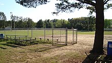
Birnamwood is a village in Marathon and Shawano counties in the U.S. state of Wisconsin. It is part of the Wausau, Wisconsin Metropolitan Statistical Area. The population was 818 at the 2010 census. Of this, 802 were in Shawano County, and 16 were in Marathon County. The village is located mostly within the town of Birnamwood in Shawano County; only a small portion extends into the town of Norrie in adjacent Marathon County. Until the 1990s, Birnamwood was home to the world's largest fiberglass badger. U.S. Route 45 runs through the village.

<span class="mw-page-title-main">Stockbridge, Wisconsin</span> Village in Wisconsin, United States

Stockbridge is a village in Calumet County, Wisconsin, United States. The population was 686 at the 2020 census. The village lies within the Town of Stockbridge.

<span class="mw-page-title-main">Superior (village), Wisconsin</span> Village in Wisconsin, United States

The Village of Superior is a village in Douglas County, Wisconsin, United States. The population was 664 at the 2010 census. The village is located within the Town of Superior and is located immediately south of and adjacent to the City of Superior.

<span class="mw-page-title-main">Melrose, Wisconsin</span> Village in Wisconsin, United States

Melrose is a village in Jackson County, Wisconsin, United States. The population was 503 at the 2010 census. The village is located within the Town of Melrose.

<span class="mw-page-title-main">Elderon, Wisconsin</span> Village in Wisconsin, United States

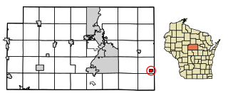
Elderon is a village in Marathon County, Wisconsin, United States. It is part of the Wausau, Wisconsin Metropolitan Statistical Area. The population was 179 at the 2010 census.

<span class="mw-page-title-main">Milltown, Wisconsin</span> Village in Wisconsin, United States

Milltown is a village in Polk County, Wisconsin, United States. The population was 917 at the 2010 census. The village is located within the Town of Milltown.

<span class="mw-page-title-main">Hawkins, Wisconsin</span> Village in Wisconsin, United States

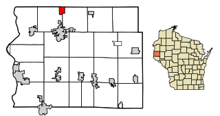
Hawkins is a village in Rusk County, Wisconsin, United States. The population was 305 at the 2010 census. The village is located within the Town of Hawkins.

<span class="mw-page-title-main">Aniwa, Wisconsin</span> Village in Wisconsin, United States

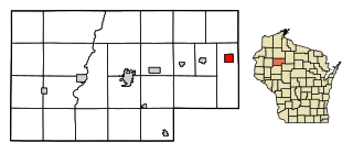
Aniwa is a village in Shawano County, Wisconsin, United States. The population was 260 at the 2010 census. The village is located within the Town of Aniwa. U.S. Route 45 runs north–south through the village.

<span class="mw-page-title-main">Star Prairie, Wisconsin</span> Village in Wisconsin, United States

Star Prairie is a village in St. Croix County in the U.S. state of Wisconsin. The population was 561 at the 2010 census. The village is located along the Apple River on the boundary between the Town of Star Prairie and the Town of Stanton.

References

  1. "2019 U.S. Gazetteer Files". United States Census Bureau. Retrieved August 7, 2020.
  2. 1 2 U.S. Geological Survey Geographic Names Information System: Lohrville, Wisconsin
  3. 1 2 "U.S. Census website". United States Census Bureau . Retrieved 2012-11-18.
  4. 1 2 "Population and Housing Unit Estimates". United States Census Bureau. May 24, 2020. Retrieved May 27, 2020.
  5. 1 2 "U.S. Census website". United States Census Bureau . Retrieved 2008-01-31.
  6. 1 2 "The History of Lohrville". The Village of Lohrville, Wisconsin. Retrieved March 20, 2014.
  7. 1 2 Crawford, Bob (1997). Walking Trails of Eastern and Central Wisconsin . University of Wisconsin Press. p.  265.
  8. Wisconsin Blue Book, 1950. State or Wisconsin. 1950. p. 466.
  9. "US Gazetteer files: 2010, 2000, and 1990". United States Census Bureau. 2011-02-12. Retrieved 2011-04-23.
  10. "US Gazetteer files 2010". United States Census Bureau. Archived from the original on 2012-01-25. Retrieved 2012-11-18.
  11. "Census of Population and Housing". Census.gov. Retrieved June 4, 2015.