Dalton Gardens, Idaho | |
---|---|
Coordinates: 47°44′0″N116°46′19″W / 47.73333°N 116.77194°W | |
Country | United States |
State | Idaho |
County | Kootenai |
Government | |
• Mayor | Dan Edwards [1] |
Area | |
• Total | 2.39 sq mi (6.18 km2) |
• Land | 2.38 sq mi (6.17 km2) |
• Water | 0.01 sq mi (0.01 km2) |
Elevation | 2,264 ft (690 m) |
Population | |
• Total | 2,335 |
• Estimate (2019) [4] | 2,410 |
• Density | 1,011.75/sq mi (390.67/km2) |
Time zone | UTC-8 (Pacific (PST)) |
• Summer (DST) | UTC-7 (PDT) |
ZIP code | 83815 |
Area code | 208 |
FIPS code | 16-20350 |
GNIS feature ID | 0396372 |
Website | daltongardens |
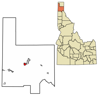
Dalton Gardens is a city in Kootenai County, Idaho, United States. It is considered a suburb of Coeur d'Alene and borders the city to the north and east. The city of Dalton Gardens is also part of the larger Spokane-Coeur d'Alene Combined Metropolitan Statistical Area which encompasses Kootenai County, Idaho. The population of Dalton Gardens was 2,335 at the time of the 2010 census. [5]
Dalton Gardens is located at 47°44′0″N116°46′19″W / 47.73333°N 116.77194°W (47.733397, -116.771940). [6]
According to the United States Census Bureau, the city has a total area of 2.32 square miles (6.01 km2), all land. [7]
Census | Pop. | Note | %± |
---|---|---|---|
1960 | 1,083 | — | |
1970 | 1,559 | 44.0% | |
1980 | 1,795 | 15.1% | |
1990 | 1,951 | 8.7% | |
2000 | 2,278 | 16.8% | |
2010 | 2,335 | 2.5% | |
2019 (est.) | 2,410 | [4] | 3.2% |
U.S. Decennial Census [8] |
As of the census [3] of 2010, there were 2,335 people, 883 households, and 689 families residing in the city. The population density was 1,006.5 inhabitants per square mile (388.6/km2). There were 917 housing units at an average density of 395.3 per square mile (152.6/km2). The racial makeup of the city was 96.8% White, 0.2% African American, 0.6% Native American, 0.4% Asian, 0.1% Pacific Islander, 0.6% from other races, and 1.3% from two or more races. Hispanic or Latino of any race were 3.2% of the population.
There were 883 households, of which 29.7% had children under the age of 18 living with them, 68.0% were married couples living together, 6.1% had a female householder with no husband present, 4.0% had a male householder with no wife present, and 22.0% were non-families. 17.7% of all households were made up of individuals, and 9.9% had someone living alone who was 65 years of age or older. The average household size was 2.64 and the average family size was 2.99.
The median age in the city was 48 years. 23.6% of residents were under the age of 18; 6.1% were between the ages of 18 and 24; 16.3% were from 25 to 44; 34.5% were from 45 to 64; and 19.4% were 65 years of age or older. The gender makeup of the city was 50.7% male and 49.3% female.
As of the census [9] of 2000, there were 2,278 people, 833 households, and 684 families residing in the city. The population density was 955.8 inhabitants per square mile (369.0/km2). There were 858 housing units at an average density of 360.0 per square mile (139.0/km2). The racial makeup of the city was 97.41% White, 0.04% African American, 0.53% Native American, 0.04% Asian, 0.13% Pacific Islander, 0.48% from other races, and 1.36% from two or more races. Hispanic or Latino of any race were 1.98% of the population.
There were 833 households, out of which 31.9% had children under the age of 18 living with them, 72.5% were married couples living together, 6.1% had a female householder with no husband present, and 17.8% were non-families. 15.4% of all households were made up of individuals, and 8.2% had someone living alone who was 65 years of age or older. The average household size was 2.73 and the average family size was 3.04.
In the city, the population was spread out, with 25.7% under the age of 18, 6.1% from 18 to 24, 21.7% from 25 to 44, 31.4% from 45 to 64, and 15.1% who were 65 years of age or older. The median age was 43 years. For every 100 females, there were 103.0 males. For every 100 females age 18 and over, there were 98.9 males.
The median income for a household in the city was $44,559, and the median income for a family was $47,083. Males had a median income of $41,696 versus $23,319 for females. The per capita income for the city was $21,521. About 3.3% of families and 3.4% of the population were below the poverty line, including 4.2% of those under age 18 and 1.3% of those age 65 or over.
Nez Perce County is a county located in the U.S. state of Idaho. As of the 2020 census, the population was 42,090. The county seat is Lewiston. The county is named after the Native American Nez Percé tribe. Nez Perce County is part of the Lewiston, Idaho–WA Metropolitan Statistical Area.
Garden City is a city in Ada County, Idaho. The population was 12,316 at the time of the 2020 census. Garden City is nearly surrounded by Boise but retains a separate municipal government.
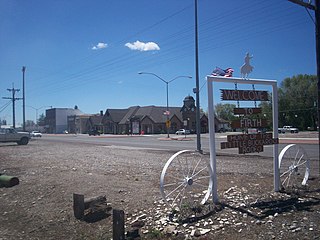
Council is a city in and the county seat of Adams County, Idaho, United States. The population was 839 at the 2010 census.
Tensed is a city in Benewah County, Idaho, United States. The population was 123 at the 2010 census, down from 126 in 2000. The city is within the Coeur d'Alene Reservation, and is accessed by U.S. Route 95, the state's primary north-south highway. The city is located about 1 mile (0.6 km) from the north entrance of McCroskey State Park.
Hope is a city in Bonner County, Idaho, United States. The population was 86 at the 2010 census.
Kootenai is a city in Bonner County, Idaho. The population was 678 at the 2010 census.
Melba is a city in Canyon County, Idaho. The population was 513 at the time of the 2010 census, up from 439 in 2000. It is part of the Boise metropolitan area.
Parma is a city in Canyon County, Idaho, United States. The population was 1,983 at the 2010 census, up from 1,771 in 2000. It is the fourth largest city in the county and the largest in the rural western portion. It is part of the Boise City–Nampa, Idaho Metropolitan Statistical Area.
Orofino is a city in and the county seat of Clearwater County, Idaho, United States, along Orofino Creek and the north bank of the Clearwater River. It is the major city within the Nez Perce Indian Reservation. The population was 3,142 at the time of the 2010 census.
Worley is a city in southwestern Kootenai County, Idaho, United States. The population was 257 at the 2010 census, up from 223 in 2000. The city is within the Coeur d'Alene Indian Reservation.
Genesee is a city in Latah County, Idaho, United States. The population was 955 at the 2010 census, up from 946 in 2000. The city was named for the Genesee region of western New York, although it may also be a modification of the biblical Genesis.
Culdesac is a city in Nez Perce County, Idaho, United States. The population was 380 at the 2010 census. It is part of the Lewiston, ID-WA Metropolitan Statistical Area.
Grand View is a city along the Snake River in Owyhee County, Idaho, United States. The population was 452 at the 2010 census. It is part of the Boise City–Nampa, Idaho Metropolitan Statistical Area.
Homedale is a city in Owyhee County Idaho. The population was 2,633 at the time of the 2010 census. The town name was chosen by drawing names from a hat during a community picnic. Homedale is part of the Boise metropolitan area. It was, at one time, the terminus of a branch of the Oregon Short Line Railroad.
Marsing is a city in Owyhee County, Idaho, United States. The population was 1,031 at the time of the 2010 census. It is part of the Boise metropolitan area.
Osburn is a city in Shoshone County, Idaho, United States. Located in the Silver Valley mining region of northern Idaho, its population was 1,555 at the 2010 census.
Smelterville is a city in Shoshone County, Idaho, United States. The population was 627 at the 2010 census.
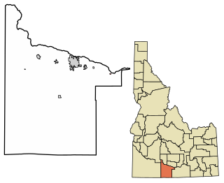
Kingston Mines is a village in Peoria County, Illinois, United States. The population was 259 at the 2000 census. It is part of the Peoria, Illinois Metropolitan Statistical Area. Located on the Illinois River, it was a shipping port, loading coal from the nearby mines.
Covington Township is a township in Tioga County, Pennsylvania, United States. The population was 1,031 at the 2020 census.
Fawn Township is a township in York County, Pennsylvania, United States. The population was 3,011 at the 2020 census.